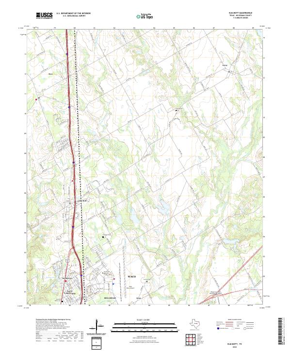
2022 Map of Elm Mott
USGS Topo · Published 2022About this map
Elm Mott and the northern outskirts of Waco anchor this landscape where the Texas Blackland Prairies meet the expanding suburban footprint of Lacy-Lakeview and Bellmead. The terrain is defined by the dendritic drainage of Tehuacana Creek and its many tributaries, including Little Tehuacana Creek and Post Oak Creek. This modern survey illustrates the transition from rural agricultural land around Ross and Leroy to the specialized institutional grounds of the Texas State Technical College - Waco, situated adjacent to the TSTC Waco Airport. Historical continuity is preserved through numerous family and community landmarks such as Gerald Cemetery and Concord Cemetery, while aviation training is highlighted by the Wings for Christ International Flight Academy near the eastern boundary. The intricate network of county roads, such as Leroy Parkway and Whiskey Hollow Road, reveals the persistent grid of early settlement even as new developments emerge along the Interstate corridors.
Find a feature on this map
147 named features on this map. Tap any name to fly to it.
Don’t see what you’re looking for? This feature index may not catch every label — zoom into the map to look around manually.
Map Details
Editions of this 2022 Elm Mott Map
This is the sole edition of this map. No revisions or reprints were ever made.
Other maps of this area

1892 · Waco
USGS Topo · 1:125,000

1920 · Waco
USGS Topo · 1:125,000

1920 · Mart
USGS Topo · 1:62,500

1924 · Waco 4-c
USGS Topo · 1:48,000

1931 · Elm Mott
USGS Topo · 1:62,500

1954 · Waco
USGS Topo · 1:250,000

1955 · Waco
USGS Topo · 1:250,000

1956 · Penelope
USGS Topo · 1:24,000

1956 · Axtell
USGS Topo · 1:24,000

1956 · West
USGS Topo · 1:24,000