1920 Map of Waco
USGS Topo · Published 1920About this map
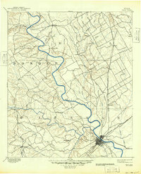
Waco serves as the focal point of this Central Texas landscape, where a dense network of iron and rail converges near the confluence of the Brazos River and the Bosque River. This military-revised survey reflects the era following the Great War, specifically noting the Rifle Range Camp MacArthur south of the city. The settlement pattern shows a high concentration of established towns along the rail lines, including West, Elm Mott, and Abbott to the north, contrasted with the winding river valleys and smaller hamlets like China Spring and Speegleville to the west.
Find a feature on this map
89 named features on this map. Tap any name to fly to it.
Don’t see what you’re looking for? This feature index may not catch every label — zoom into the map to look around manually.
Map Details
Editions of this 1920 Waco Map
This is the sole edition of this map. No revisions or reprints were ever made.
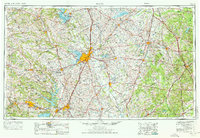
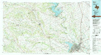
Historical Maps of Waco Through Time
5 maps found