1920s Maps of McMullen County, Texas
Explore 6 historic maps of McMullen County from the 1920s. These maps offer a rare glimpse into what life looked like during the 1920s — showing old roads, neighborhoods, homes, and landmarks that have changed or disappeared over time.
Whether you're researching your family's past, planning a metal detecting trip, or studying how McMullen County's landscape evolved across the 1920s, these high-resolution maps are a powerful tool for exploring the history of this region.
- Focus on a specific era: All maps on this page are from the 1920s, giving you a focused view of this time period.
- See what’s changed: Compare century-old streets, trails, and buildings to today's modern landscape using overlays and satellite layers.
- Research with precision: Use these maps for genealogy, historical research, land use analysis, or educational projects.
- View, download, or print: Maps are fully viewable online in high resolution, and can be downloaded or printed for your own records.
Start exploring McMullen County's history through authentic maps from the 1920s. This is your window into the past.
McMullen County, TX maps
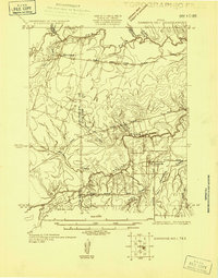
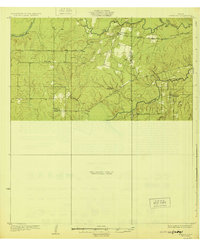
(6)- 1920 Map of Mikeska
 1920 Mikeska1920 Print · USGSSouth Texas ranching country comes to life in this post-World War I tactical survey of the Live Oak County area. Genealogists and historians can trace family landholdings from OAKVILLE to George West, locating ancestral landmarks like Simmons City, Mikeska, and the O'Connor Ranch.
 - 1925 Map of Simmons No. 1
 1925 Simmons No. 11925 Print · USGSThe South Texas ranching country of Live Oak and McMullen counties comes into focus during the mid-twenties. Genealogists and researchers can trace the routes of Rocky Reagan Road and find early locations for Calliham and Simmons.
 - 1925 Map of Tilden No. 1
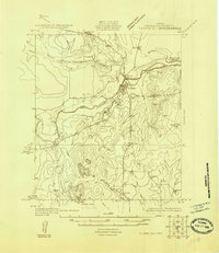 1925 Tilden No. 11925 Print · USGSMcMullen County ranching country is captured here in the mid-twenties as the settlement of Tilden centered the local economy. Genealogists and land historians can trace the early drainage of the Frio River and landmarks like Kings Hills.
 - 1925 Map of Crowther No. 3
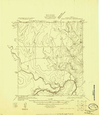 1925 Crowther No. 31925 Print · USGSMcMullen County at the mid-point of the twenties shows a detailed view of the winding Frio River and its complex drainage basins. Genealogists and historians can trace the paths of San Miguel Creek, Opossum Creek, and Frenchman Br.
 - 1925 Map of Simmons No. 2
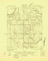 1925 Simmons No. 21925 Print · USGSMcMullen County ranching country is documented here in the mid-twenties, showing a landscape of river bends and early wagon roads. Researchers can locate the settlement of Wentz, the rural Bruce School, and the path of the Tilden and Three Rivers Road.
 - 1929 Map of Simmons
 1929 Simmons1929 Print · USGSSouth Texas ranching and river country are captured here in the late 1920s, showing the early road networks and small outposts. Researchers can trace family sites near Wentz, the isolated Brice Sch, and the old George West Road.2 unique versions available
End of results
Showing maps 1-6 of 6
Top cities of McMullen County
Frequently asked questions
- What are the different types of historical maps available for McMullen County?
- What is the oldest map of McMullen County?
- Where can I purchase historical maps of McMullen County for my home or office?
- Where can I download high-res historical maps of McMullen County?
- Are there historical topographic maps available for McMullen County?
- Is there historical aerial imagery available for McMullen County?
- Where are historical maps of McMullen County sourced from?