Old Maps of McMullen County, Texas for Genealogy
Trace your family roots with 202 historic maps of McMullen County. These high-res maps reveal old neighborhoods, homesites, landmarks, and streets — helping you uncover where your ancestors lived and how the area evolved over time.
- Explore historic neighborhoods: Identify where your relatives may have lived in the 1800s or 1900s.
- Compare maps over time: Trace the changes in streets, buildings, and landmarks for multi-generational research.
- Perfect for genealogy & ancestry research: Used by family historians and researchers to map out lineage and migration.
These maps are an incredible resource for exploring your personal connection to McMullen County's past.
McMullen County, TX maps
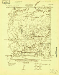
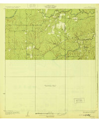
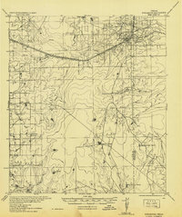
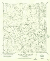
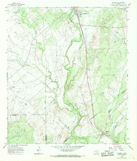
(202)- 1920 Map of Mikeska
 1920 Mikeska1920 Print · USGSSouth Texas ranching country comes to life in this post-World War I tactical survey of the Live Oak County area. Genealogists and historians can trace family landholdings from OAKVILLE to George West, locating ancestral landmarks like Simmons City, Mikeska, and the O'Connor Ranch.
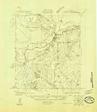
 - 1925 Map of Simmons No. 1
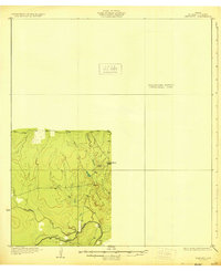
 1925 Simmons No. 11925 Print · USGSThe South Texas ranching country of Live Oak and McMullen counties comes into focus during the mid-twenties. Genealogists and researchers can trace the routes of Rocky Reagan Road and find early locations for Calliham and Simmons.
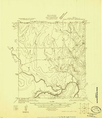
 - 1925 Map of Tilden No. 1
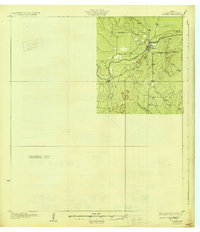
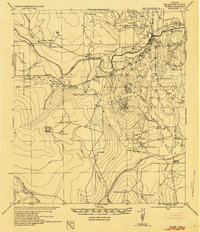
 1925 Tilden No. 11925 Print · USGSMcMullen County ranching country is captured here in the mid-twenties as the settlement of Tilden centered the local economy. Genealogists and land historians can trace the early drainage of the Frio River and landmarks like Kings Hills.
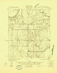
 - 1925 Map of Crowther No. 3
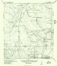
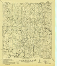
 1925 Crowther No. 31925 Print · USGSMcMullen County at the mid-point of the twenties shows a detailed view of the winding Frio River and its complex drainage basins. Genealogists and historians can trace the paths of San Miguel Creek, Opossum Creek, and Frenchman Br.
 - 1925 Map of Simmons No. 2
 1925 Simmons No. 21925 Print · USGSMcMullen County ranching country is documented here in the mid-twenties, showing a landscape of river bends and early wagon roads. Researchers can locate the settlement of Wentz, the rural Bruce School, and the path of the Tilden and Three Rivers Road.
 - 1929 Map of Simmons
 1929 Simmons1929 Print · USGSSouth Texas ranching and river country are captured here in the late 1920s, showing the early road networks and small outposts. Researchers can trace family sites near Wentz, the isolated Brice Sch, and the old George West Road.2 unique versions available
 - 1930 Map of Tilden
 1930 Tilden1930 Print · USGSMcMullen County settlement and drainage patterns are captured here in the mid-1920s during a pivotal water engineering survey. Genealogists and researchers can trace the early footprint of Tilden and its proximity to the Frio River and Calliham Road.2 unique versions available
 - 1930 Map of Whitsett
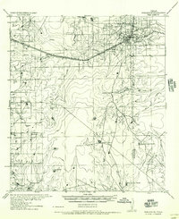
 1930 Whitsett1930 Print · USGSThe South Texas brush country unfolds in this late-1920s survey of McMullin County, showing the region as it appeared before widespread development. Trace early drainage routes like San Miguel Creek and find the small settlement of Crowther near Opossum Hill.2 unique versions available
 - 1937 Map of Loma Alta, 1956 Print
 1937 Loma Alta1956 Print · USGSSouth Texas ranching and oil development meet along the McMullen and Duval county line in the mid-1930s. Genealogists and historians can locate family holdings like Pony Jim Martin Ranch and industrial sites including Eagle Hill Settlement and Seven Sisters.
 - 1942 Map of Fowlerton
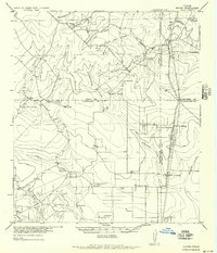
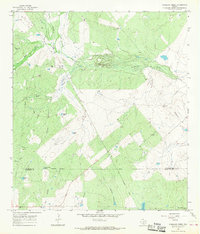
 1942 Fowlerton1942 Print · USGSSouth Texas ranching and rail commerce converge in the early 1940s near the Frio River. Researchers can trace historic family holdings like Guadalupe Ranch or follow the path of the San Antonio Uvalde and Gulf State Highway No 72.
 - 1942 Map of Tilden
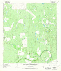
 1942 Tilden1942 Print · USGSMcMullen County ranching country is shown here in the early 1940s, situated between the Frio and Nueces rivers. Genealogists can trace family holdings like Kuykendall Ranch and Dickenson Ranch or locate the abandoned Tisdale Ranch and early Oil Test Wells.
 - 1942 Map of Whitsett
 1942 Whitsett1942 Print · USGSRanching and early oil exploration define this South Texas landscape during the early years of the war. Genealogists can trace family holdings like the Peeler Ranch and Jacob Ranch or locate the Old Oil Field near the settlement of Crowther.
 - 1953 Map of Crystal City
 1953 Crystal City1953 Print · USGSSouth Texas in the early fifties was a landscape of expanding oil fields and vital rail connections. Genealogists and researchers can trace family lands along the Nueces River or locate heritage sites in Asherton, Big Wells, and Batesville.
 - 1955 Map of Crystal City, 1976 Print
 1955 Crystal City1976 Print · USGSSouth Texas ranching and oil country come into focus in the mid-fifties as the rail lines and rivers connect growing hubs. Researchers can trace the development of energy fields like Washburn Oil Field or locate historic settlements from Asherton to Three Rivers.
 - 1956 Map of Piedra Creek
 1956 Piedra Creek1956 Print · USGSThe ranching country of La Salle and McMullen Counties is captured here in the mid-1950s, following military surveys of the brushy plains. Researchers can locate remote family landmarks like the Dobie Ranch or trace the early Oil Field at Munson.
 - 1956 Map of Hindes
 1956 Hindes1956 Print · USGSSouth Texas ranching country comes alive in this mid-century survey of the Frio and La Salle county lines. Family history researchers can trace local landmarks like the Arnold School, Schoerp & Spettel Ranch, and rail stops at Prince Siding and Zella Siding.
 - 1956 Map of Franklin Settlement
 1956 Franklin Settlement1956 Print · USGSSouth Texas ranching life is well-documented in this mid-century survey of the Atascosa and McMullen county line. Genealogists can locate family holdings like Burmeister Ranch, Kenny Ranch, and the Franklin Settlement (Cross).
 - 1956 Map of Fowlerton
 1956 Fowlerton1956 Print · USGSLa Salle County ranching and rail infrastructure are captured here in the mid-1940s as military surveys were adapted for civil use. Genealogists can locate named homesteads and outposts like Salem, Hermann Sons, and Lester J Ranch along the San Antonio Uvalde and Gulf rail line.
 - 1961 Map of Crystal City
 1961 Crystal City1961 Print · USGSSouth Texas in the early sixties reveals a landscape of massive cattle ranches and emerging oil fields. Genealogists and historians can trace the Missouri Pacific rail lines through Crystal City, or locate water features like Espantosa Lake and Boynton Reservoir.
 - 1965 Map of Caballos Creek, 1966 Print
 1965 Caballos Creek1966 Print · USGSThe ranchlands of South Texas are captured here in the mid-1960s, showing a landscape defined by large cattle operations and petroleum exploration. You can trace the Old Railroad Grade or locate family sites like Peeler Ranch and the small Cem tucked away in the brush.
 - 1965 Map of Crowther, 1968 Print
 1965 Crowther1968 Print · USGSMcMullen County was characterized by a ranching and resource economy in the mid-1960s, centered around the Frio River. Researchers can trace the legacy of local industry and water rights through the Old Railroad Grade, Oil Wells, and numerous named landmarks like Pot of Gold Tank.2 unique versions available
 - 1965 Map of Whitsett, 1968 Print
 1965 Whitsett1968 Print · USGSSouth Texas ranching and rail activity are captured here during the mid-sixties, centered on the Missouri Pacific line. Genealogists and historians can trace family-named sites like Tom Ranch and 74 Ranch or the small settlements of Campbellton and Whitsett.2 unique versions available
 - 1965 Map of Willow Hollow Tank, 1968 Print
 1965 Willow Hollow Tank1968 Print · USGSThe Live Oak County brush country during the mid-sixties reveals an active landscape of petroleum extraction and ranching. Genealogists and historians can trace the extent of the Jacob Oil Field, find the Landing Strip, and locate the Willow Hollow Tank.
 - 1967 Map of Calliham NW, 1970 Print
 1967 Calliham NW1970 Print · USGSMcMullen County ranching and energy production are captured in the late sixties as the search for oil intensified. Researchers can trace land use patterns around Landers, the Dragoon Oil And Gas Field, and the Frio River.
 - 1967 Map of Calliham, 1970 Print
 1967 Calliham1970 Print · USGSSettled between the forks of the Frio and Nueces Rivers in the late sixties, this McMullen and Live Oak county borderland reflects a rugged era of ranching and oil production. Trace family landmarks and industry sites from the Cem and Calliham townsite to the Ezzel Ranch Oil Field.2 unique versions available
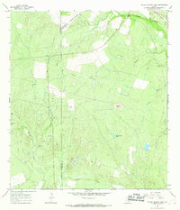
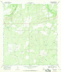
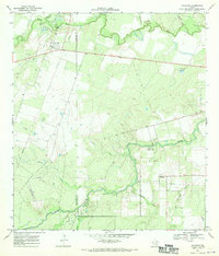
Showing maps 1-25 of 202
Top cities of McMullen County
Frequently asked questions
- What are the different types of historical maps available for McMullen County?
- What is the oldest map of McMullen County?
- Where can I purchase historical maps of McMullen County for my home or office?
- Where can I download high-res historical maps of McMullen County?
- Are there historical topographic maps available for McMullen County?
- Is there historical aerial imagery available for McMullen County?
- Where are historical maps of McMullen County sourced from?