1960s Maps of Milano, Texas
Explore 2 historic maps of Milano from the 1960s. These maps offer a rare glimpse into what life looked like during the 1960s — showing old roads, neighborhoods, homes, and landmarks that have changed or disappeared over time.
Whether you're researching your family's past, planning a metal detecting trip, or studying how Milano's landscape evolved across the 1960s, these high-resolution maps are a powerful tool for exploring the history of this region.
- Focus on a specific era: All maps on this page are from the 1960s, giving you a focused view of this time period.
- See what’s changed: Compare century-old streets, trails, and buildings to today's modern landscape using overlays and satellite layers.
- Research with precision: Use these maps for genealogy, historical research, land use analysis, or educational projects.
- View, download, or print: Maps are fully viewable online in high resolution, and can be downloaded or printed for your own records.
Start exploring Milano's history through authentic maps from the 1960s. This is your window into the past.
Milano, TX maps
(2)- 1961 Map of Rockdale East, 1964 Print
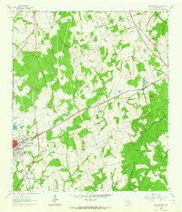 1961 Rockdale East1964 Print · USGSThe eastern edge of Rockdale and the surrounding Milam County prairie are captured in the early sixties, showing a landscape defined by rail lines and rural community centers. Family historians can trace local landmarks like Aycock Sch, San Jose Cem, and Mt Zion Ch.3 unique versions available
 - 1962 Map of Milano, 1964 Print
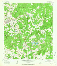 1962 Milano1964 Print · USGSRailroad history and rural community life converge in early 1960s Texas at the busy junction of the Missouri Pacific and Santa Fe lines. Local researchers can trace family roots through landmarks like Sand Grove Ch, Hurt Cem, and the settlement at Elevation.2 unique versions available
End of results
Showing maps 1-2 of 2
Top cities near Milano
Frequently asked questions
- What are the different types of historical maps available for Milano?
- What is the oldest map of Milano?
- Where can I purchase historical maps of Milano for my home or office?
- Where can I download high-res historical maps of Milano?
- Are there historical topographic maps available for Milano?
- Is there historical aerial imagery available for Milano?
- Where are historical maps of Milano sourced from?