Old Maps of Ridge, Texas for Academic Research
Study the evolution of Ridge with 14 high-resolution historic maps. Whether you're teaching, researching, or modeling changes in land use, these maps provide essential visual documentation of urban, environmental, and geographic change.
- Analyze long-term change: Track patterns in development, transportation, and natural features.
- Ideal for environmental or urban studies: Support academic projects with primary historical map data.
- Use in the classroom or lab: Educators and researchers rely on these maps to bring historical context to life.
These maps are a powerful tool for teaching, research, and visualizing how Ridge has changed over the decades.
Ridge, TX maps
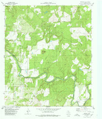
(14)- 1885 Map of San Saba
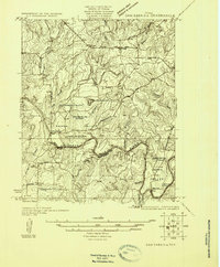
 1885 San Saba1885 Print · USGSCentral Texas in the late nineteenth century comes alive through this survey of the river valleys and high knobs. Genealogists and researchers can trace the early foundations of San Saba and Goldthwaite, or find forgotten locations like Regency and Bendy.
 - 1894 Map of San Saba
 1894 San Saba1894 Print · USGSCentral Texas in the late nineteenth century is defined here by the meeting of the San Saba River and the Colorado River. Researchers can trace the path of the Gulf Colorado and Santa Fe Railroad near Goldthwaite or locate early settlements like Richland Springs and Red Bluff.4 unique versions available
 - 1925 Map of San Saba 2-a
 1925 San Saba 2-a1925 Print · USGSMills and San Saba counties are shown in the mid-1920s as rural ranching communities centered on the Colorado River. Genealogists and historians can trace family roots through the Hanna Valley Cem, Ratler, and the Mesquite Church.
 - 1930 Map of Richland Springs
 1930 Richland Springs1930 Print · USGSThe Colorado River divides Mills and San Saba counties in the late 1920s, a period defined by small-town farming and ranching. You can trace early family sites through several river crossings and community hubs like Hanna Valley Cem and the Jones Valley Sch.
 - 1948 Map of Richland Springs, 1966 Print
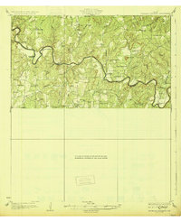
 1948 Richland Springs1966 Print · USGSThe northern San Saba County landscape in the late 1940s is defined by its deep river valleys and the presence of the Camp Bowie Military Reservation. Genealogists and historians can trace rural school districts and small settlements like Locker, Skeeterville, and Varga Chapel Church.
 - 1950 Map of Richland Springs
 1950 Richland Springs1950 Print · USGSRichland Springs and the surrounding San Saba ranch lands are captured here at mid-century, just as the regional rail and river network reached its mature form. Genealogists can locate family landmarks like Varga Chapel, Old Algerita Cemetery, and China Creek School.
 - 1954 Map of Brownwood, 1955 Print
 1954 Brownwood1955 Print · USGSCentral Texas in the early fifties shows a landscape of rail-linked cattle towns and winding river valleys before modern highway expansion. Genealogists and historians can trace family-named peaks and vanished rail stops like Trickham, Santa Anna, and the Brady Mountains.3 unique versions available
 - 1980 Map of Regency
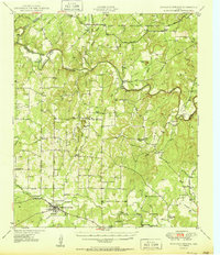
 1980 Regency1980 Print · USGSThe Colorado River marks the county line in this central Texas landscape during the late seventies. Researchers can locate rural landmarks like Regency, the Ridge Community Hall, and family sites at Hollis Cem or Mesquite Cem.
 - 1985 Map of San Saba
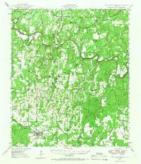
 1985 San Saba1985 Print · USGSCentral Texas in the mid-eighties was a landscape of river-valley ranching and quiet railroad towns. Researchers can trace family history through sites like San Saba Cem, follow the Atchison Topeka and Santa Fe line, or explore landmarks near Pecan Bayou.2 unique versions available
 - 2010 Map of Regency, 2010 Print
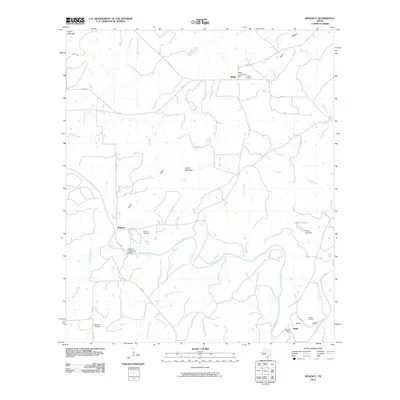 2010 Regency2010 Print · USGSCovers Ridge, including Ratler, Mills County, and other nearby areas
 - 2012 Map of Regency, 2012 Print
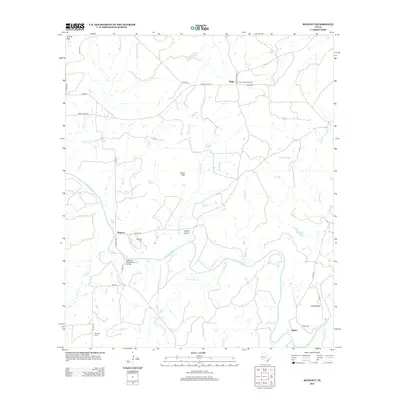 2012 Regency2012 Print · USGSCovers Ridge, including Ratler, Mills County, and other nearby areas
 - 2016 Map of Regency, 2016 Print
 2016 Regency2016 Print · USGSCovers Ridge, including Ratler, Mills County, and other nearby areas
 - 2019 Map of Regency, 2019 Print
 2019 Regency2019 Print · USGSCovers Ridge, including Ratler, Mills County, and other nearby areas
 - 2022 Map of Regency, 2022 Print
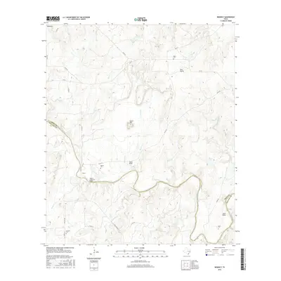
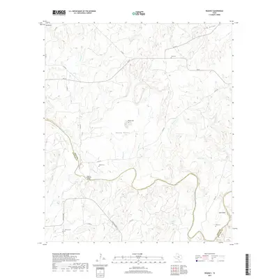
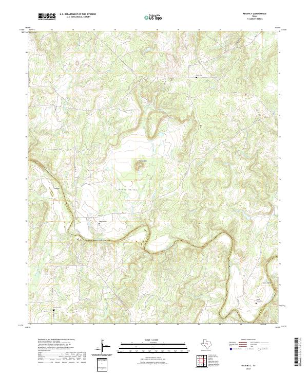 2022 Regency2022 Print · USGSThe Colorado River meanders along the San Saba and Mills county line in this contemporary record of Central Texas. Genealogists can trace family names through landmarks like Hanna Valley and search for ancestors at Regency Cem or Jones Valley Cem.
End of results
Showing maps 1-14 of 14
Top cities near Ridge
- Brownwood historical maps
- Goldthwaite historical maps
- Richland Springs historical maps
- Mullin historical maps
Frequently asked questions
- What are the different types of historical maps available for Ridge?
- What is the oldest map of Ridge?
- Where can I purchase historical maps of Ridge for my home or office?
- Where can I download high-res historical maps of Ridge?
- Are there historical topographic maps available for Ridge?
- Is there historical aerial imagery available for Ridge?
- Where are historical maps of Ridge sourced from?