Old Maps of Kerens, Texas
Explore 21 old maps of Kerens, spanning from 1954 to today. These high-resolution historic maps reveal how streets, neighborhoods, landmarks, and natural features evolved over time — perfect for genealogy, metal detecting, research, and local history exploration.
What you can do with these maps:
- See how Kerens changed over time: Compare historical maps to modern-day views to trace roads, homesites, rail lines & more.
- View detailed metadata: Each map includes creators, publishers, year, scale, and archive source.
- Overlay maps with satellite & LiDAR: Visualize the past alongside modern tools to explore terrain & human change.
- Trusted historical sources: Maps sourced from the USGS, Library of Congress, and other archives.
- Access maps your way: View online, download high-res files, or order prints for personal or research use.
Start exploring old maps of Kerens to uncover forgotten places, hidden landmarks, and the deep history beneath your feet.
Kerens, TX maps
(21)- 1954 Map of Dallas, 1963 Print
 1954 Dallas1963 Print · USGSNorth Texas in the mid-fifties and early sixties reveals a landscape of rapid urban growth and water management. Genealogists and historians can trace the evolution of the metroplex through landmarks like Hensley Field, Boles Orphan Home, and the Texas & Pacific RR.4 unique versions available
 - 1958 Map of Dallas
 1958 Dallas1958 Print · USGSNorth Texas in the late fifties shows the dramatic expansion of the Metroplex as it absorbs surrounding farm towns. Genealogists and historians can trace old rail lines like the Missouri-Kansas-Texas and locate early lakefront developments at Eagle Mountain Lake and Lake Worth Village.
 - 1960 Map of Goodlow Park, 1961 Print
 1960 Goodlow Park1961 Print · USGSNavarro County life in the early sixties centers on small farming communities and the growing oil industry. Genealogists can locate family landmarks like Alligator Ch, Petersburg Cem, and the settlements of Rural Shade and Goodnight.3 unique versions available
 - 1961 Map of Kerens, 1962 Print
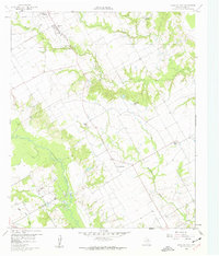
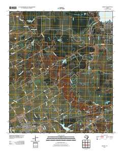
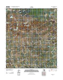
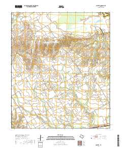
 1961 Kerens1962 Print · USGSKerens and the fertile Trinity River bottomlands are captured here in the early sixties, showing a landscape defined by rail, oil, and water. Genealogists and researchers can locate Oak Grove Ch, the Bazette Oil Field, and family-named water features like Singletary Lake.3 unique versions available
 - 1962 Map of Bazette, 1965 Print
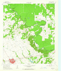
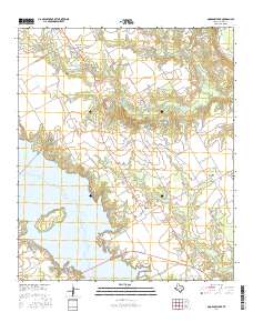
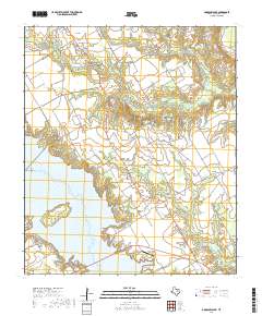
 1962 Bazette1965 Print · USGSThe Trinity River bottomlands and the crossroads of Bazette are captured here in the early sixties. Genealogists and local historians can trace family locations through Phillips Cem, Roane Ch, and the numerous Oil Wells scattered across the prairie.2 unique versions available
 - 1985 Map of Corsicana, 1986 Print
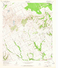
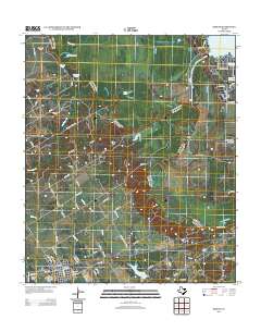
 1985 Corsicana1986 Print · USGSNorth Central Texas was defined by its expanding water reservoirs and deep-rooted rail corridors in the mid-eighties. Researchers can trace the heritage of local communities through landmarks like Southwestern Bible Institute, Navarro College, and rural markers such as Derrs Chapel.2 unique versions available
 - 2010 Map of Bazette, 2010 Print
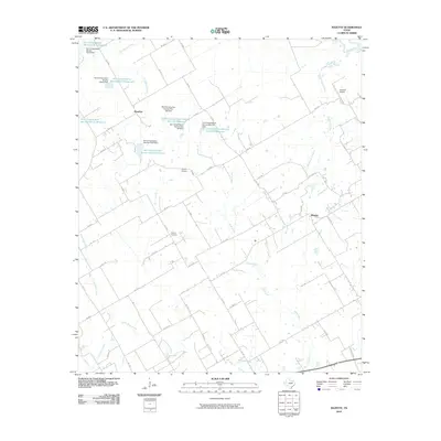 2010 Bazette2010 Print · USGSCovers Kerens, including Powell, Bazette, and other nearby areas
 - 2010 Map of Goodlow Park, 2010 Print
 2010 Goodlow Park2010 Print · USGSCovers Kerens, including Eureka, Rural Shade, and other nearby areas
 - 2010 Map of Kerens, 2010 Print
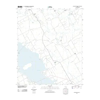
 2010 Kerens2010 Print · USGSCovers Kerens, including Tool, Trinidad, and other nearby areas
 - 2012 Map of Goodlow Park, 2012 Print
 2012 Goodlow Park2012 Print · USGSCovers Kerens, including Eureka, Rural Shade, and other nearby areas
 - 2012 Map of Kerens, 2012 Print
 2012 Kerens2012 Print · USGSCovers Kerens, including Tool, Trinidad, and other nearby areas
 - 2012 Map of Bazette, 2012 Print
 2012 Bazette2012 Print · USGSCovers Kerens, including Powell, Bazette, and other nearby areas
 - 2016 Map of Goodlow Park, 2016 Print
 2016 Goodlow Park2016 Print · USGSCovers Kerens, including Eureka, Rural Shade, and other nearby areas
 - 2016 Map of Bazette, 2016 Print
 2016 Bazette2016 Print · USGSCovers Kerens, including Powell, Bazette, and other nearby areas
 - 2016 Map of Kerens, 2016 Print
 2016 Kerens2016 Print · USGSCovers Kerens, including Tool, Trinidad, and other nearby areas
 - 2019 Map of Bazette, 2019 Print
 2019 Bazette2019 Print · USGSCovers Kerens, including Powell, Bazette, and other nearby areas
 - 2019 Map of Goodlow Park, 2019 Print
 2019 Goodlow Park2019 Print · USGSCovers Kerens, including Eureka, Rural Shade, and other nearby areas
 - 2019 Map of Kerens, 2019 Print
 2019 Kerens2019 Print · USGSCovers Kerens, including Tool, Trinidad, and other nearby areas
 - 2022 Map of Bazette, 2022 Print
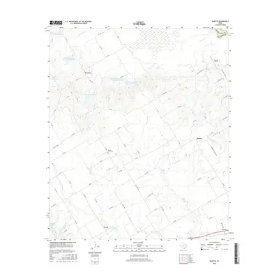
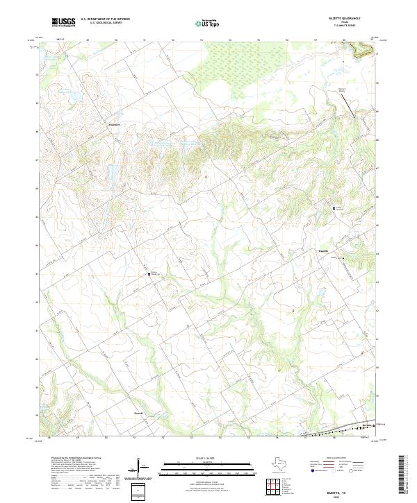 2022 Bazette2022 Print · USGSNavarro County's rural landscape is captured here in the early twenty-first century, showing a region shaped by the Trinity River and local agriculture. Researchers can locate several burial grounds and crossroads including Wesleys Chapel Cem, Bazette, and Montfort.
 - 2022 Map of Goodlow Park, 2022 Print
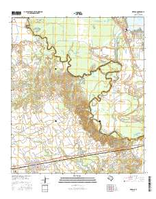
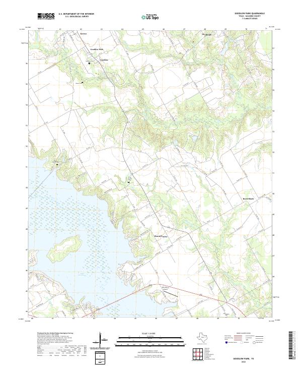 2022 Goodlow Park2022 Print · USGSNavarro County's lakeside and rural landscapes are captured here in the early twenty-first century. Researchers can trace family history at Goodlow Cem and Petersburg Cem or locate settlements like Rural Shade and Round Prairie.
 - 2022 Map of Kerens, 2022 Print
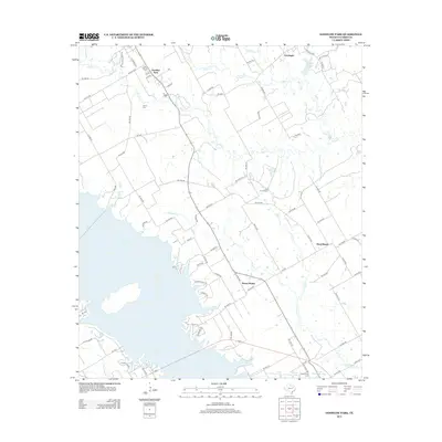
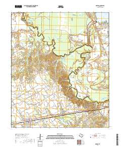
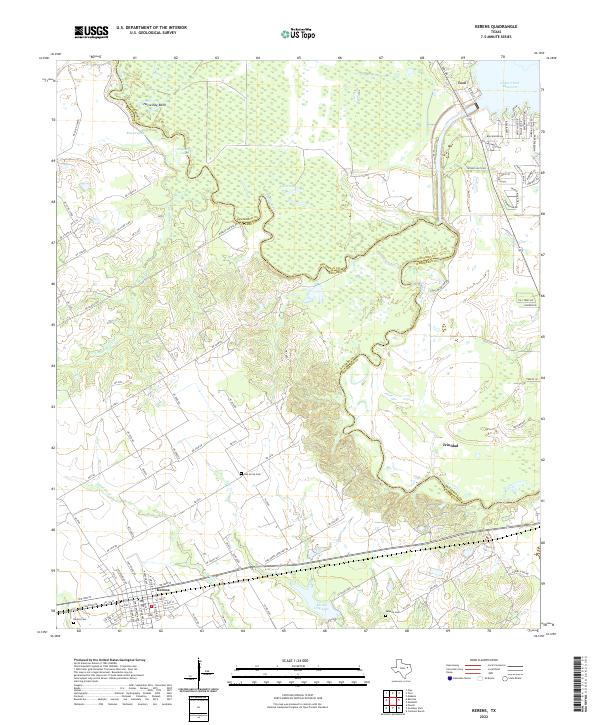 2022 Kerens2022 Print · USGSThe Navarro and Henderson County borderlands come to life in this contemporary study of the Trinity River valley. Genealogists and local historians can trace family plots at Oak Grove Cem and Samaria Cem or explore the waterfront of Tool.
End of results
Showing maps 1-21 of 21
Top cities near Kerens
- Corsicana historical maps
- Ennis historical maps
- Gun Barrel City historical maps
- Mabank historical maps
- Tool historical maps
- Malakoff historical maps
See more
Top neighborhoods of Kerens
Frequently asked questions
- What are the different types of historical maps available for Kerens?
- What is the oldest map of Kerens?
- Where can I purchase historical maps of Kerens for my home or office?
- Where can I download high-res historical maps of Kerens?
- Are there historical topographic maps available for Kerens?
- Is there historical aerial imagery available for Kerens?
- Where are historical maps of Kerens sourced from?