Old Maps of Orange, Texas for Academic Research
Study the evolution of Orange with 56 high-resolution historic maps. Whether you're teaching, researching, or modeling changes in land use, these maps provide essential visual documentation of urban, environmental, and geographic change.
- Analyze long-term change: Track patterns in development, transportation, and natural features.
- Ideal for environmental or urban studies: Support academic projects with primary historical map data.
- Use in the classroom or lab: Educators and researchers rely on these maps to bring historical context to life.
These maps are a powerful tool for teaching, research, and visualizing how Orange has changed over the decades.
Orange, TX maps
(56)- 1926 Map of Terry
 1926 Terry1926 Print · USGSCoastal Orange County was a hub of energy and rail transit in the mid-twenties, centered on the Neches River wetlands. Researchers can trace early infrastructure like the Southern Pacific tracks and the Mansfield Gulf Ferry Road.
 - 1926 Map of Texla
 1926 Texla1926 Print · USGSCoastal Texas in the mid-1920s is defined by its winding waterways and expanding rail lines. Genealogists and industrial historians can trace the Kansas City Southern route past the Linscomb Cem and the settlement at Texla.
 - 1926 Map of Mauriceville
 1926 Mauriceville1926 Print · USGSSoutheast Texas at the height of the mid-twenties rail era shows a landscape of timber-driven settlements and winding waterways. Genealogists and researchers can locate early schools and junctions like Little Cypress School, Lemonville, and Hartburg.
 - 1932 Map of Orange
 1932 Orange1932 Print · USGSSoutheastern Texas at the dawn of the 1930s is defined by the bustling riverfront of Orange and the intricate bends of the Sabine River. Researchers can trace the early street plan of the city, the Southern Pacific rail lines, and river landmarks like Morgan Bluff.2 unique versions available
 - 1943 Map of Orangefield, 1953 Print
 1943 Orangefield1953 Print · USGSSoutheastern Texas in the early 1940s reveals a landscape of industrial expansion and historic river crossings. Researchers can trace family sites like Jett Cemetery or locate early infrastructure such as oil wells and the Old Mansfield Ferry Rd.
 - 1943 Map of Mauriceville, 1953 Print
 1943 Mauriceville1953 Print · USGSSoutheast Texas at the dawn of the 1940s reveals a rural landscape defined by logging railroads and bayou drainage. Genealogists and historians can trace family locations near Wilkinson Cem, the Little Cypress Sch, and the junction at Mauriceville.
 - 1943 Map of Terry, 1953 Print
 1943 Terry1953 Print · USGSCoastal Texas during the war years reveals a landscape of industrial waterways and remote rail outposts along the Orange and Jefferson County line. Researchers can trace the Southern Pacific line through Terry and locate historic sites like Wallace Cem and Evergreen Ch.
 - 1943 Map of Texla, 1953 Print
 1943 Texla1953 Print · USGSSoutheast Texas at the height of the Second World War shows a landscape defined by the intersection of new rail lines and older timber mill roads. Genealogists can locate family sites like Singleton Cem and Linscomb Cem near the banks of Cow Bayou.
 - 1946 Map of Phoenix Lake
 1946 Phoenix Lake1946 Print · USGSThe Louisiana-Texas borderlands along the Sabine River are captured here in the mid-1940s, showing a transition from swampy wilderness to industrial waterway. Researchers can trace the development of the Intracoastal Waterway and locate named landmarks like Sassafras Island and Perry Ridge.
 - 1947 Map of Toomey
 1947 Toomey1947 Print · USGSCalcasieu Parish at the Texas border is seen here in the late 1940s, where the winding river bottoms meet the railroad corridor. Researchers can trace family sites like Comier Cemetery and the settlement at Toomey along the Southern Pacific line.
 - 1952 Map of Lake Charles
 1952 Lake Charles1952 Print · USGSSouthwest Louisiana is captured here in the mid-fifties, showing a landscape defined by the rise of the petrochemical industry and deep-water navigation. Researchers can trace family roots through numerous small-town settlements and oil developments like Nibletts Bluff, the Lockport Oil Field, and Starks.
 - 1954 Map of Toomey
 1954 Toomey1954 Print · USGSThe Louisiana-Texas borderlands in the mid-fifties are defined here by the winding Sabine River and the marshes of Calcasieu Parish. Researchers can locate Nibletts Bluff on the riverbank or trace family names at the Comier Cemetery near Toomey.
 - 1954 Map of Phoenix Lake
 1954 Phoenix Lake1954 Print · USGSThe Louisiana-Texas borderlands are captured here in the mid-fifties, showing a landscape defined by wetlands and the Sabine River. Researchers can trace early infrastructure like Burton Shell Road and named landmarks such as Sassafras Island or Phoenix Lake.
 - 1954 Map of Lake Charles, 1964 Print
 1954 Lake Charles1964 Print · USGSSouthwest Louisiana in the mid-fifties is defined by its massive petroleum industry and its complex network of bayous and rail lines. Researchers can trace the development of the Sulphur Mines Oil Field or locate historic settlements like Longville and De Quincy.3 unique versions available
 - 1955 Map of Orange, 1956 Print
 1955 Orange1956 Print · USGSThe Texas-Louisiana borderlands in the mid-fifties center on the industrial hubs and vast marshlands of the Sabine River. Genealogists and historians can locate community sites like Reed Cem, Crossroad Ch, and the Gum Cove Ferry crossing.
 - 1957 Map of Texla, 1958 Print
 1957 Texla1958 Print · USGSOrange County's transition from timber and rail to mid-century residential growth is captured here in the late fifties. Genealogists and local historians can trace family sites like Singleton Cem and the Log Cabin Tabernacle near the old Texla townsite.3 unique versions available
 - 1957 Map of Orangefield, 1958 Print
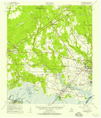 1957 Orangefield1958 Print · USGSSoutheast Texas at the peak of the mid-century oil boom is detailed here, showing the intricate intersection of rail lines and bayous. Genealogists can locate family landmarks such as Linscomb Cem, Winfree Ch, and the settlement of Mauriceville.2 unique versions available
 - 1957 Map of Terry, 1958 Print
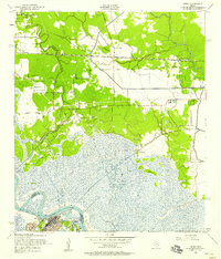 1957 Terry1958 Print · USGSThe Texas Gulf Coast comes into focus in the 1950s as a landscape of marshy bayous, rail-side hamlets, and rising oil industry. Researchers can trace family history through numerous small burial grounds like Thomas Cem or locate the old landing at Bessie Heights near the Neches River.6 unique versions available
 - 1957 Map of Orangefield, 1958 Print
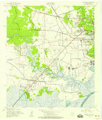 1957 Orangefield1958 Print · USGSThe coastal marshlands and oil-country settlements of Orange County are captured here in the late fifties as Bridge City and Orangefield began to expand. Genealogists can locate numerous family landmarks, including Winfree Ch, Jett Cem, and the old McLewis Sch.7 unique versions available
 - 1957 Map of Mauriceville, 1958 Print
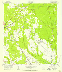 1957 Mauriceville1958 Print · USGSMauriceville and the Orange County wetlands are shown here in the mid-fifties, where rail hubs met the oil and timber landscape. Genealogists and researchers can trace the Kansas City Southern line through Lemonville, find Wilkinson Cem, or locate the Little Cypress Sch.3 unique versions available
 - 1960 Map of Echo, 1961 Print
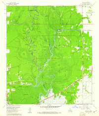 1960 Echo1961 Print · USGSThe Sabine River bottomlands on the Texas-Louisiana border are captured here at the start of the 1960s. Researchers can trace the winding river at Niblett Bluff and locate family landmarks like Comier Cem and Crossroad Ch.4 unique versions available
 - 1960 Map of Orange, 1961 Print
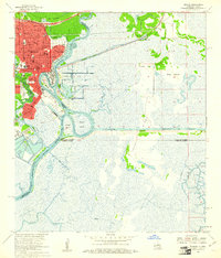 1960 Orange1961 Print · USGSOrange and the Sabine River borderlands at the start of the sixties reveal a thriving maritime and industrial hub. Genealogists and researchers can locate the U S Naval Station, historical schools like Stark High Sch, and Evergreen Cem.5 unique versions available
 - 1960 Map of Orange, 1961 Print
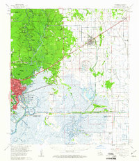 1960 Orange1961 Print · USGSThe Texas-Louisiana borderlands come alive in the early sixties, showing the industrial waterfront of Orange alongside the rail-tied towns of Vinton and Edgerly. Genealogists and historians can locate rural landmarks like Granger Cem, Manley Sch, and the riverside Niblett Bluff.2 unique versions available
 - 1986 Map of Lake Charles
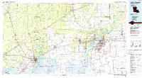 1986 Lake Charles1986 Print · USGSThe Louisiana-Texas borderlands are captured here in the mid-1980s, showcasing the industrial growth of the Lake Charles region and its rail-linked satellite towns. Trace the evolution of coastal settlements and family landmarks from Sulphur to the Highland Cem.2 unique versions available
 - 1994 Map of Echo, 1996 Print
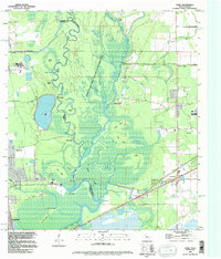 1994 Echo1996 Print · USGSThe Sabine River borderlands in the mid-nineties reveal a landscape of dense wetlands and river-edge settlements. Researchers can trace family history through sites like Cormier Cem and Lee Cem or explore named landmarks like Niblett Bluff and Echo.
Showing maps 1-25 of 56
Top cities near Orange
- Port Arthur historical maps
- Nederland historical maps
- Groves historical maps
- Port Neches historical maps
- Vidor historical maps
- Bridge City historical maps
See more
Top neighborhoods of Orange
- Brownwood historical maps
- Francis historical maps
- Pine Grove historical maps
- Cove historical maps
- Stark historical maps
- Bancroft historical maps
Frequently asked questions
- What are the different types of historical maps available for Orange?
- What is the oldest map of Orange?
- Where can I purchase historical maps of Orange for my home or office?
- Where can I download high-res historical maps of Orange?
- Are there historical topographic maps available for Orange?
- Is there historical aerial imagery available for Orange?
- Where are historical maps of Orange sourced from?