Old Maps of Springtown, Texas for Metal Detecting
Plan your next treasure hunt with 23 historic maps of Springtown. Find old homesites, ghost towns, trails, and gathering spots that may be lost to time — perfect for identifying promising metal detecting locations.
- Locate forgotten sites: Uncover places like long-lost settlements, abandoned rail lines, or gathering spots.
- Plan better hunts: Use map overlays combined with LiDAR or satellite views to narrow in on historically rich areas.
- Made for detectorists: Thousands of hobbyists use these maps to discover relics, coins, and hidden history.
Use these historic maps to boost your research and find new opportunities beneath the surface of Springtown.
Springtown, TX maps
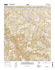
(23)- 1891 Map of Weatherford
 1891 Weatherford1891 Print · USGSParker County and the surrounding ranchlands are shown here in the 1890s as the rail network transformed the region. Researchers can trace early river transport at Powell Ferry or locate vanished sites like Veal Station, Center Mill, and the Bear Creek P.O.
 - 1893 Map of Weatherford
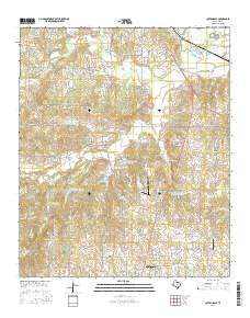
 1893 Weatherford1893 Print · USGSParker County was at a pivotal turning point in the late nineteenth century as railroads began to stitch together the North Texas cattle country. Genealogists and local historians can trace early crossings like Powell Ferry and landmarks like Center Mill or Veal Station.5 unique versions available
 - 1930 Map of Boyd
 1930 Boyd1930 Print · USGSNorth-central Texas rural life comes into focus in the mid-1920s as the Chicago Rock Island and Gulf railroad tracks its way through Boyd. Genealogists and historians can locate old landmarks like Arkansas Sch and the community of Aurora.2 unique versions available
 - 1932 Map of Springtown
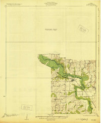
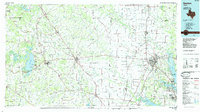
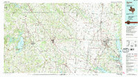
 1932 Springtown1932 Print · USGSThe crossroads of North Texas in the 1920s and 30s reveal a landscape of small farming communities and country parishes. Trace the early footprints of Reno, Briar, and Azle, or locate family sites near New Hope Ch and Onion Hill Sch.
 - 1954 Map of Dallas, 1963 Print
 1954 Dallas1963 Print · USGSNorth Texas in the mid-fifties and early sixties reveals a landscape of rapid urban growth and water management. Genealogists and historians can trace the evolution of the metroplex through landmarks like Hensley Field, Boles Orphan Home, and the Texas & Pacific RR.4 unique versions available
 - 1954 Map of Sherman, 1964 Print
 1954 Sherman1964 Print · USGSThe Red River valley and North Texas plains are captured here in the mid-fifties, showing the region as new reservoirs like Lake Texoma and Lavon Reservoir reshaped the land. Genealogists can trace family roots through specific local landmarks like Courtney P O, Pilot Grove Sch, and New Hope Ch.2 unique versions available
 - 1958 Map of Dallas
 1958 Dallas1958 Print · USGSNorth Texas in the late fifties shows the dramatic expansion of the Metroplex as it absorbs surrounding farm towns. Genealogists and historians can trace old rail lines like the Missouri-Kansas-Texas and locate early lakefront developments at Eagle Mountain Lake and Lake Worth Village.
 - 1958 Map of Sherman, 1959 Print
 1958 Sherman1959 Print · USGSNorth Texas and Southern Oklahoma were undergoing significant development in the late fifties as the Red River Valley transit networks matured. Researchers can trace historic family-named locations such as Saddler Bend, the grounds of Perrin AFB, and early shoreline developments at Lake Texoma.
 - 1958 Map of Springtown, 1960 Print
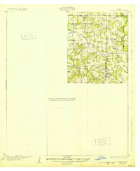
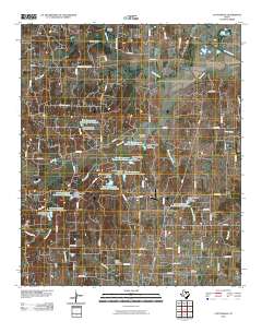
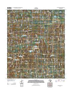
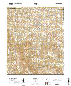
 1958 Springtown1960 Print · USGSSpringtown and the surrounding Parker County countryside are shown here at the height of the mid-century oil boom. Genealogists and historians can trace family sites at Goshen, locate the Historical Monument at Veal Station, or find burials in the Bill Clark Cem.4 unique versions available
 - 1960 Map of Cottondale, 1961 Print
 1960 Cottondale1961 Print · USGSWise County in the early sixties reveals a landscape shaped by emerging energy fields and older rail corridors. Researchers can locate vanished points like Draco (Site) and Lucky Ridge (Site) alongside Annas Chapel and its cemetery.
 - 1985 Map of Fort Worth
 1985 Fort Worth1985 Print · USGSMid-1980s Tarrant County and Parker County emerge from a transition between urban sprawl and rural cattle country. Researchers can trace the expansion of Fort Worth and Arlington alongside older landmarks like Nebo Mtn and Kikapoo Falls.2 unique versions available
 - 1985 Map of Denton
 1985 Denton1985 Print · USGSNorth Texas in the mid-eighties shows a region of growing towns and established rail lines. Trace family roots and local history through Wizard Wells, the old Oaklawn Cem, and the tracks of the Burlington Northern.
 - 1991 Map of Denton
 1991 Denton1991 Print · USGSNorth Texas in the early nineties shows a region transitioning between rural heritage and modern infrastructure across several counties. Genealogists and historians can trace rail lines like the Missouri Pacific or find established settlements such as Sanger, Bolivar, and Greenwood.2 unique versions available
 - 2010 Map of Cottondale, 2010 Print
 2010 Cottondale2010 Print · USGSCovers Springtown, including Lucky Ridge, Cottondale, and other nearby areas
 - 2010 Map of Springtown, 2010 Print
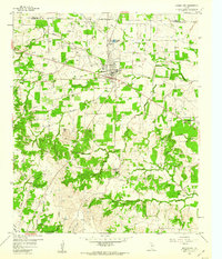
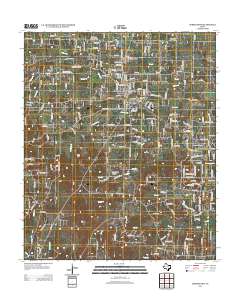
 2010 Springtown2010 Print · USGSCovers Springtown, including Goshen, Highland Addition, and other nearby areas
 - 2012 Map of Springtown, 2012 Print
 2012 Springtown2012 Print · USGSCovers Springtown, including Goshen, Highland Addition, and other nearby areas
 - 2013 Map of Cottondale, 2013 Print
 2013 Cottondale2013 Print · USGSCovers Springtown, including Lucky Ridge, Cottondale, and other nearby areas
 - 2016 Map of Springtown, 2016 Print
 2016 Springtown2016 Print · USGSCovers Springtown, including Goshen, Highland Addition, and other nearby areas
 - 2016 Map of Cottondale, 2016 Print
 2016 Cottondale2016 Print · USGSCovers Springtown, including Lucky Ridge, Cottondale, and other nearby areas
 - 2019 Map of Springtown, 2019 Print
 2019 Springtown2019 Print · USGSCovers Springtown, including Goshen, Highland Addition, and other nearby areas
 - 2019 Map of Cottondale, 2019 Print
 2019 Cottondale2019 Print · USGSCovers Springtown, including Lucky Ridge, Cottondale, and other nearby areas
 - 2022 Map of Cottondale, 2022 Print
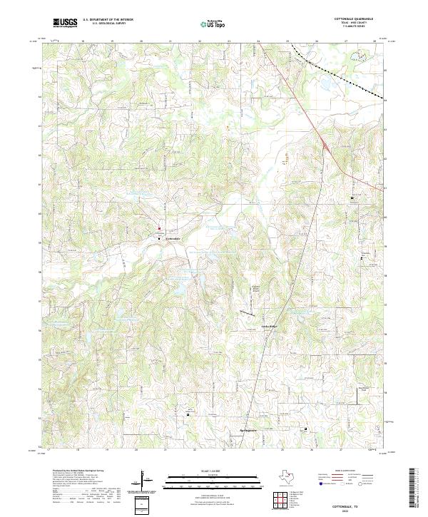 2022 Cottondale2022 Print · USGSWise County's rural landscape is captured here in the early twenty-first century, showing the evolved settlement patterns around Cottondale and Lucky Ridge. Genealogists can locate family burial sites at Garvin Cem, Friendship Cem, and Annis Chapel Cem.
 - 2022 Map of Springtown, 2022 Print
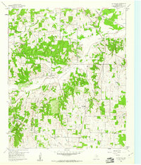
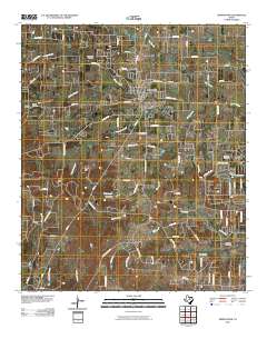
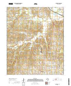
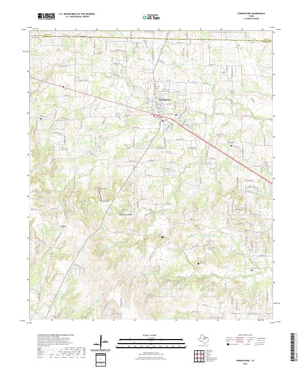 2022 Springtown2022 Print · USGSSpringtown and the surrounding Parker County countryside are captured in this recent survey during a period of steady rural growth. Genealogists can trace family heritage through local landmarks like Veal Station Cem, Bud Clark Cem, and Hangmans Hollow.
End of results
Showing maps 1-23 of 23
Top cities near Springtown
- Fort Worth historical maps
- Weatherford historical maps
- White Settlement historical maps
- Azle historical maps
- Bridgeport historical maps
- Willow Park historical maps
See more
Frequently asked questions
- What are the different types of historical maps available for Springtown?
- What is the oldest map of Springtown?
- Where can I purchase historical maps of Springtown for my home or office?
- Where can I download high-res historical maps of Springtown?
- Are there historical topographic maps available for Springtown?
- Is there historical aerial imagery available for Springtown?
- Where are historical maps of Springtown sourced from?