Old Maps of Portland, Texas for Genealogy
Trace your family roots with 21 historic maps of Portland. These high-res maps reveal old neighborhoods, homesites, landmarks, and streets — helping you uncover where your ancestors lived and how the area evolved over time.
- Explore historic neighborhoods: Identify where your relatives may have lived in the 1800s or 1900s.
- Compare maps over time: Trace the changes in streets, buildings, and landmarks for multi-generational research.
- Perfect for genealogy & ancestry research: Used by family historians and researchers to map out lineage and migration.
These maps are an incredible resource for exploring your personal connection to Portland's past.
Portland, TX maps
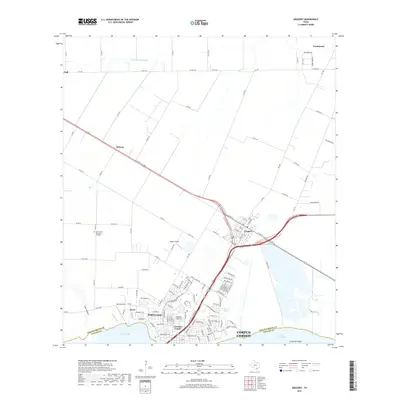
(21)- 1925 Map of Corpus Christi, 1949 Print
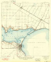 1925 Corpus Christi1949 Print · USGSCorpus Christi and the surrounding coastal plains are captured here in the 1920s, showing the early rail-and-port network of the Texas coast. Researchers can trace rural school locations like Sodville School and early industry at the West Portland Gin.
 - 1950 Map of Corpus Christi, 1953 Print
 1950 Corpus Christi1953 Print · USGSThe South Texas coast comes into focus during the early fifties, showing the interplay between booming oil fields and expansive ranching operations. Genealogists and historians can trace the Texas Mexican rail line through Kingsville or locate heritage sites like Chapman Ranch and Riviera Beach.
 - 1951 Map of Portland, 1952 Print
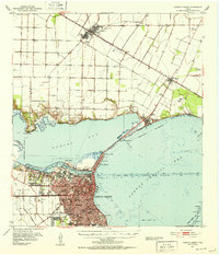
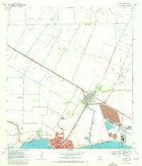
 1951 Portland1952 Print · USGSCoastal Texas in the early fifties is defined here by the maritime and rail activity surrounding Portland. Local historians can trace the original path of the Nueces Bay Causeway, the Southern Pacific line, and the dredging of the Corpus Christi Ship Channel.
 - 1951 Map of Corpus Christi, 1952 Print
 1951 Corpus Christi1952 Print · USGSCorpus Christi and its surrounding bays were undergoing significant industrial and maritime growth in the early fifties. Genealogists and local historians can trace family roots at Bellevue Cem or locate former landmarks like Rosita Ranch and the Cliff Maus Airport.2 unique versions available
 - 1956 Map of Corpus Christi
 1956 Corpus Christi1956 Print · USGSThe South Texas coast and the burgeoning port of Corpus Christi are captured here during the mid-fifties. Genealogists and historians can trace the rail-and-oil economy through labels like Robstown Airpark, Chapman Ranch, and the Missouri Pacific railroad.
 - 1960 Map of Corpus Christi
 1960 Corpus Christi1960 Print · USGSCoastal South Texas and the Nueces County hinterlands are detailed in this mid-century survey. Genealogists and historians can trace early settlement patterns and rural landmarks like Casa Blanca during a period of steady regional growth.
 - 1966 Map of Corpus Christi
 1966 Corpus Christi1966 Print · USGSThe Texas Coastal Bend in the mid-1960s reveals a landscape where massive cattle empires and strategic military bases meet the Gulf. Trace the vast reaches of King Ranch or locate aviation history at the Corpus Christi Air Station and Kingsville Air Station.
 - 1968 Map of Portland, 1971 Print
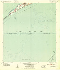
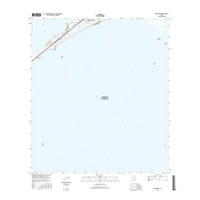
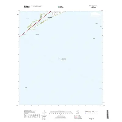
 1968 Portland1971 Print · USGSCoastal Texas in the late sixties shows a landscape defined by the energy industry and maritime navigation. Trace the infrastructure of the bay, from the Causeway at Indian Point to the Gas Wells scattered near Alta Vista Reef.2 unique versions available
 - 1969 Map of Gregory, 1972 Print
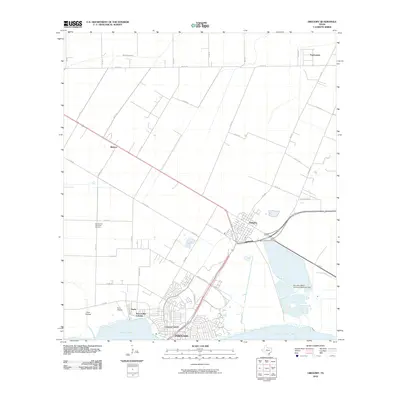
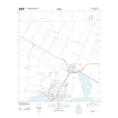
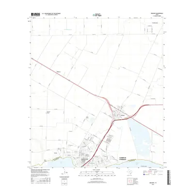
 1969 Gregory1972 Print · USGSSan Patricio County’s shoreline in the late sixties shows the rise of industrial and suburban development along the bays. Genealogists and historians can trace the early layouts of Portland and Gregory, finding landmarks like Hunt Airport and Austin Sch.4 unique versions available
 - 1984 Map of Corpus Christi
 1984 Corpus Christi1984 Print · USGSThe Texas Coastal Bend in the 1980s reveals a landscape defined by deep-water ports and sprawling ranchlands. Researchers can trace the rail lines of the Texas Mexican railroad or locate historical landmarks like the Chapman Ranch and Seaside Memorial Cem.
 - 1989 Map of Corpus Christi, 1991 Print
 1989 Corpus Christi1991 Print · USGSCoastal South Texas and its deep bays are captured here in the late eighties, showcasing a landscape of military aviation and barrier island preservation. Researchers can trace family roots in Petronila or Vattmannville and locate landmarks like Cabaniss Field and Baffin.
 - 2010 Map of Gregory, 2010 Print
 2010 Gregory2010 Print · USGSCovers Portland, including Corpus Christi, Taft, and other nearby areas
 - 2010 Map of Portland, 2010 Print
 2010 Portland2010 Print · USGSCovers Portland, including Corpus Christi, Nueces County, and other nearby areas
 - 2013 Map of Gregory, 2013 Print
 2013 Gregory2013 Print · USGSCovers Portland, including Corpus Christi, Taft, and other nearby areas
 - 2013 Map of Portland, 2013 Print
 2013 Portland2013 Print · USGSCovers Portland, including Corpus Christi, Nueces County, and other nearby areas
 - 2016 Map of Gregory, 2016 Print
 2016 Gregory2016 Print · USGSCovers Portland, including Corpus Christi, Taft, and other nearby areas
 - 2016 Map of Portland, 2016 Print
 2016 Portland2016 Print · USGSCovers Portland, including Corpus Christi, Nueces County, and other nearby areas
 - 2019 Map of Portland, 2019 Print
 2019 Portland2019 Print · USGSCovers Portland, including Corpus Christi, Nueces County, and other nearby areas
 - 2019 Map of Gregory, 2019 Print
 2019 Gregory2019 Print · USGSCovers Portland, including Corpus Christi, Taft, and other nearby areas
 - 2022 Map of Gregory, 2022 Print
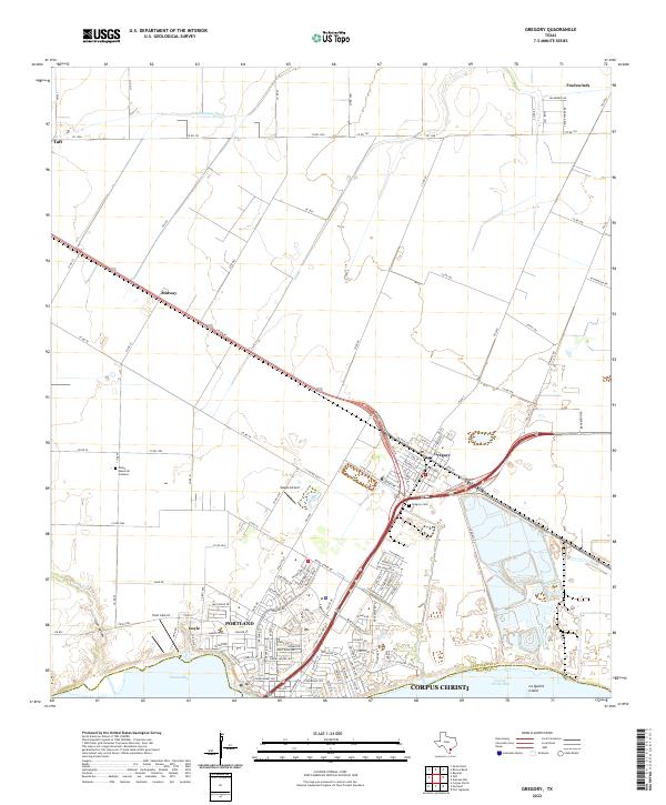 2022 Gregory2022 Print · USGSThe San Patricio County coastline and the growing suburbs of Portland are documented here in the early 2020s. Researchers can trace the layout of coastal settlements like Gregory and Doyle or locate family sites at Gregory Cem.
 - 2022 Map of Portland, 2022 Print
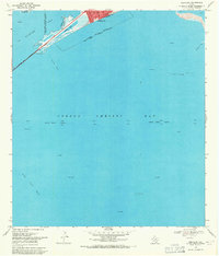
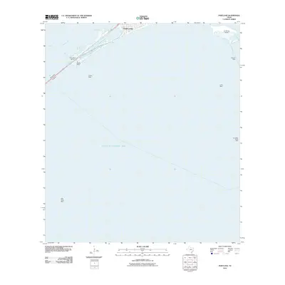
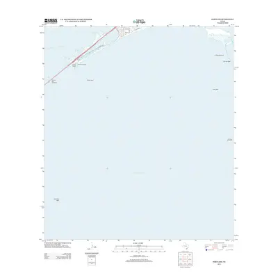
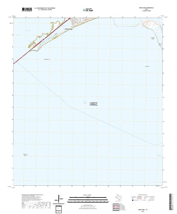 2022 Portland2022 Print · USGSThe Texas Gulf Coast comes into focus in the early 2020s where Portland overlooks the junction of Nueces Bay and the open gulf. Trace the shoreline from Indian Point to La Quinta Island and locate the Indian Point Pier.
End of results
Showing maps 1-21 of 21
Top cities near Portland
- Corpus Christi historical maps
- Rockport historical maps
- Ingleside historical maps
- Aransas Pass historical maps
- Sinton historical maps
- Port Aransas historical maps
See more
Top neighborhoods of Portland
- Nueces Bay Colonia historical maps
- Nueces Bayfront Colonia historical maps
- Doyle historical maps
- Doyle Addition Colonia historical maps
Frequently asked questions
- What are the different types of historical maps available for Portland?
- What is the oldest map of Portland?
- Where can I purchase historical maps of Portland for my home or office?
- Where can I download high-res historical maps of Portland?
- Are there historical topographic maps available for Portland?
- Is there historical aerial imagery available for Portland?
- Where are historical maps of Portland sourced from?