Old Maps of Boden, Texas for Academic Research
Study the evolution of Boden with 11 high-resolution historic maps. Whether you're teaching, researching, or modeling changes in land use, these maps provide essential visual documentation of urban, environmental, and geographic change.
- Analyze long-term change: Track patterns in development, transportation, and natural features.
- Ideal for environmental or urban studies: Support academic projects with primary historical map data.
- Use in the classroom or lab: Educators and researchers rely on these maps to bring historical context to life.
These maps are a powerful tool for teaching, research, and visualizing how Boden has changed over the decades.
Boden, TX maps
(11)- 1934 Map of Ady, 1958 Print
 1934 Ady1958 Print · USGSThe Texas Panhandle ranchlands along the Canadian River were defined by isolated water holes and railroad spurs during the 1930s. Researchers can locate named sites like L S Ranch, Bivins River Camp, and the Old Blackburn Place.2 unique versions available
 - 1936 Map of Ady
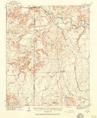
 1936 Ady1936 Print · USGSPotter and Oldham Counties are shown here during the mid-1930s, when the cattle industry and the railroad defined life along the Canadian River. Genealogists and historians can locate early homesteads like Old Blackburn Place and ranching landmarks such as L S Ranch or the Tecovas Spring Fryingpan Ranch.
 - 1954 Map of Tucumcari, 1965 Print
 1954 Tucumcari1965 Print · USGSThe high plains along the New Mexico and Texas border come alive in this mid-century survey, just as the regional highway network was maturing. Trace the historic route of U.S. 66 through Glenrio and San Jon or locate remote rail sidings like Rehm Station and Obar.2 unique versions available
 - 1958 Map of Tucumcari
 1958 Tucumcari1958 Print · USGSEastern New Mexico and the Texas Panhandle meet in this mid-century survey of the high plains ranching and rail corridor. Researchers can trace the path of Mother Road travelers through Tucumcari and Glenrio or locate remote rail stops like Nara Visa Station and Hartley Station.
 - 1966 Map of Boden, 1969 Print
 1966 Boden1969 Print · USGSIn the mid-sixties, this Potter County landscape shows the sparse settlement and infrastructure of the Texas Panhandle. Genealogists and historians can trace the Fort Worth and Denver railroad through Boden or locate old ranching landmarks like the Highway Windmill.
 - 1985 Map of Vega, 1986 Print
 1985 Vega1986 Print · USGSThe Texas Panhandle is captured in the mid-eighties as the cattle and rail economy shaped the landscape from the Canadian River breaks to the southern plains. Researchers can trace the Atchison Topeka and Santa Fe line through Vega and Wildorado or locate landmarks like the Old Railroad Grade and Bivins Lake.2 unique versions available
 - 2010 Map of Boden, 2010 Print
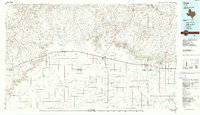
 2010 Boden2010 Print · USGSCovers Boden, including Potter County, United States, and other nearby areas
 - 2012 Map of Boden, 2012 Print
 2012 Boden2012 Print · USGSCovers Boden, including Potter County, United States, and other nearby areas
 - 2016 Map of Boden, 2016 Print
 2016 Boden2016 Print · USGSCovers Boden, including Potter County, United States, and other nearby areas
 - 2019 Map of Boden, 2019 Print
 2019 Boden2019 Print · USGSCovers Boden, including Potter County, United States, and other nearby areas
 - 2022 Map of Boden, 2022 Print
 2022 Boden2022 Print · USGSPotter County, Texas, near the Canadian River valley is shown here in the early 2020s as a landscape of ranching roads and river breaks. Local researchers can trace family-named landmarks and geographic features like Boden, Whale Pond, and The Island.
End of results
Showing maps 1-11 of 11
Top cities near Boden
Frequently asked questions
- What are the different types of historical maps available for Boden?
- What is the oldest map of Boden?
- Where can I purchase historical maps of Boden for my home or office?
- Where can I download high-res historical maps of Boden?
- Are there historical topographic maps available for Boden?
- Is there historical aerial imagery available for Boden?
- Where are historical maps of Boden sourced from?