2020s Maps of Balmorhea, Texas
Explore 2 historic maps of Balmorhea from the 2020s. These maps offer a rare glimpse into what life looked like during the 2020s — showing old roads, neighborhoods, homes, and landmarks that have changed or disappeared over time.
Whether you're researching your family's past, planning a metal detecting trip, or studying how Balmorhea's landscape evolved across the 2020s, these high-resolution maps are a powerful tool for exploring the history of this region.
- Focus on a specific era: All maps on this page are from the 2020s, giving you a focused view of this time period.
- See what’s changed: Compare century-old streets, trails, and buildings to today's modern landscape using overlays and satellite layers.
- Research with precision: Use these maps for genealogy, historical research, land use analysis, or educational projects.
- View, download, or print: Maps are fully viewable online in high resolution, and can be downloaded or printed for your own records.
Start exploring Balmorhea's history through authentic maps from the 2020s. This is your window into the past.
Balmorhea, TX maps
(2)- 2022 Map of Toyahvale, 2022 Print
 2022 Toyahvale2022 Print · USGSThe desert oases of Reeves County are centered here at the southern edge of the Toyah Basin. Researchers can trace the complex irrigation networks of the Madera Diversion Canal and Main Canal or locate local landmarks like San Solomon Spring and Balmorhea Cem.
 - 2022 Map of Balmorhea, 2022 Print
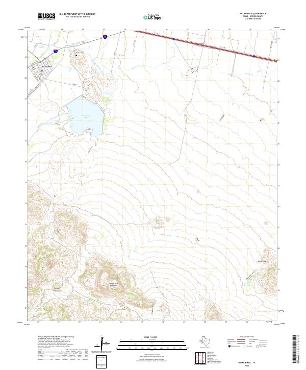 2022 Balmorhea2022 Print · USGSThe desert springs and irrigation canals of Balmorhea are documented here in the early twenty-first century. Researchers can trace the water network from Sandia Springs to Balmorhea Lake, or locate family sites near Brogado Cem and along Railroad Ave.
End of results
Showing maps 1-2 of 2
Frequently asked questions
- What are the different types of historical maps available for Balmorhea?
- What is the oldest map of Balmorhea?
- Where can I purchase historical maps of Balmorhea for my home or office?
- Where can I download high-res historical maps of Balmorhea?
- Are there historical topographic maps available for Balmorhea?
- Is there historical aerial imagery available for Balmorhea?
- Where are historical maps of Balmorhea sourced from?