Old Maps of Sabine County, Texas for Genealogy
Trace your family roots with 143 historic maps of Sabine County. These high-res maps reveal old neighborhoods, homesites, landmarks, and streets — helping you uncover where your ancestors lived and how the area evolved over time.
- Explore historic neighborhoods: Identify where your relatives may have lived in the 1800s or 1900s.
- Compare maps over time: Trace the changes in streets, buildings, and landmarks for multi-generational research.
- Perfect for genealogy & ancestry research: Used by family historians and researchers to map out lineage and migration.
These maps are an incredible resource for exploring your personal connection to Sabine County's past.
Sabine County, TX maps
(143)- 1941 Map of Zwolle
 1941 Zwolle1941 Print · USGSSabine Parish in the early 1940s is captured here as a landscape of timber-driven rail lines and riverside crossings. Genealogists can trace the rural communities of the era through sites like Pattersons Ferry, Alliance Sch, and Sardis Cem.
 - 1944 Map of Negreet
 1944 Negreet1944 Print · USGSThe Sabine River valley at the height of the Second World War shows a landscape of river sloughs and forest communities before the arrival of the great reservoirs. Genealogists can trace family roots through numerous rural landmarks like Beulah Ch, Redland Cem, and the old Negreet School.
 - 1944 Map of Wiergate
 1944 Wiergate1944 Print · USGSNewton County and the Sabine River borderlands are captured here in the mid-1940s during the peak of the local timber era. Genealogists and researchers can trace family landmarks like Toledo Cem, the Gulf Northern rail line, and the rural Mayflower Sch.2 unique versions available
 - 1944 Map of Patroon
 1944 Patroon1944 Print · USGSThe Sabine River bottomlands at the Texas-Louisiana border come to life in this mid-century survey of Shelby County. Researchers can locate vanished landmarks like the Patroon CCC Camp, rural stores at Jordans Store, and local gathering places like Beech Grove Ch.2 unique versions available
 - 1944 Map of Zwolle
 1944 Zwolle1944 Print · USGSSabine Parish and the borderlands of Louisiana and Texas are captured here during the wartime economy. Family historians can locate rural landmarks like Noble Cem, Alliance Sch, and small community centers at Belmont and Vines.2 unique versions available
 - 1948 Map of Wiergate, 1954 Print
 1948 Wiergate1954 Print · USGSThe Sabine River bottomlands and the timbered hills of Newton County are mapped here in the late 1940s. Genealogists and historians can trace rural life through landmarks like Anthonys Ferry, Scott Cem, and the old Sycamore Sch in the heart of the Sabine National Forest.
 - 1953 Map of Alexandria, 1963 Print
 1953 Alexandria1963 Print · USGSCentral Louisiana during the early fifties is mapped here at the intersection of the piney woods and the Red River valley. Genealogists and historians can trace the rail-and-river network connecting towns like Alexandria, Natchitoches, and the grounds of Camp Beauregard.3 unique versions available
 - 1953 Map of Palestine, 1964 Print
 1953 Palestine1964 Print · USGSEast Texas was defined by its deep pine forests and burgeoning energy sector in the mid-1950s. Genealogists and historians can trace the rail-and-river economy through settlements like Tennessee Colony and Pollok or explore the early footprints of the Cayuga Oil Field and Davy Crockett National Forest.2 unique versions available
 - 1954 Map of Toro, 1958 Print
 1954 Toro1958 Print · USGSMid-century Sabine Parish comes to life in this survey of the communities along the Texas and Louisiana border. Trace the vanished timber economy through a dismantled railroad and find local history at McMillion Cemetery, Toro, and Pine Flat School.3 unique versions available
 - 1954 Map of Columbus, 1958 Print
 1954 Columbus1958 Print · USGSThe Sabine River borderlands in the mid-1950s reveal a landscape of dense piney woods and winding bayous. Researchers can trace the river's old oxbows at Harpers Bend and locate rural landmarks like Blue Springs School, the dismantled railroad, and Columbus.3 unique versions available
 - 1954 Map of Fairdale, 1958 Print
 1954 Fairdale1958 Print · USGSThe deep timberlands of East Texas are captured here in the mid-1950s as the Sabine National Forest reclaimed the landscape. Researchers can trace the path of a dismantled railroad and locate family burial sites at Fairmount Cemetery or Mt Sinai Cemetery.2 unique versions available
 - 1954 Map of Negreet, 1958 Print
 1954 Negreet1958 Print · USGSSabine Parish and the Texas borderlands are captured here in the mid-fifties, dominated by the winding river and forest reaches. Genealogists and researchers can trace rural life through landmarks like McFarland Store, Toro High School, and Pendleton Church.4 unique versions available
 - 1954 Map of Wiergate, 1958 Print
 1954 Wiergate1958 Print · USGSThe Sabine River bottomlands and the pine forests of Newton County are shown here in the mid-1950s. Genealogists and local historians can trace family locations through sites like Anthonys Ferry, Fairmount Cemetery, and the Survey School.3 unique versions available
 - 1954 Map of Haddens, 1958 Print
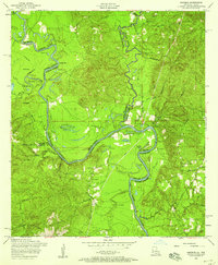 1954 Haddens1958 Print · USGSThe Sabine River basin at the Louisiana-Texas border comes to life in this mid-century survey. You can trace old river crossings and family landmarks like Anthonys Ferry, Toledo Cemetery, and Freedom Rest Church.3 unique versions available
 - 1954 Map of Salter Creek, 1970 Print
 1954 Salter Creek1970 Print · USGSThe Texas-Louisiana borderlands appear here in the mid-fifties, just as the landscape was being reshaped by large-scale water management projects. Researchers can trace the river's original bends near Goodlow Bluff and find rural sites like Mullet Cemetery and Shady Grove.2 unique versions available
 - 1955 Map of Alexandria
 1955 Alexandria1955 Print · USGSCentral Louisiana in the mid-fifties is a landscape of river-port cities, sprawling timberlands, and massive military reservations. Genealogists and historians can trace the rail networks of the Texas & Pacific RR and locate sites like Camp Polk Military Reservation and Natchitoches.
 - 1956 Map of Patroon, 1957 Print
 1956 Patroon1957 Print · USGSThe Texas-Louisiana borderlands along the Sabine River are captured here in the mid-1950s, showing a landscape of river bends and pine forests. Genealogists can trace family footprints through rural sites like Bulls Ankle, Ragtown, and Harvey Cem.4 unique versions available
 - 1957 Map of Palestine
 1957 Palestine1957 Print · USGSEast Texas in the mid-fifties reveals a landscape of deep pine forests and winding river valleys before the era of massive reservoir construction. Researchers can trace the legacy of the timber and rail industries through labels for the Missouri Pacific RR, Davy Crockett National Forest, and Nacogdoches.
 - 1957 Map of Brookeland, 1959 Print
 1957 Brookeland1959 Print · USGSDeep in the Piney Woods during the late fifties, this area shows a landscape defined by timber, rail, and family settlements. Genealogists can trace rural roots at Weeks Settlement, Browndell, and the Low Cem (Historical Mon).2 unique versions available
 - 1957 Map of Zwolle, 1966 Print
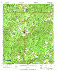 1957 Zwolle1966 Print · USGSSabine Parish in the late fifties shows a rural landscape of timber, oil, and rail transport. Researchers can trace the Kansas City Southern Ry through Zwolle or locate rural landmarks like San Patricio Ch and Clyde Cem.4 unique versions available
 - 1958 Map of Hemphill, 1959 Print
 1958 Hemphill1959 Print · USGSIn the piney woods of East Texas during the late fifties, the timber industry and rural settlements defined the landscape. Genealogists and historians can trace family burial sites like Mc Mahan Chapel Cem or locate the Austin College Forestry Camp.4 unique versions available
 - 1958 Map of Mc Gee Bend, 1959 Print
 1958 Mc Gee Bend1959 Print · USGSEast Texas at the end of the 1950s shows a landscape on the brink of change as the Angelina River is harnessed. Trace lost locations like Veach and Zavala or locate family roots at Oak Grove Ch and Sinclair Cem.3 unique versions available
 - 1958 Map of Bronson, 1959 Print
 1958 Bronson1959 Print · USGSSan Augustine and Sabine counties are captured in the late fifties as the regional landscape prepared for the creation of the McGee Bend Reservoir. Researchers can trace rural cemeteries like Nath Beck Cem, visit Maxey Town, and follow the old Gulf Colorado and Santa Fe Railroad Grade.3 unique versions available
 - 1969 Map of Brookeland, 1970 Print
 1969 Brookeland1970 Print · USGSEast Texas timberlands and rising reservoir waters meet in this late-sixties study of the Sabine National Forest. Trace the local genealogy of Brookeland through landmarks like Lowe Cem (Historical Mon) and Weeks Settlement.
 - 1984 Map of Milam
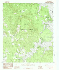 1984 Milam1984 Print · USGSThe Sabine River borderlands in the mid-1980s reveal a landscape shaped by timber and the rising waters of the Toledo Bend Reservoir. Local historians can trace lakeside settlements like Mid Lake Village and Milam alongside forest landmarks such as Chambers Tower.
Showing maps 1-25 of 143
Top cities of Sabine County
Frequently asked questions
- What are the different types of historical maps available for Sabine County?
- What is the oldest map of Sabine County?
- Where can I purchase historical maps of Sabine County for my home or office?
- Where can I download high-res historical maps of Sabine County?
- Are there historical topographic maps available for Sabine County?
- Is there historical aerial imagery available for Sabine County?
- Where are historical maps of Sabine County sourced from?