1900s (20th Century) Maps of Smith County, Texas
Explore 46 historic maps of Smith County from the 1900s (20th Century). These maps offer a rare glimpse into what life looked like during the 1900s — showing old roads, neighborhoods, homes, and landmarks that have changed or disappeared over time.
Whether you're researching your family's past, planning a metal detecting trip, or studying how Smith County's landscape evolved across the 1900s, these high-resolution maps are a powerful tool for exploring the history of this region.
- Focus on a specific era: All maps on this page are from the 1900s, giving you a focused view of this time period.
- See what’s changed: Compare century-old streets, trails, and buildings to today's modern landscape using overlays and satellite layers.
- Research with precision: Use these maps for genealogy, historical research, land use analysis, or educational projects.
- View, download, or print: Maps are fully viewable online in high resolution, and can be downloaded or printed for your own records.
Start exploring Smith County's history through authentic maps from the 1900s. This is your window into the past.
Smith County, TX maps
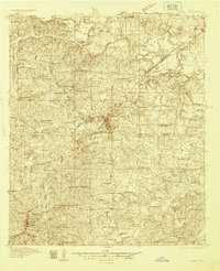
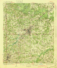
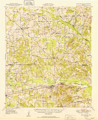
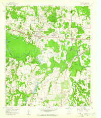
(46)- 1935 Map of Henderson
 1935 Henderson1935 Print · USGSRusk County in the mid-1930s is a landscape defined by the East Texas oil boom and its sprawling rural communities. Researchers can trace early family sites like Old London Cemetery and Duncan Cemetery or locate industrial landmarks like the Lisbon Gasoline Company Plant.
 - 1936 Map of Kilgore
 1936 Kilgore1936 Print · USGSThe East Texas Oil Field era is in full swing here in the mid-1930s, showing a landscape of rapid industrial and rural development. Genealogists can trace family ties at Leveretts Chapel Sch or Kilgore Cem, and locate vanished landmarks like Swamp City or the Gregg County Prison Farm.2 unique versions available
 - 1937 Map of Troupe
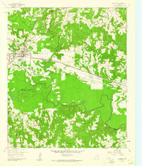
 1937 Troupe1937 Print · USGSEast Texas oil and rail culture are on full display in the 1930s as the Missouri Pacific railroad connects rural communities. Local historians can trace the foundations of the regional economy through sites like the Sun Oil Camp, St Clair City, and Henry's Chapel.
 - 1938 Map of Winona
 1938 Winona1938 Print · USGSSmith County during the late thirties was a landscape of close-knit rural communities and a burgeoning highway system. Family historians can trace numerous rural schoolhouses and churches like the Maggie Murphy Sch and White Chapel, alongside the St Louis Southwestern Line railroad.
 - 1939 Map of Henderson
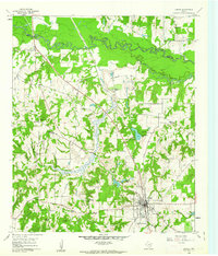
 1939 Henderson1939 Print · USGSRusk County at the peak of the 1930s oil boom reveals a landscape of rapidly growing settlements and dense rural infrastructure. Researchers can trace the footprints of Joinerville, Old London, and Gaston School alongside the Missouri Pacific rail line.
 - 1940 Map of Kilgore
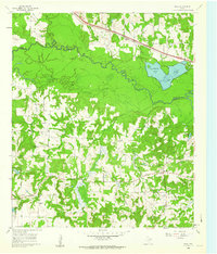
 1940 Kilgore1940 Print · USGSKilgore and the surrounding oil fields come to life in this mid-century survey of the East Texas boom. Researchers can trace the layout of early energy settlements like Oil City and Swamp City alongside rural landmarks like Laird Hill Sch and Rock Springs Mission.2 unique versions available
 - 1943 Map of Troup
 1943 Troup1943 Print · USGSEast Texas agriculture and rail towns thrive in the late 1930s along the Smith and Cherokee County line. Family historians can trace rural roots through numerous landmarks like Tecula Cem, Walnut Grove Ch, and Enterprise Sch.3 unique versions available
 - 1943 Map of Winona
 1943 Winona1943 Print · USGSThe rural landscape of Smith County is captured here just before the mid-century, showing a vibrant network of community schools and churches. Genealogists can trace family footprints through sites like Seastrunk Cem, Maggie Murphy Sch, and the St Louis Southwestern rail line.2 unique versions available
 - 1946 Map of Bullard, 1960 Print
 1946 Bullard1960 Print · USGSEast Texas rail and river life converge in the 1940s as the St Louis Southwestern tracks link rural farming hubs. Trace local family history through numerous landmarks like Larissa Cem, the Kickapoo Monument, and Mount Selman.2 unique versions available
 - 1948 Map of Bullard
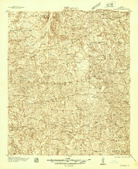
 1948 Bullard1948 Print · USGSNortheastern Cherokee and southern Smith counties are captured here in the late forties, showcasing a network of rural schools and rail-fed towns. Genealogists can trace family sites at Larissa Cem, Mount Comfort Ch, and the high ground of Kickapoo Mtn.
 - 1948 Map of Tyler, 1964 Print
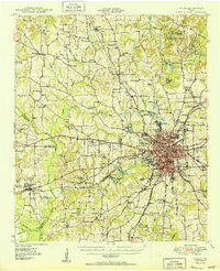
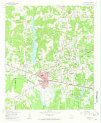
 1948 Tyler1964 Print · USGSSmith County and the growing city of Tyler are captured here in the late 1940s, showing a landscape of rail-driven commerce and established rural communities. Local historians can trace family roots through numerous landmarks like Camp Ford, Pounds Field, and Texas College.2 unique versions available
 - 1948 Map of Brownsboro, 1966 Print
 1948 Brownsboro1966 Print · USGSHenderson and Van Zandt counties appear here in the late 1940s as a landscape of rural schoolhouses and family cemeteries along the St Louis Southwestern rails. Genealogists can locate family landmarks like Old Norwegian Cem, Smith Chapel, and Prairie Springs Cem.
 - 1949 Map of Tyler
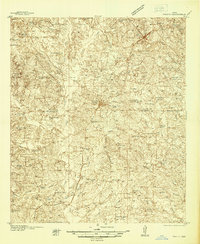
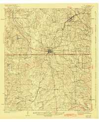
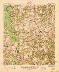
 1949 Tyler1949 Print · USGSMid-century Smith County is captured here at a peak of rail and aviation development, centered on the growing hub of Tyler. Genealogists and historians can trace numerous country churches and schools like Lanes Chapel and Young Hill Sch, alongside the sprawling grounds of Camp Ford.
 - 1949 Map of Brownsboro
 1949 Brownsboro1949 Print · USGSEast Texas at the end of the 1940s reveals a network of railroad towns and oil fields at the Henderson and Smith county line. Genealogy researchers can trace local family roots through sites like Old Norwegian Cem, Sexton Chapel, and Arc Ridge Sch.
 - 1956 Map of Tyler
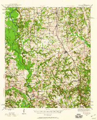
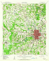
 1956 Tyler1956 Print · USGSEast Texas was a powerhouse of oil production and rail transport during the mid-fifties, centered on the sprawling East Texas Oil Field. Researchers can trace the heritage of industrial hubs like Kilgore, military sites such as the Longhorn Ordnance Works, and many rural landmarks like Mount Enterprise.5 unique versions available
 - 1959 Map of Golden, 1960 Print
 1959 Golden1960 Print · USGSThe Sabine River bottomlands in the late fifties show a landscape of deep wetlands and evolving industry at the junction of three counties. Genealogists and local historians can trace rural landmarks like Sand Springs Church, the Greenland Ford Cem, and the community of Golden.3 unique versions available
 - 1959 Map of Van Lake, 1960 Print
 1959 Van Lake1960 Print · USGSThe oil-rich landscape of East Texas in the late fifties comes alive on this map, showing the rural crossroads and petroleum fields of Smith and Van Zandt counties. Genealogists can locate family landmarks like Dickerson Cem and churches like Union Chapel and Wisdom Temple.4 unique versions available
 - 1959 Map of Grand Saline, 1961 Print
 1959 Grand Saline1961 Print · USGSEast Texas in the late fifties reveals a landscape shaped by the oil industry and the railroad. Researchers can trace family-named sites and vanished landmarks like Collins Ferry, Van Oil Field, and the Union Chapel.2 unique versions available
 - 1960 Map of Hawkins, 1961 Print
 1960 Hawkins1961 Print · USGSHawkins and the Sabine River valley are shown here during the peak of the local oil boom in the early sixties. Researchers can trace family sites near Jarvis Christian College, find old burials at Liberty Cem, or locate the Hawkins Oil Field wells.3 unique versions available
 - 1960 Map of Big Sandy, 1961 Print
 1960 Big Sandy1961 Print · USGSIn the early 1960s, this East Texas corridor was defined by the confluence of major rail lines and the Sabine River. Genealogists can trace family names and rural communities through Union Grove Ch, Chilton Cem, and the old settlement at Waters Bluff.3 unique versions available
 - 1960 Map of Lindale, 1962 Print
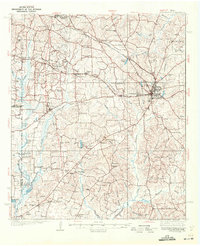
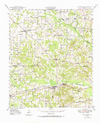
 1960 Lindale1962 Print · USGSLindale and its East Texas surroundings are captured here at a moment of mid-century growth along the Missouri Pacific rail line. Genealogists and local historians can trace family roots through sites like Flewellen Cem, the Bragg Morris High Sch, and the community at Friendship.3 unique versions available
 - 1960 Map of Crow, 1962 Print
 1960 Crow1962 Print · USGSWood and Smith Counties are captured here in the early sixties, defined by the winding Sabine River and the rural community of Red Springs. Researchers can locate Red Springs Cem, family-named water bodies like Overton Lake, and several country churches.2 unique versions available
 - 1960 Map of Gladewater, 1962 Print
 1960 Gladewater1962 Print · USGSEast Texas at the start of the 1960s reveals a landscape of oil production and rural communities centered on the Sabine River. Researchers can trace the Texas and Pacific rail line through Gladewater and locate local landmarks like the Edwards Cem and Warren City.2 unique versions available
 - 1966 Map of Chandler, 1967 Print
 1966 Chandler1967 Print · USGSChandler and the surrounding East Texas countryside are shown in the mid-sixties during the development of Lake Palestine. Researchers can trace old family roots at Macedonia Cem and Sevenleague Cem or locate former community centers like Dixie Sch.3 unique versions available
 - 1966 Map of Hope Pond, 1968 Print
 1966 Hope Pond1968 Print · USGSEast of Tyler in the mid-1960s, this area of Smith County shows a rural landscape of winding creeks and family cemeteries. Genealogists can locate legacy sites like Holt Cem and Wilson Curtis Cem or trace the path of the Missouri Pacific railroad.3 unique versions available
Showing maps 1-25 of 46
Top cities of Smith County
- Tyler historical maps
- Whitehouse historical maps
- Lindale historical maps
- Hideaway historical maps
- Troup historical maps
- Arp historical maps
See more
Frequently asked questions
- What are the different types of historical maps available for Smith County?
- What is the oldest map of Smith County?
- Where can I purchase historical maps of Smith County for my home or office?
- Where can I download high-res historical maps of Smith County?
- Are there historical topographic maps available for Smith County?
- Is there historical aerial imagery available for Smith County?
- Where are historical maps of Smith County sourced from?