1900s (20th Century) Maps of Ingham Ranch, Texas
Explore 5 historic maps of Ingham Ranch from the 1900s (20th Century). These maps offer a rare glimpse into what life looked like during the 1900s — showing old roads, neighborhoods, homes, and landmarks that have changed or disappeared over time.
Whether you're researching your family's past, planning a metal detecting trip, or studying how Ingham Ranch's landscape evolved across the 1900s, these high-resolution maps are a powerful tool for exploring the history of this region.
- Focus on a specific era: All maps on this page are from the 1900s, giving you a focused view of this time period.
- See what’s changed: Compare century-old streets, trails, and buildings to today's modern landscape using overlays and satellite layers.
- Research with precision: Use these maps for genealogy, historical research, land use analysis, or educational projects.
- View, download, or print: Maps are fully viewable online in high resolution, and can be downloaded or printed for your own records.
Start exploring Ingham Ranch's history through authentic maps from the 1900s. This is your window into the past.
Ingham Ranch, TX maps
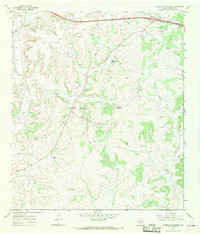
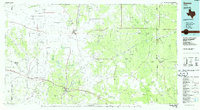
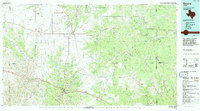
(5)- 1954 Map of Sonora, 1965 Print
 1954 Sonora1965 Print · USGSThe Edwards Plateau and West Texas ranching country come alive in this mid-century survey of the canyons and plateaus. Genealogists and historians can trace the remote settlements of Pandale and Loma Alta or follow the path of the Panhandle and Santa Fe RR.2 unique versions available
 - 1958 Map of Sonora
 1958 Sonora1958 Print · USGSThe Edwards Plateau and Trans-Pecos region come alive in the late fifties, showing a landscape of remote ranchlands and historic frontier outposts. Trace the legacy of Fort Lancaster Ruins, the limestone depths of Devils Sinkhole Cavern, and the path of the Pecos River.
 - 1967 Map of Caverns Of Sonora, 1970 Print
 1967 Caverns Of Sonora1970 Print · USGSSutton County ranchlands are captured here in the late sixties, showing a landscape of scattered family holdings and energy exploration. Researchers can trace the footprints of the Simmons Ranch, Valliant Ranch, and the Caverns of Sonora.2 unique versions available
 - 1985 Map of Sonora, 1986 Print
 1985 Sonora1986 Print · USGSThe Edwards Plateau in the mid-1980s reveals a landscape of ranching heritage and expanding energy production. Researchers can trace the Old Railroad Grade, locate the historic Fort McKavett, and explore the extent of the Steen Gas Field.
 - 1994 Map of Sonora
 1994 Sonora1994 Print · USGSThe West Texas ranching and energy country around Sonora and Eldorado comes to life in this mid-nineties survey. Researchers can trace the extensive Page Oil and Gas Field network, locate the Caverns of Sonora, and follow the headwaters of the North Llano River.
End of results
Showing maps 1-5 of 5
Top cities near Ingham Ranch
Frequently asked questions
- What are the different types of historical maps available for Ingham Ranch?
- What is the oldest map of Ingham Ranch?
- Where can I purchase historical maps of Ingham Ranch for my home or office?
- Where can I download high-res historical maps of Ingham Ranch?
- Are there historical topographic maps available for Ingham Ranch?
- Is there historical aerial imagery available for Ingham Ranch?
- Where are historical maps of Ingham Ranch sourced from?