
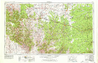
1954 Map of Sonora
USGS Topo · Published 1965About this map
The Edwards Plateau landscape of West Texas is revealed in this mid-century survey, documenting a region defined by its deep canyons and critical water courses. Centered on Sonora, the map traces the intricate drainage networks of the Pecos River and Devils River, alongside numerous tributaries like Howards Creek and Johnson Run. The terrain is marked by significant geological features including Yates Mesa and a series of prominent breaks such as Government Canyon and Meyers Canyon.
Find a feature on this map
47 named features on this map. Tap any name to fly to it.
Don’t see what you’re looking for? This feature index may not catch every label — zoom into the map to look around manually.
Map Details
Editions of this 1954 Sonora Map
2 editions found
Other maps of this area

1892 · San Angelo
USGS Topo · 1:125,000

1892 · Eden
USGS Topo · 1:125,000

1893 · Rock Springs
USGS Topo · 1:125,000

1893 · Fort McKavett
USGS Topo · 1:125,000

1893 · Nueces
USGS Topo · 1:125,000

1895 · Sherwood
USGS Topo · 1:125,000

1896 · Nueces
USGS Topo · 1:125,000

1896 · Eden
USGS Topo · 1:125,000

1918 · Dryden Crossing
USGS Topo · 1:62,500

1920 · Big Lake
USGS Topo · 1:62,500