2020s Maps of Swisher County, Texas
Explore 20 historic maps of Swisher County from the 2020s. These maps offer a rare glimpse into what life looked like during the 2020s — showing old roads, neighborhoods, homes, and landmarks that have changed or disappeared over time.
Whether you're researching your family's past, planning a metal detecting trip, or studying how Swisher County's landscape evolved across the 2020s, these high-resolution maps are a powerful tool for exploring the history of this region.
- Focus on a specific era: All maps on this page are from the 2020s, giving you a focused view of this time period.
- See what’s changed: Compare century-old streets, trails, and buildings to today's modern landscape using overlays and satellite layers.
- Research with precision: Use these maps for genealogy, historical research, land use analysis, or educational projects.
- View, download, or print: Maps are fully viewable online in high resolution, and can be downloaded or printed for your own records.
Start exploring Swisher County's history through authentic maps from the 2020s. This is your window into the past.
Swisher County, TX maps
(20)- 2022 Map of Rock Creek, 2022 Print
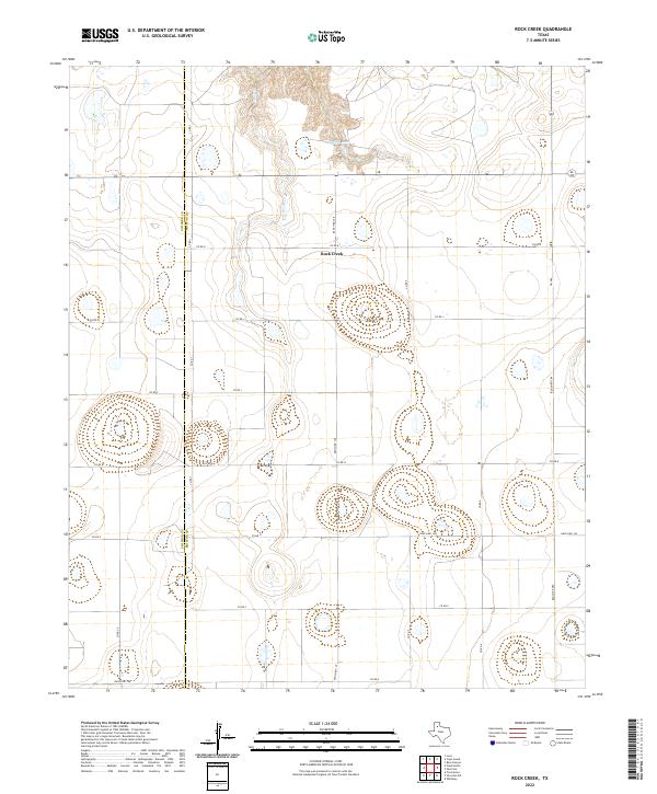 2022 Rock Creek2022 Print · USGSThe high plains along the Swisher Co Briscoe Co line are defined by the deep drainages of Rock Creek in this recent survey. Local researchers can trace the intricate network of section roads like Ranch Rd 145 and Co Rd K as they navigate the area surrounding Mayfield Lake.
 - 2022 Map of Silverton SW, 2022 Print
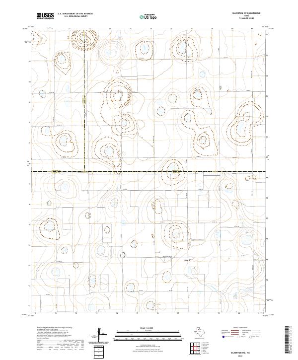 2022 Silverton SW2022 Print · USGSThe High Plains of Floyd and Briscoe counties are captured here in the early twenty-first century, showing a landscape of playa lakes and deep agricultural roots. Researchers can trace the tri-county boundary lines near the settlement of Lone Star and along the winding path of Quitaque Cr.
 - 2022 Map of Tule Lake NW, 2022 Print
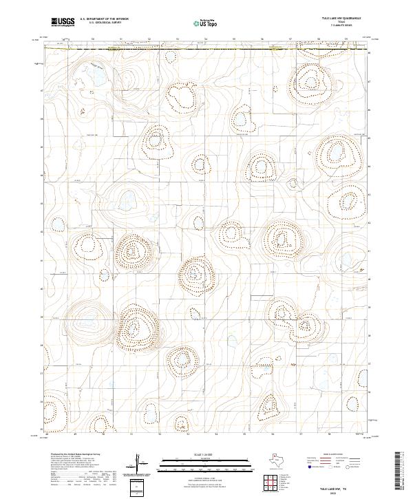 2022 Tule Lake NW2022 Print · USGSThe High Plains along the Randall and Swisher county line are shown here in their modern rural state. Local historians can trace the grid of ranching roads and water features like Happy Draw, FM 1075, and Ranch RD 1881.
 - 2022 Map of Tule Lake, 2022 Print
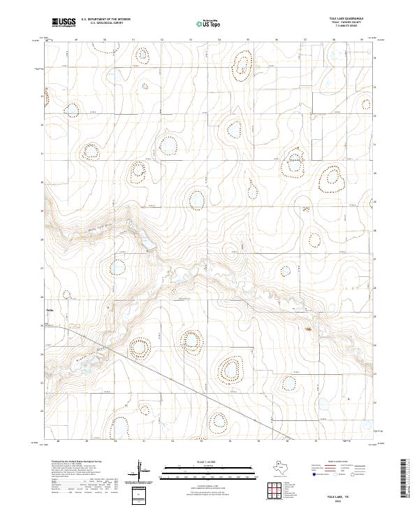 2022 Tule Lake2022 Print · USGSThe eastern outskirts of Tulia meet the expansive draws of the Texas Panhandle in the early twenty-first century. Researchers can trace the hydraulic landscape from North Tule Draw to the Bill Bivens Reservoir and the rural network of Co Rd 15.
 - 2022 Map of Lakeview, 2022 Print
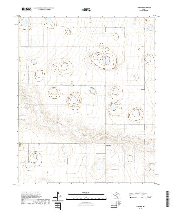 2022 Lakeview2022 Print · USGSThe High Plains of the Texas Panhandle are captured here in the early twenty-first century, showing the intersection of agricultural land and administrative borders. Researchers can trace the path of Middle Tule Draw or locate the community of Lakeview near the junction of Fm 1424 and Co Rd N.
 - 2022 Map of Love, 2022 Print
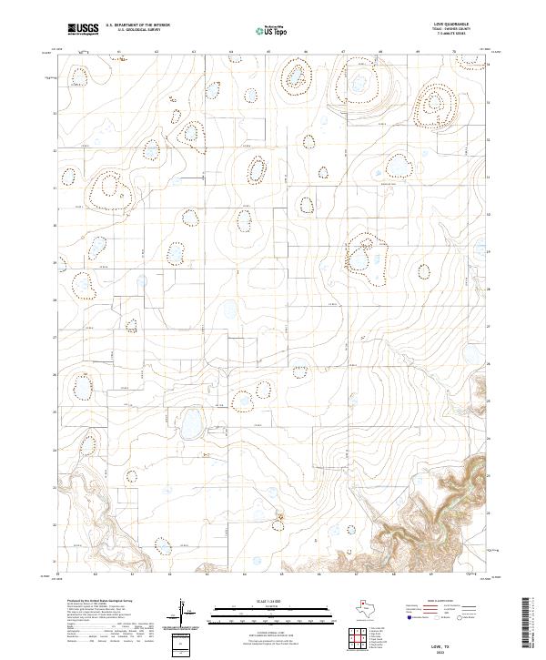 2022 Love2022 Print · USGSSwisher County ranchlands and canyon breaks are captured here in the early twenty-first century. Researchers can trace the rugged descent of Tule Cr or navigate the extensive network of rural thoroughfares like FM 2301 and Ranch Rd 3300.
 - 2022 Map of Claytonville, 2022 Print
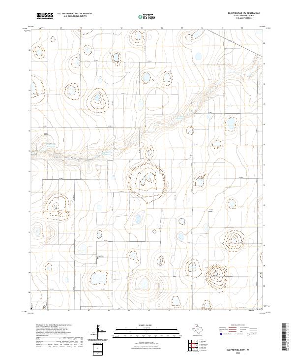
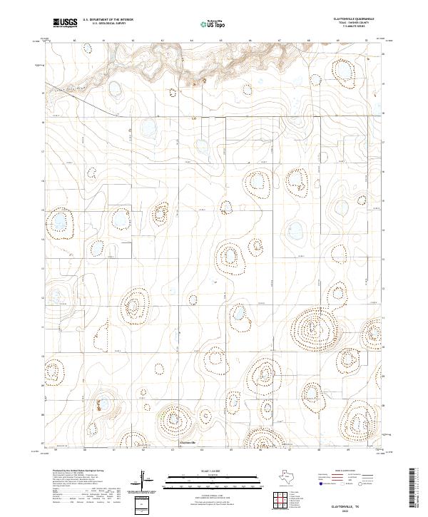 2022 Claytonville2022 Print · USGSSwisher County agricultural lands and the community of Claytonville are captured here in the early twenty-first century. Researchers can trace the drainage of South Tule Draw and Tule Cr as they cut through a landscape of playa lakes and rural routes like Fm 2301.
 - 2022 Map of Vigo Park, 2022 Print
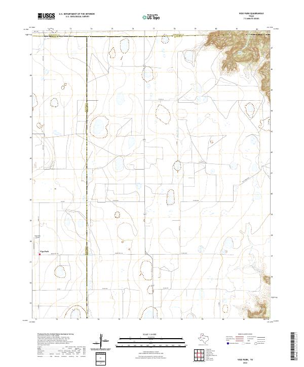 2022 Vigo Park2022 Print · USGSThe Texas Panhandle near the Briscoe and Swisher county lines comes into focus in this contemporary survey of the High Plains. Local researchers can trace the rural network surrounding Vigo Park, from the Vigo Park Airport to the canyon breaks near Mulsey Springs.
 - 2022 Map of Kress West, 2022 Print
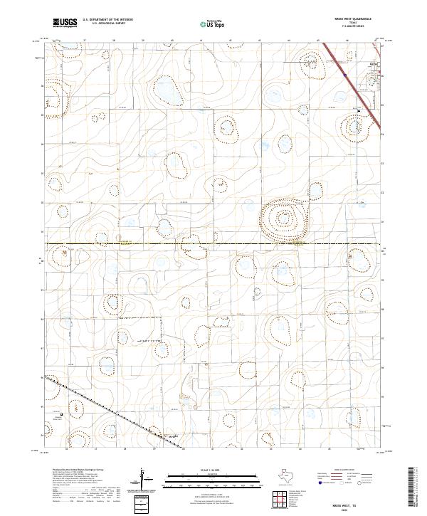 2022 Kress West2022 Print · USGSThe High Plains of West Texas are captured here at the county line between Swisher and Hale, showing the agricultural grids and small settlements of the region. Local historians can trace the roads around Kress and Wright, or locate family sites at Kress Cem and Running Water Cem.
 - 2022 Map of Edmonson, 2022 Print
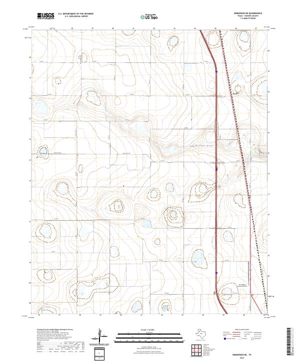
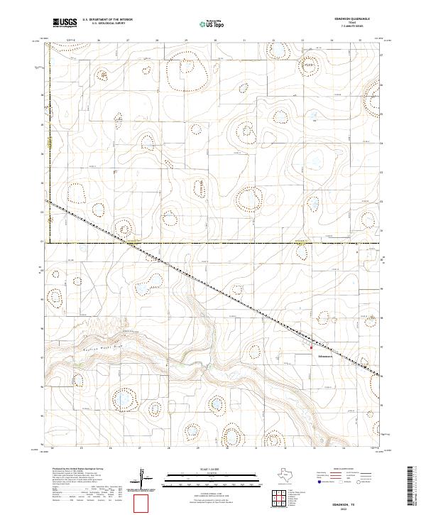 2022 Edmonson2022 Print · USGSThe Texas High Plains at the Hale and Swisher county line are centered on the community of Edmonson in the early 2020s. Researchers can trace the winding course of Running Water Draw and locate rural farmsteads along FM 1424 and FM 179.
 - 2022 Map of Providence, 2022 Print
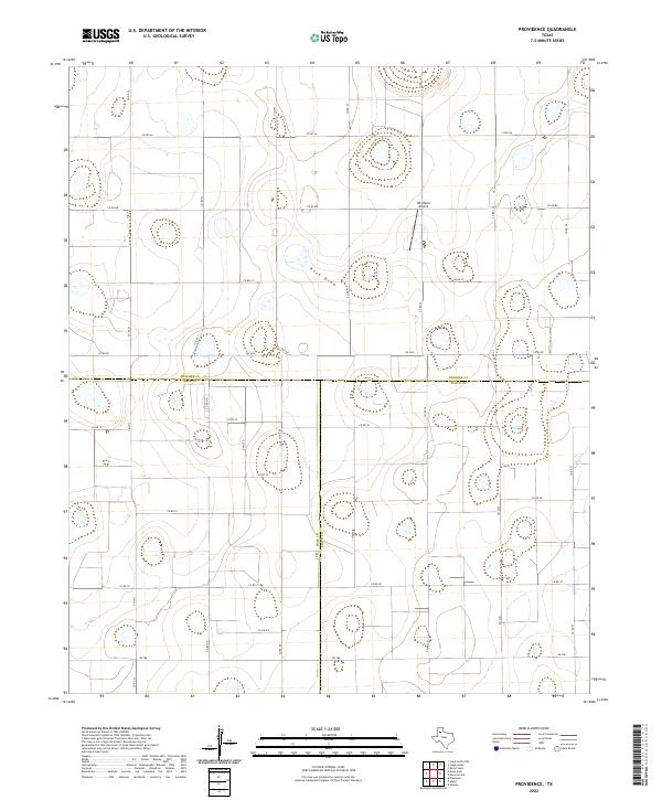 2022 Providence2022 Print · USGSThe High Plains at the meeting point of Swisher, Hale, and Floyd counties are shown here in modern detail. Researchers can trace the rural infrastructure of this ranching and farming hub through landmarks like Whitfield Airport and the seasonal path of Rock Draw.
 - 2022 Map of Cope Creek, 2022 Print
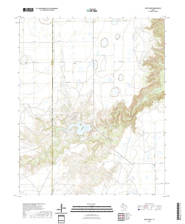 2022 Cope Creek2022 Print · USGSBriscoe and Swisher counties meet at the dramatic edge of the Llano Estacado in this contemporary survey of the Texas Panhandle. Genealogists and local historians can locate Milo Cem and trace the complex drainages of Tule Creek and The Narrows.
 - 2022 Map of Jackson Hill, 2022 Print
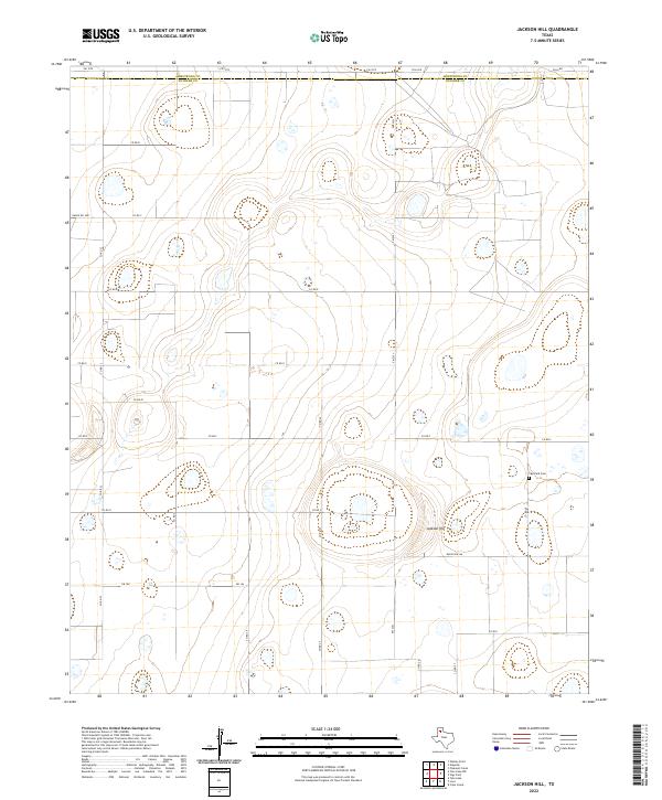 2022 Jackson Hill2022 Print · USGSThe Texas Panhandle plains meet at the Swisher and Armstrong county line in this contemporary topographical survey. Genealogists and local researchers can locate the Vigo Park Cem and trace the rural road network surrounding Jackson Hill.
 - 2022 Map of Tulia NW, 2022 Print
 2022 Tulia NW2022 Print · USGSSwisher County and the surrounding High Plains are captured here in the early twenty-first century, showing the organized grid of the Texas Panhandle. Modern researchers can trace agricultural boundaries and water drainage features like North Tule Draw, Happy Draw, and North Tule Lake.
 - 2022 Map of Center Plains School, 2022 Print
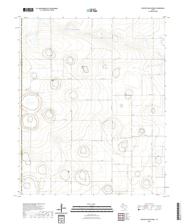 2022 Center Plains School2022 Print · USGSThe Texas Panhandle's agricultural heartland is documented here in the early twenty-first century as it straddles the Castro Co line. Local researchers can trace the path of South Tule Draw or locate rural homesteads along FM 1424 and Ranch Rd 928.
 - 2022 Map of Edmonson NE, 2022 Print
 2022 Edmonson NE2022 Print · USGSThe Texas Panhandle's ranching heartland is documented here in the early twenty-first century, showing a vast grid of rural roads and water management features. Researchers can trace the path of South Tule Draw or locate regional landmarks like the Joe Vaughn Spraying Airport and Eunice.
 - 2022 Map of Claytonville NW, 2022 Print
 2022 Claytonville NW2022 Print · USGSSwisher County at the start of the 2020s reveals a structured agricultural landscape defined by vital water management. Researchers can locate Wright Cem and trace rural water sources like South Tule Draw and Roy Stockett Reservoir.
 - 2022 Map of Happy, 2022 Print
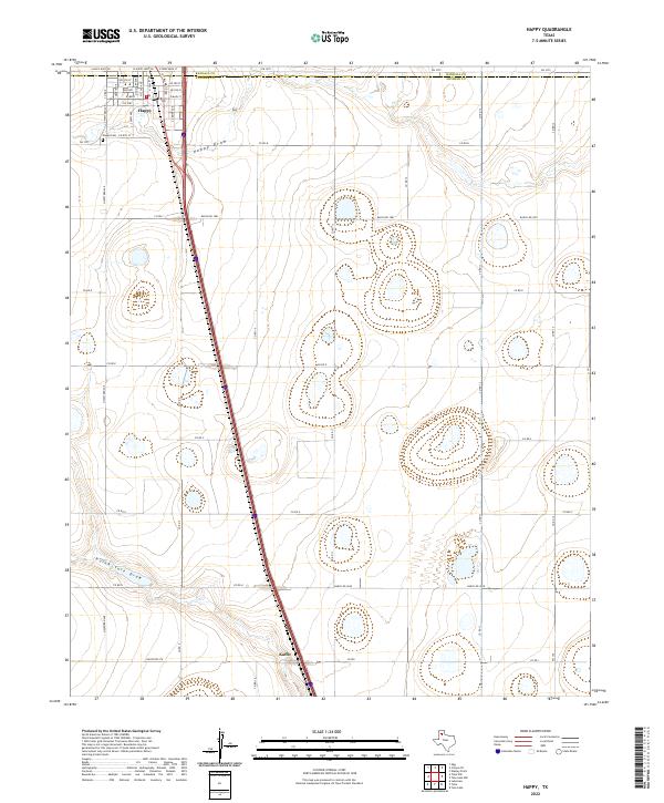 2022 Happy2022 Print · USGSThe town of Happy straddles the county line between Randall and Swisher during the early 2020s. Researchers can trace local lineage at the Happy Cem or follow the paths of Happy Draw and the southern settlement at Kaffir.
 - 2022 Map of Tulia, 2022 Print
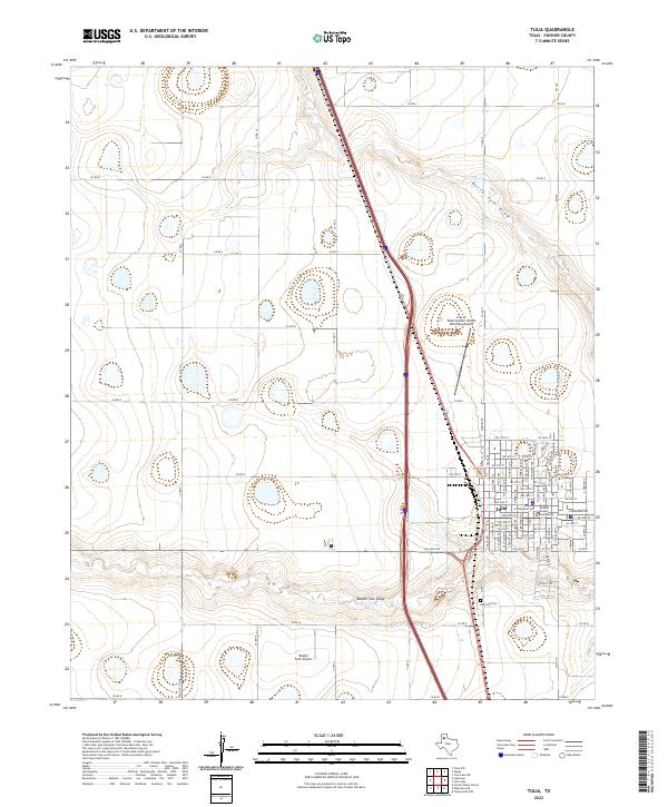 2022 Tulia2022 Print · USGSTulia and the surrounding High Plains are captured here in the early twenty-first century, showing the intersection of agriculture and aviation. Researchers can trace family sites near Rose Hill Cem or locate specific landmarks like the Swisher County Courthouse and Vaughn Farm Airport.
 - 2022 Map of Kress East, 2022 Print
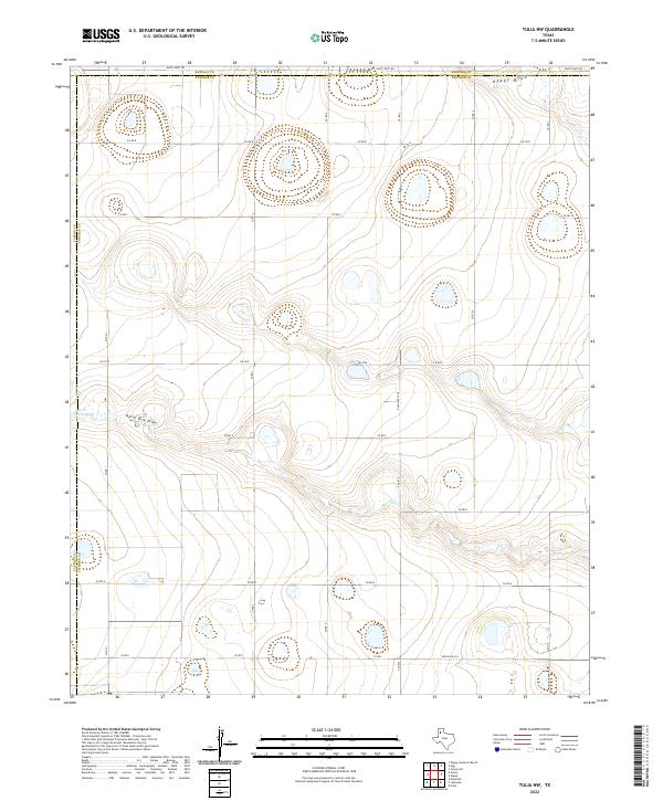
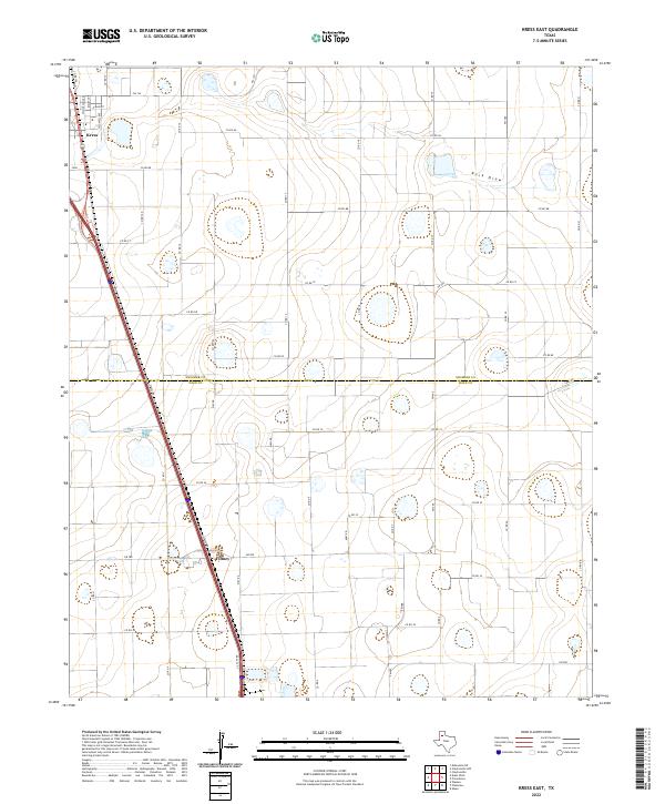 2022 Kress East2022 Print · USGSThe High Plains of the Texas Panhandle are captured here in the early twenty-first century, showing the rural landscape across the Swisher and Hale county line. Genealogists and local historians can trace the streets of Kress, the small settlement of Finney, and the winding path of Rock Draw.
End of results
Showing maps 1-20 of 20
Top cities of Swisher County
Frequently asked questions
- What are the different types of historical maps available for Swisher County?
- What is the oldest map of Swisher County?
- Where can I purchase historical maps of Swisher County for my home or office?
- Where can I download high-res historical maps of Swisher County?
- Are there historical topographic maps available for Swisher County?
- Is there historical aerial imagery available for Swisher County?
- Where are historical maps of Swisher County sourced from?