Old Maps of Swisher County, Texas for Academic Research
Study the evolution of Swisher County with 124 high-resolution historic maps. Whether you're teaching, researching, or modeling changes in land use, these maps provide essential visual documentation of urban, environmental, and geographic change.
- Analyze long-term change: Track patterns in development, transportation, and natural features.
- Ideal for environmental or urban studies: Support academic projects with primary historical map data.
- Use in the classroom or lab: Educators and researchers rely on these maps to bring historical context to life.
These maps are a powerful tool for teaching, research, and visualizing how Swisher County has changed over the decades.
Swisher County, TX maps
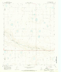
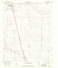
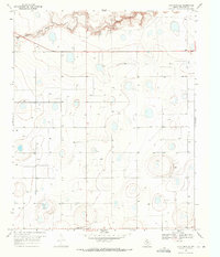
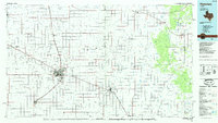
(124)- 1954 Map of Plainview, 1966 Print
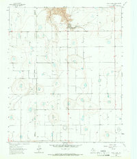
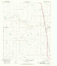
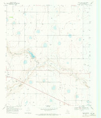
 1954 Plainview1966 Print · USGSThe Texas Panhandle and the rugged Caprock Escarpment appear in detail as the region's agricultural and rail networks reached their mid-century peak. Trace family roots and old land patterns through the canyons and plains near Plainview, Palo Duro State Park, and Childress.3 unique versions available
 - 1958 Map of Plainview
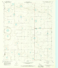
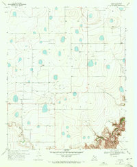
 1958 Plainview1958 Print · USGSThe High Plains and Caprock Escarpment meet in the late fifties, showcasing the ranching and rail networks of the Texas Panhandle. Trace family roots and vanished stops along the Panhandle and Santa Fe railroad through Plainview, Silverton, and Matador.
 - 1965 Map of Rock Creek, 1967 Print
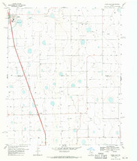
 1965 Rock Creek1967 Print · USGSThe Texas Panhandle at the edge of the Caprock reveals a landscape of ranching and early rural infrastructure in the mid-1960s. Genealogists and researchers can trace the Swisher Co Briscoe Co boundary near the small settlements of Rock Creek and Mercer.
 - 1965 Map of Vigo Park, 1967 Print
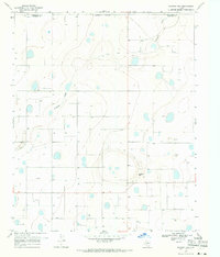
 1965 Vigo Park1967 Print · USGSBriscoe County and the surrounding Texas Panhandle ranch lands are captured here in the mid-sixties. Researchers can trace family landholdings and rural landmarks like Vigo Park, the San Jacinto Sch, and the McMurtry Farm.
 - 1965 Map of Silverton SW, 1967 Print
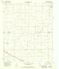
 1965 Silverton SW1967 Print · USGSThe High Plains of the Texas Panhandle come into focus during the mid-sixties at the junction of Briscoe, Swisher, and Floyd counties. Local researchers can trace the course of Quitaque Creek, locate the community of Lone Star, and follow the Fort Worth and Denver rail line.
 - 1965 Map of Cope Creek, 1967 Print
 1965 Cope Creek1967 Print · USGSThe High Plains breaks of Briscoe County come alive in this mid-sixties survey of the canyon lands along the Swisher County line. Researchers can locate remote homesteads like Flowers Ranch, find family burial sites at the local Cem, and trace the winding course of Cope Creek.2 unique versions available
 - 1965 Map of Edmonson NE, 1968 Print
 1965 Edmonson NE1968 Print · USGSSwisher County in the mid-1960s reveals a landscape of industrial farming and rail-side stops along the Llano Estacado. Researchers can trace the Atchison Topeka and Santa Fe railroad corridor past Eunice and the Cowan Landing Strip.
 - 1965 Map of Kress West, 1968 Print
 1965 Kress West1968 Print · USGSThe High Plains landscape of Swisher and Hale counties is captured in the mid-1960s, showing a vital agricultural rail corridor. Researchers can trace family roots at Running Water Cem and follow the Fort Worth and Denver line through Farmers Spur.
 - 1965 Map of Tulia, 1968 Print
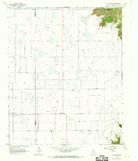
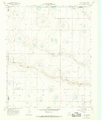
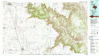
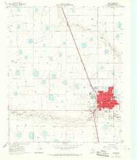 1965 Tulia1968 Print · USGSTulia is shown during a period of steady mid-century growth, anchored by its position along the Atchison Topeka and Santa Fe railroad. Genealogists and local historians can locate the Rose Hill Cemetery, Calvary Church, and the central Courthouse.2 unique versions available
 - 1965 Map of Edmonson, 1968 Print
 1965 Edmonson1968 Print · USGSThe Texas Panhandle comes into focus during the mid-sixties as agricultural and rail networks expanded across the plains. Genealogists and local historians can trace the footprint of Edmonson and Center Plains alongside the Fort Worth and Denver line.
 - 1965 Map of Lakeview, 1968 Print
 1965 Lakeview1968 Print · USGSThe Texas Panhandle plains near the Swisher and Castro County line come into focus during the mid-sixties. Researchers can trace the local landscape around Lakeview, from the seasonal path of Middle Tule Draw to a regional Gravel Pit and dozens of individual wells.
 - 1965 Map of Happy, 1968 Print
 1965 Happy1968 Print · USGSThe High Plains of Swisher and Randall Counties are captured here in the mid-1960s, a period of established rail transport and rural agricultural growth. Researchers can trace the path of the Atchison Topeka and Santa Fe railroad from Happy down to Kaffir or locate the Happy Cem.
 - 1965 Map of Center Plains School, 1968 Print
 1965 Center Plains School1968 Print · USGSThe High Plains of the Texas Panhandle come into focus during the mid-sixties, showing a landscape defined by industrial agriculture and cattle ranching. Trace local history through the Center Plains Sch, the Cripple T Farm, and the regional Grain Elevator.
 - 1966 Map of Tulia NW, 1968 Print
 1966 Tulia NW1968 Print · USGSSwisher County in the mid-sixties shows a quiet Panhandle landscape shaped by the natural carving of North Tule Draw. Local historians can trace the paths of early energy infrastructure like the Pipeline or locate the site of the Radio Tower.
 - 1968 Map of Tule Lake, 1971 Print
 1968 Tule Lake1971 Print · USGSThe Texas Panhandle plains near Tulia come into focus in the late 1960s, a period when groundwater management and local recreation shaped the landscape. Researchers can trace the drainage of Tule Lake and find landmarks like the Rodeo Ground and the settlement of Shafer.
 - 1969 Map of Love, 1971 Print
 1969 Love1971 Print · USGSThe Texas Panhandle of the late sixties is revealed here as a landscape of isolated farmsteads and agricultural labor near Love. Family historians and researchers can trace the distribution of numerous wells, agricultural Storage Bins, and the drainage of Tule Creek.
 - 1969 Map of Kress East, 1971 Print
 1969 Kress East1971 Print · USGSThe Texas Panhandle at the end of the sixties shows a landscape of intensive irrigation and rail-based commerce. Trace the path of the Atchison Topeka and Santa Fe railroad through Kress and Finney or locate numerous historic wells.
 - 1969 Map of Jackson Hill, 1971 Print
 1969 Jackson Hill1971 Print · USGSThe Texas Panhandle in the late sixties remains a landscape of isolated ranching outposts and high plains terrain. Researchers can trace local lineage at Vigo Park Cem or locate the settlement of Ackley and the prominent rise of Jackson Hill.
 - 1969 Map of Claytonville, 1971 Print
 1969 Claytonville1971 Print · USGSThe High Plains of Swisher County appear here in the late sixties as an intensive agricultural landscape. Researchers can locate the settlement of Claytonville and trace the deep contours of Tule Draw and South Tule Creek.
 - 1969 Map of Tule Lake NW, 1971 Print
 1969 Tule Lake NW1971 Print · USGSThe Texas Panhandle's agricultural landscape comes alive in this late-1960s survey of the plains. Researchers can trace rural property lines and water sources along Happy Draw and locate specific sites like the Storage Bins near the county lines.
 - 1969 Map of Claytonville NW, 1971 Print
 1969 Claytonville NW1971 Print · USGSSwisher County in the late sixties shows a landscape of intensive groundwater use and open ranchland. Genealogists and local historians can locate the Wright Cem and trace the meandering course of the South Tule Draw through the high plains.
 - 1969 Map of Providence, 1971 Print
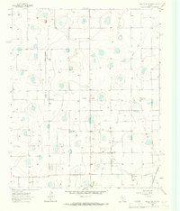
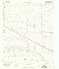
 1969 Providence1971 Print · USGSThe West Texas High Plains at the close of the sixties reveal a focused agricultural landscape at the meeting point of three counties. Genealogists and historians can trace the rural cotton industry through Providence Gin and Crume Gin, or locate the small community at Barrett.
 - 1985 Map of Plainview
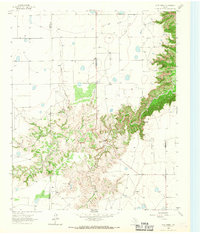
 1985 Plainview1985 Print · USGSThe Texas Panhandle's agricultural heartland and the dramatic escarpment are captured here in the mid-eighties. Genealogists and local historians can trace the rail-side growth of Lockney, the layout of Plainview, and the rugged breaks of Caprock Canyon State Park.2 unique versions available
 - 1985 Map of Tulia
 1985 Tulia1985 Print · USGSThe Texas Panhandle in the mid-1980s displays a stark landscape where industrial agriculture meets the deep breaks of Palo Duro Canyon. Genealogists and researchers can trace rural life near Tulia or find old community centers like Vigo Park, Wayside, and Cleta.2 unique versions available
 - 2010 Map of Silverton SW, 2010 Print
 2010 Silverton SW2010 Print · USGSCovers Swisher County, including Lone Star, Briscoe County, and other nearby areas
Showing maps 1-25 of 124
Top cities of Swisher County
Frequently asked questions
- What are the different types of historical maps available for Swisher County?
- What is the oldest map of Swisher County?
- Where can I purchase historical maps of Swisher County for my home or office?
- Where can I download high-res historical maps of Swisher County?
- Are there historical topographic maps available for Swisher County?
- Is there historical aerial imagery available for Swisher County?
- Where are historical maps of Swisher County sourced from?