Old Maps of Lakeside, Texas for Genealogy
Trace your family roots with 21 historic maps of Lakeside. These high-res maps reveal old neighborhoods, homesites, landmarks, and streets — helping you uncover where your ancestors lived and how the area evolved over time.
- Explore historic neighborhoods: Identify where your relatives may have lived in the 1800s or 1900s.
- Compare maps over time: Trace the changes in streets, buildings, and landmarks for multi-generational research.
- Perfect for genealogy & ancestry research: Used by family historians and researchers to map out lineage and migration.
These maps are an incredible resource for exploring your personal connection to Lakeside's past.
Lakeside, TX maps
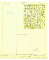
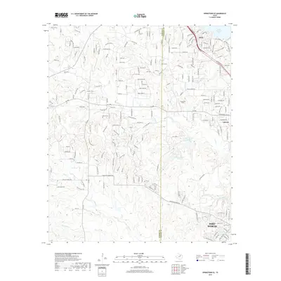
(21)- 1891 Map of Weatherford
 1891 Weatherford1891 Print · USGSParker County and the surrounding ranchlands are shown here in the 1890s as the rail network transformed the region. Researchers can trace early river transport at Powell Ferry or locate vanished sites like Veal Station, Center Mill, and the Bear Creek P.O.
 - 1893 Map of Weatherford
 1893 Weatherford1893 Print · USGSParker County was at a pivotal turning point in the late nineteenth century as railroads began to stitch together the North Texas cattle country. Genealogists and local historians can trace early crossings like Powell Ferry and landmarks like Center Mill or Veal Station.5 unique versions available
 - 1894 Map of Fort Worth, 1918 Print
 1894 Fort Worth1918 Print · USGSNorth Texas at the end of the nineteenth century centers on a burgeoning Fort Worth and its strategic rail junctions. Researchers can locate early township sites like Johnson Station and Birdville or trace the military footprint of Camp Bowie.3 unique versions available
 - 1932 Map of Springtown
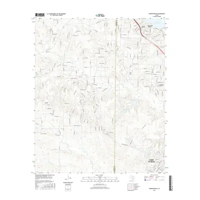
 1932 Springtown1932 Print · USGSThe crossroads of North Texas in the 1920s and 30s reveal a landscape of small farming communities and country parishes. Trace the early footprints of Reno, Briar, and Azle, or locate family sites near New Hope Ch and Onion Hill Sch.
 - 1954 Map of Dallas, 1963 Print
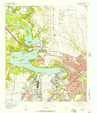
 1954 Dallas1963 Print · USGSNorth Texas in the mid-fifties and early sixties reveals a landscape of rapid urban growth and water management. Genealogists and historians can trace the evolution of the metroplex through landmarks like Hensley Field, Boles Orphan Home, and the Texas & Pacific RR.4 unique versions available
 - 1955 Map of Lake Worth, 1957 Print
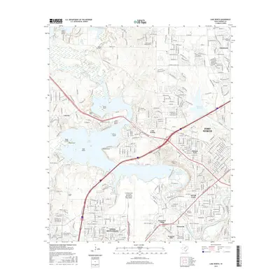
 1955 Lake Worth1957 Print · USGSMid-century Tarrant County reveals a landscape shaped by military aviation and lakeside development. Researchers can trace the massive Carswell Air Force Base complex and local landmarks like White Settlement and Indian Oaks Ch.5 unique versions available
 - 1955 Map of Haltom City, 1964 Print
 1955 Haltom City1964 Print · USGSTarrant County at the peak of the mid-century aviation and defense boom shows a region rapidly transforming from ranch land into a strategic hub. Genealogists and historians can trace family plots at Mount Olivet Cemetery or the early footprints of Haltom City, Saginaw, and White Settlement.
 - 1955 Map of Springtown SE, 1969 Print
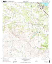 1955 Springtown SE1969 Print · USGSParker and Tarrant counties meet here in the mid-fifties, capturing a landscape in transition from quiet ranchland to lakefront development. Genealogists and local researchers can trace early family sites like Huff Cem, the Bluff Springs Sch, and the cluster of homes at Castle Hill Estate.
 - 1958 Map of Dallas
 1958 Dallas1958 Print · USGSNorth Texas in the late fifties shows the dramatic expansion of the Metroplex as it absorbs surrounding farm towns. Genealogists and historians can trace old rail lines like the Missouri-Kansas-Texas and locate early lakefront developments at Eagle Mountain Lake and Lake Worth Village.
 - 1985 Map of Fort Worth
 1985 Fort Worth1985 Print · USGSMid-1980s Tarrant County and Parker County emerge from a transition between urban sprawl and rural cattle country. Researchers can trace the expansion of Fort Worth and Arlington alongside older landmarks like Nebo Mtn and Kikapoo Falls.2 unique versions available
 - 1995 Map of Lake Worth, 2001 Print
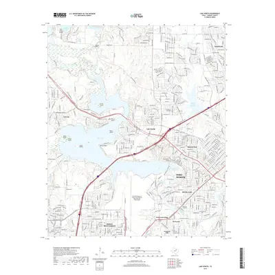
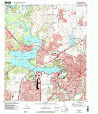 1995 Lake Worth2001 Print · USGSTarrant County's suburban and military landscape is captured here in the mid-1990s as defense industries and lakefront recreation define the area's character. Researchers can trace the layout of Air Force Plant 4, locate the private cemetery, or find early school sites like Castleberry Sch.
 - 2010 Map of Lake Worth, 2010 Print
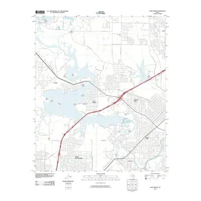 2010 Lake Worth2010 Print · USGSCovers Lakeside, including Fort Worth, Saginaw, and other nearby areas
 - 2010 Map of Springtown SE, 2010 Print
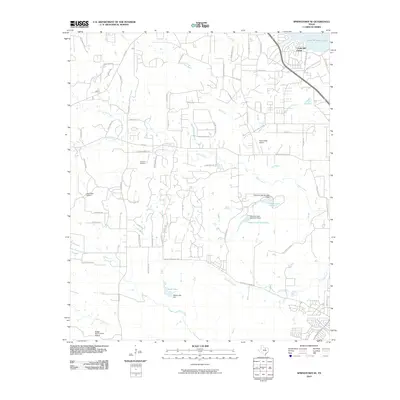 2010 Springtown SE2010 Print · USGSCovers Lakeside, including Fort Worth, Azle, and other nearby areas
 - 2013 Map of Lake Worth, 2013 Print
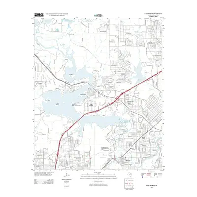 2013 Lake Worth2013 Print · USGSCovers Lakeside, including Fort Worth, Saginaw, and other nearby areas
 - 2013 Map of Springtown SE, 2013 Print
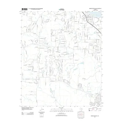 2013 Springtown SE2013 Print · USGSCovers Lakeside, including Fort Worth, Azle, and other nearby areas
 - 2016 Map of Springtown SE, 2016 Print
 2016 Springtown SE2016 Print · USGSCovers Lakeside, including Fort Worth, Azle, and other nearby areas
 - 2016 Map of Lake Worth, 2016 Print
 2016 Lake Worth2016 Print · USGSCovers Lakeside, including Fort Worth, Saginaw, and other nearby areas
 - 2019 Map of Lake Worth, 2019 Print
 2019 Lake Worth2019 Print · USGSCovers Lakeside, including Fort Worth, Saginaw, and other nearby areas
 - 2019 Map of Springtown SE, 2019 Print
 2019 Springtown SE2019 Print · USGSCovers Lakeside, including Fort Worth, Azle, and other nearby areas
 - 2022 Map of Springtown SE, 2022 Print
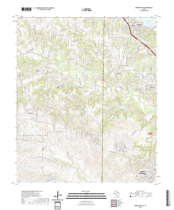 2022 Springtown SE2022 Print · USGSThe border of Parker and Tarrant counties comes into focus in the early 2020s, showing the residential growth surrounding the city of Azle. Genealogists can locate family-named sites like Murr - Copeland Cem or trace the drainage of Live Oak Creek and Marys Creek.
 - 2022 Map of Lake Worth, 2022 Print
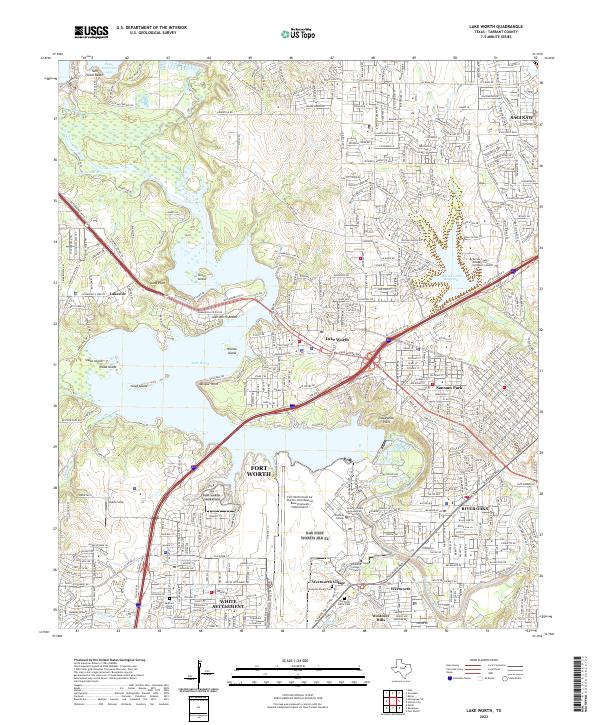 2022 Lake Worth2022 Print · USGSThe northwest Fort Worth corridor comes into focus in this recent survey, centered on the strategic Fort Worth Naval Air Station Joint Reserve Base (Carswell Field) Airport. Researchers can trace old family sites at Thompson Family Cem or explore the shorelines of Lake Worth and Greer Island.
End of results
Showing maps 1-21 of 21
Top cities near Lakeside
- Fort Worth historical maps
- North Richland Hills historical maps
- Keller historical maps
- Haltom City historical maps
- Weatherford historical maps
- Watauga historical maps
See more
Frequently asked questions
- What are the different types of historical maps available for Lakeside?
- What is the oldest map of Lakeside?
- Where can I purchase historical maps of Lakeside for my home or office?
- Where can I download high-res historical maps of Lakeside?
- Are there historical topographic maps available for Lakeside?
- Is there historical aerial imagery available for Lakeside?
- Where are historical maps of Lakeside sourced from?