2020s Maps of Merkel, Texas
Explore 2 historic maps of Merkel from the 2020s. These maps offer a rare glimpse into what life looked like during the 2020s — showing old roads, neighborhoods, homes, and landmarks that have changed or disappeared over time.
Whether you're researching your family's past, planning a metal detecting trip, or studying how Merkel's landscape evolved across the 2020s, these high-resolution maps are a powerful tool for exploring the history of this region.
- Focus on a specific era: All maps on this page are from the 2020s, giving you a focused view of this time period.
- See what’s changed: Compare century-old streets, trails, and buildings to today's modern landscape using overlays and satellite layers.
- Research with precision: Use these maps for genealogy, historical research, land use analysis, or educational projects.
- View, download, or print: Maps are fully viewable online in high resolution, and can be downloaded or printed for your own records.
Start exploring Merkel's history through authentic maps from the 2020s. This is your window into the past.
Merkel, TX maps
(2)- 2022 Map of Merkel East, 2022 Print
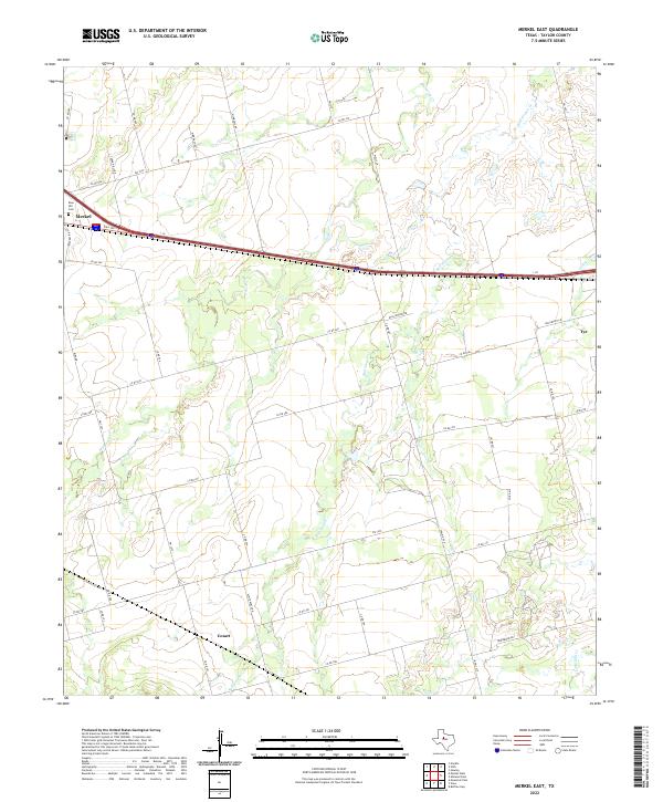 2022 Merkel East2022 Print · USGSTaylor County settlement patterns are visible in the modern era as the communities of Merkel and Tye expand along the interstate corridor. Researchers can trace rural landmarks like Rose Hill Cem, the Cozart area, and family-named roads such as Wimberly Rd.
 - 2022 Map of Merkel West, 2022 Print
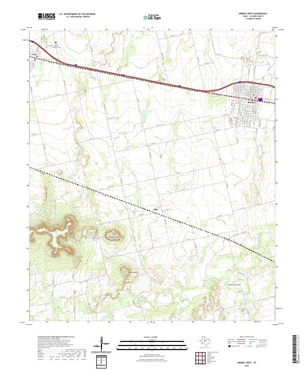 2022 Merkel West2022 Print · USGSThe Taylor County high plains and breaks come into focus in 2022, centered on the Interstate 20 corridor. Trace local landmarks like the White Church, Trent Garden of Memories Cem, and the prominent slopes of Blowout Mtn.
End of results
Showing maps 1-2 of 2
Top cities near Merkel
- Abilene historical maps
- Tye historical maps
- Hawley historical maps
- Buffalo Gap historical maps
- Trent historical maps
Frequently asked questions
- What are the different types of historical maps available for Merkel?
- What is the oldest map of Merkel?
- Where can I purchase historical maps of Merkel for my home or office?
- Where can I download high-res historical maps of Merkel?
- Are there historical topographic maps available for Merkel?
- Is there historical aerial imagery available for Merkel?
- Where are historical maps of Merkel sourced from?