1970s Maps of Terry County, Texas
Explore 7 historic maps of Terry County from the 1970s. These maps offer a rare glimpse into what life looked like during the 1970s — showing old roads, neighborhoods, homes, and landmarks that have changed or disappeared over time.
Whether you're researching your family's past, planning a metal detecting trip, or studying how Terry County's landscape evolved across the 1970s, these high-resolution maps are a powerful tool for exploring the history of this region.
- Focus on a specific era: All maps on this page are from the 1970s, giving you a focused view of this time period.
- See what’s changed: Compare century-old streets, trails, and buildings to today's modern landscape using overlays and satellite layers.
- Research with precision: Use these maps for genealogy, historical research, land use analysis, or educational projects.
- View, download, or print: Maps are fully viewable online in high resolution, and can be downloaded or printed for your own records.
Start exploring Terry County's history through authentic maps from the 1970s. This is your window into the past.
Terry County, TX maps
(7)- 1970 Map of Seagraves, 1973 Print
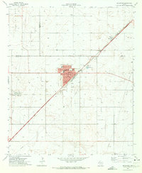 1970 Seagraves1973 Print · USGSSeagraves is captured in the early 1970s at the meeting of Yoakum, Terry, and Gaines counties during a period of steady industrial and oil production. Researchers can locate specific family sites near Webb Cem, trace the ATCHISON TOPEKA AND SANTA FE rail lines, or find the Rodeo Ground.
 - 1970 Map of Tokio, 1973 Print
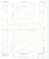 1970 Tokio1973 Print · USGSThe West Texas High Plains come into focus during the early 1970s at the junction of the Prentice Oil and Gas Field and Tokio. Researchers can trace the intensive network of pipelines, local Gravel Pits, and a Pumping Sta that drove the regional energy economy.
 - 1970 Map of Tokio SE, 1973 Print
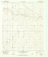 1970 Tokio SE1973 Print · USGSThe West Texas High Plains at the Yoakum and Terry county line come into focus in 1970. Researchers can trace the development of local energy and industry through Oil Wells, a Pumping Sta, and Sulphur Springs Draw.
 - 1976 Map of Meadow NE, 1978 Print
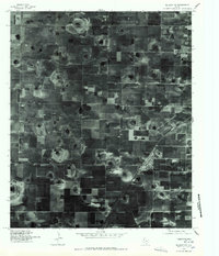
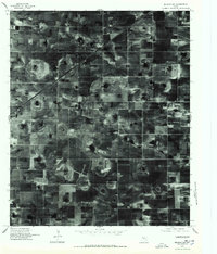 1976 Meadow NE1978 Print · USGSAgricultural patterns dominate the Lubbock County landscape in the mid-seventies, showing the precise grid of West Texas farming. Researchers can locate family operations like the Mc Nabb Farm Airport and trace the evolution of local irrigation systems.
 - 1976 Map of Meadow NW, 1978 Print
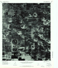
 1976 Meadow NW1978 Print · USGSHockley County agriculture is captured in great detail during the mid-seventies, showing the intersection of industrial farming and small-town life. Researchers can trace the street grid and rail siding of Ropesville alongside the distinct circular patterns of High Plains irrigation.
 - 1976 Map of Meadow SW, 1978 Print
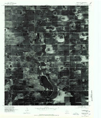 1976 Meadow SW1978 Print · USGSThe High Plains of West Texas are captured in this mid-seventies aerial survey, showing the agricultural development surrounding Meadow. Researchers can trace the geometric layout of local farms and the distinct natural basin of Rich Lake during this era.
 - 1976 Map of Meadow SE, 1978 Print
 1976 Meadow SE1978 Print · USGSLynn County agricultural patterns are frozen in time in this mid-seventies aerial survey of the High Plains. Researchers can trace the development of rural homesteads near Lakeview and identify the specific location of center-pivot irrigation fields and playa lakes.
End of results
Showing maps 1-7 of 7
Top cities of Terry County
Frequently asked questions
- What are the different types of historical maps available for Terry County?
- What is the oldest map of Terry County?
- Where can I purchase historical maps of Terry County for my home or office?
- Where can I download high-res historical maps of Terry County?
- Are there historical topographic maps available for Terry County?
- Is there historical aerial imagery available for Terry County?
- Where are historical maps of Terry County sourced from?