
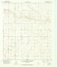
1970 Map of Seagraves
USGS Topo · Published 1973About this map
Seagraves emerges as a vital agricultural and industrial hub in the South Plains in this 1970 study, positioned at the triple junction of Yoakum, Terry, and Gaines counties. The town grid is clearly defined, centered around Main Ave and Ave F, featuring essential civic landmarks including the High Sch, Jr High Sch, and the local Hospital. The surrounding landscape is dominated by the extraction and storage industries, evidenced by the Reeves Field Oil and several Carbon Plant sites. Transport and logistics are anchored by the Atchison Topeka and Santa Fe railroad, which cuts diagonally across the terrain, serving the massive Storage Bins and a nearby Airfield. For genealogists, the rural Webb Cem and another Cemetery north of town provide specific points of interest. Cultural life is reflected in the dedicated Rodeo Ground and Athletic Field, underscoring the community's local social priorities.
Find a feature on this map
24 named features on this map. Tap any name to fly to it.
Don’t see what you’re looking for? This feature index may not catch every label — zoom into the map to look around manually.
Map Details
Editions of this 1970 Seagraves Map
This is the sole edition of this map. No revisions or reprints were ever made.
Other maps of this area

1954 · Hobbs
USGS Topo · 1:250,000

1954 · Brownfield
USGS Topo · 1:250,000

1958 · Brownfield
USGS Topo · 1:250,000

1958 · Hobbs
USGS Topo · 1:250,000

1962 · Brownfield
USGS Topo · 1:250,000

1969 · Loop
USGS Topo · 1:24,000

1969 · Wellman
USGS Topo · 1:24,000

1970 · Seagraves SW
USGS Topo · 1:24,000

1970 · Seagraves SE
USGS Topo · 1:24,000
1970 · Tokio SE
USGS Topo · 1:24,000