
1969 Map of Wellman
USGS Topo · Published 1971About this map
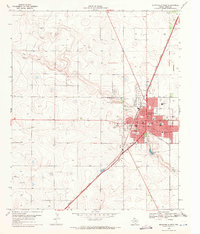
Wellman serves as the central hub of this West Texas landscape, situated at the intersection of local infrastructure and natural drainage patterns in Terry County. The town is oriented around the Atchison Topeka and Santa Fe railroad, which cuts a sharp diagonal across the high plains. The terrain is defined by the winding course of Sulphur Springs Draw, a prominent natural feature that snakes through the area, contrasting with the rigid geometry of the surrounding section lines and roadways.
Find a feature on this map
9 named features on this map. Tap any name to fly to it.
Don’t see what you’re looking for? This feature index may not catch every label — zoom into the map to look around manually.
Map Details
Editions of this 1969 Wellman Map
This is the sole edition of this map. No revisions or reprints were ever made.
Other maps of this area

1954 · Hobbs
USGS Topo · 1:250,000

1954 · Brownfield
USGS Topo · 1:250,000

1958 · Brownfield
USGS Topo · 1:250,000

1958 · Hobbs
USGS Topo · 1:250,000

1962 · Brownfield
USGS Topo · 1:250,000

1969 · Gomez
USGS Topo · 1:24,000

1969 · Foster
USGS Topo · 1:24,000

1969 · Loop
USGS Topo · 1:24,000

1969 · Ashmore
USGS Topo · 1:24,000
1969 · Brownfield West
USGS Topo · 1:24,000