2020s Maps of San Angelo, Texas
Explore 7 historic maps of San Angelo from the 2020s. These maps offer a rare glimpse into what life looked like during the 2020s — showing old roads, neighborhoods, homes, and landmarks that have changed or disappeared over time.
Whether you're researching your family's past, planning a metal detecting trip, or studying how San Angelo's landscape evolved across the 2020s, these high-resolution maps are a powerful tool for exploring the history of this region.
- Focus on a specific era: All maps on this page are from the 2020s, giving you a focused view of this time period.
- See what’s changed: Compare century-old streets, trails, and buildings to today's modern landscape using overlays and satellite layers.
- Research with precision: Use these maps for genealogy, historical research, land use analysis, or educational projects.
- View, download, or print: Maps are fully viewable online in high resolution, and can be downloaded or printed for your own records.
Start exploring San Angelo's history through authentic maps from the 2020s. This is your window into the past.
San Angelo, TX maps
(7)- 2022 Map of Twin Buttes, 2022 Print
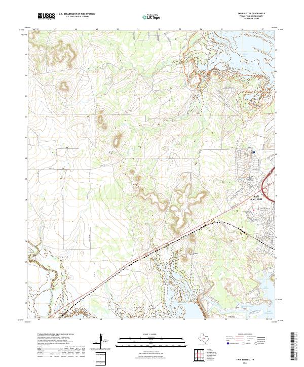 2022 Twin Buttes2022 Print · USGSThe western edges of San Angelo meet the vast Concho River watershed in this 2022 survey of Tom Green County. Researchers can trace the complex shoreline of Twin Buttes Reservoir and locate local landmarks like Twin Buttes and Pulliam Point.
 - 2022 Map of Pecan Station, 2022 Print
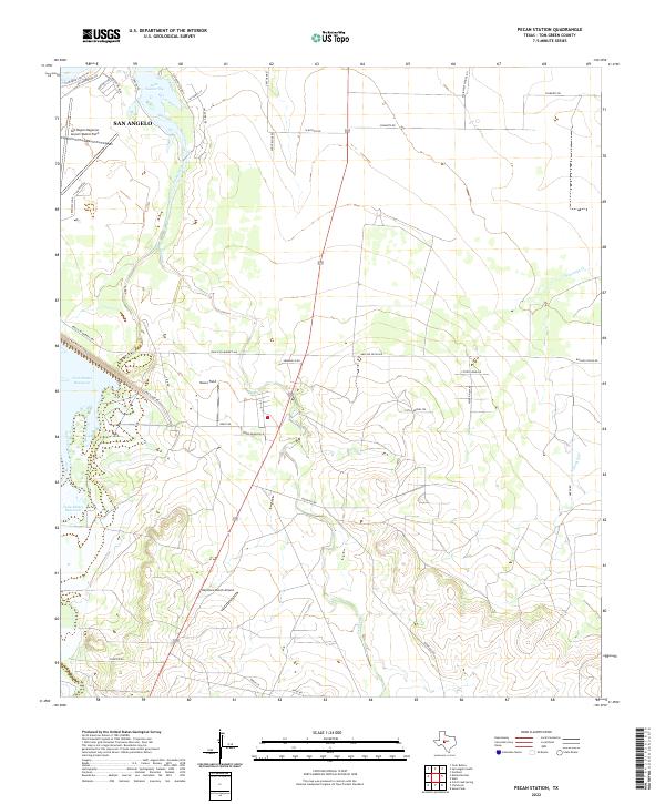 2022 Pecan Station2022 Print · USGSThe southern outskirts of San Angelo meet the West Texas ranchlands in the early 2020s. Aviation and water history converge here at the San Angelo Regional Airport/Mathis Field and the sprawling waters of Twin Buttes Reservoir.
 - 2022 Map of Harriet, 2022 Print
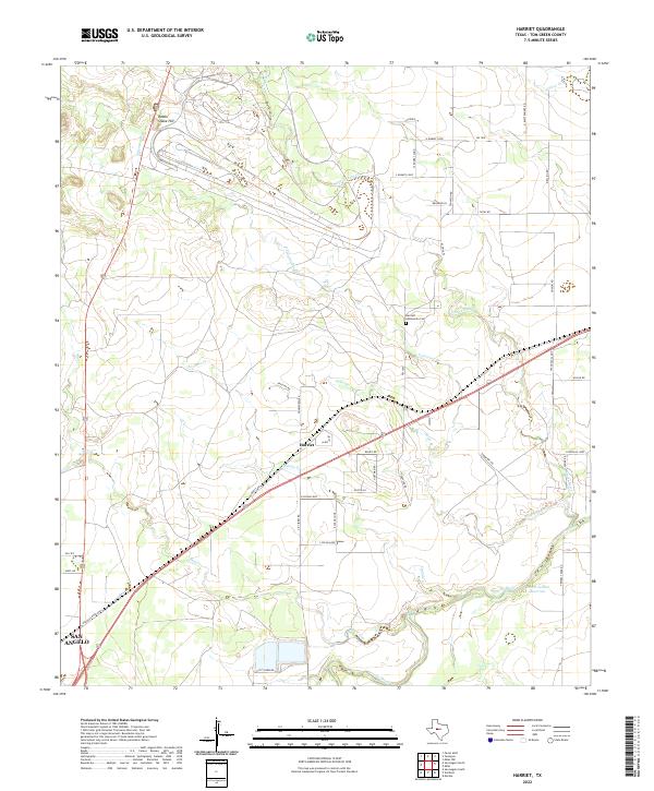 2022 Harriet2022 Print · USGSTom Green County ranch lands are captured here in the early 2020s as the area maintains its rural character northeast of the city. Genealogists and local researchers can trace family-named roads or locate the Harriett Community Cem near Harriet and Alma.
 - 2022 Map of Knickerbocker, 2022 Print
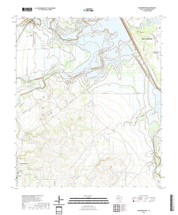 2022 Knickerbocker2022 Print · USGSTom Green County is shown here in the 2020s, dominated by the reservoir system and the quiet settlement of Knickerbocker. Genealogists can locate family names at the Knickerbocker Community Cem or trace the drainage of the Middle Concho River.
 - 2022 Map of Veribest, 2022 Print
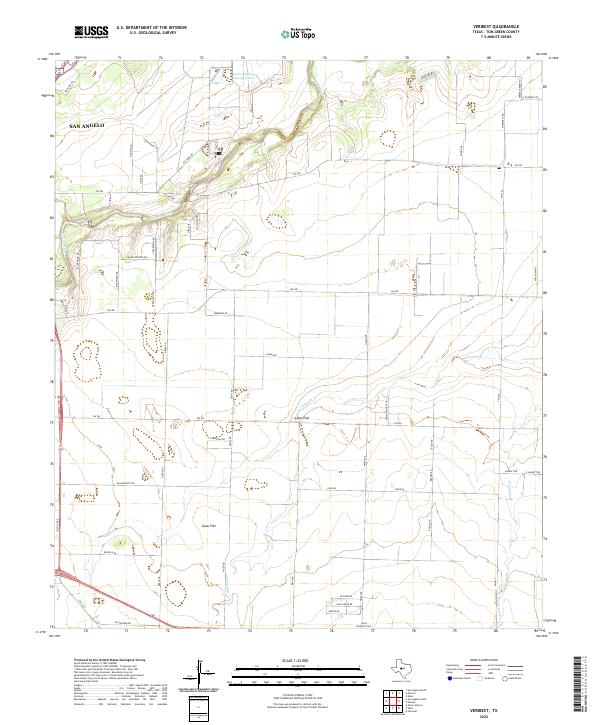 2022 Veribest2022 Print · USGSTom Green County as it appeared in 2022 shows the quiet agricultural landscape of the Lipan Flat just east of the city. Genealogists and local historians can trace family roots near Waterloo or locate the Saint Ambrose Cem along the winding Concho River.
 - 2022 Map of San Angelo North, 2022 Print
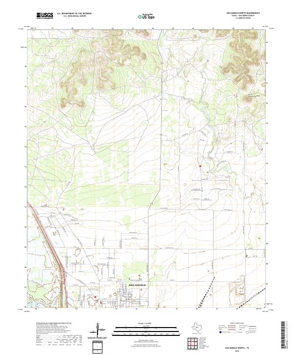 2022 San Angelo North2022 Print · USGSModern Tom Green County appears here as the northern suburbs of San Angelo extend toward the open ranch land. Researchers can trace local development along W Old Sterling City Hwy or find landmarks like Devils Courthouse Peak.
 - 2022 Map of San Angelo South, 2022 Print
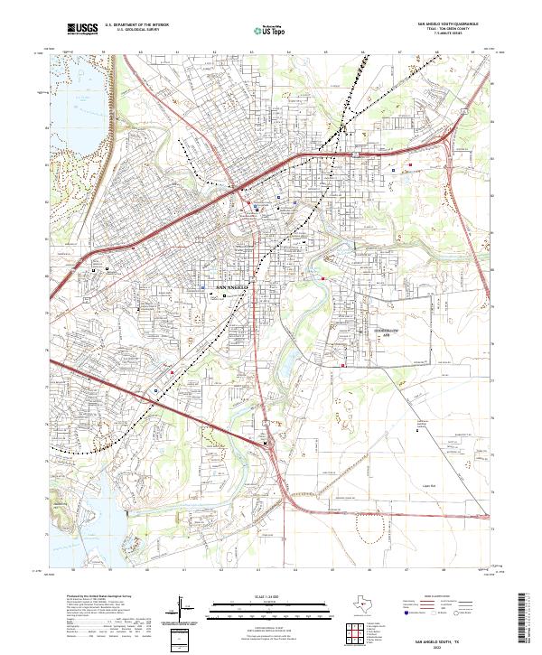 2022 San Angelo South2022 Print · USGSCovers San Angelo, including Alvery Junction, Tom Green County, and other nearby areas
End of results
Showing maps 1-7 of 7
Top cities near San Angelo
Top neighborhoods of San Angelo
- Alvery Junction historical maps
- Belaire historical maps
- Bentwood historical maps
- Butler Farms historical maps
- Central historical maps
- Riverside historical maps
See more
Frequently asked questions
- What are the different types of historical maps available for San Angelo?
- What is the oldest map of San Angelo?
- Where can I purchase historical maps of San Angelo for my home or office?
- Where can I download high-res historical maps of San Angelo?
- Are there historical topographic maps available for San Angelo?
- Is there historical aerial imagery available for San Angelo?
- Where are historical maps of San Angelo sourced from?