Old Maps of Larga Vista, Laredo for Genealogy
Trace your family roots with 9 historic maps of Larga Vista. These high-res maps reveal old neighborhoods, homesites, landmarks, and streets — helping you uncover where your ancestors lived and how the area evolved over time.
- Explore historic neighborhoods: Identify where your relatives may have lived in the 1800s or 1900s.
- Compare maps over time: Trace the changes in streets, buildings, and landmarks for multi-generational research.
- Perfect for genealogy & ancestry research: Used by family historians and researchers to map out lineage and migration.
These maps are an incredible resource for exploring your personal connection to Larga Vista's past.
Larga Vista, Laredo maps
(9)- 1933 Map of Becerra Creek, 1956 Print
 1933 Becerra Creek1956 Print · USGSSouth Texas ranching country along the border comes into focus in the early twentieth century. Genealogists and local historians can trace family landholdings like the Dario Sanchez Pasture or search for roots near the Johnson Settlement and Mann Ranch.
 - 1956 Map of Laredo, 1960 Print
 1956 Laredo1960 Print · USGSSouth Texas in the mid-fifties reveals a landscape shaped by border commerce, military aviation, and a booming oil industry. Trace the historic Texas and Mexican RR line through Hebbronville or locate the sprawling Mirando City Oil Field and Laredo AFB.3 unique versions available
 - 1979 Map of Laredo South, 1980 Print
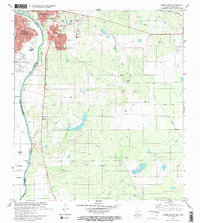 1979 Laredo South1980 Print · USGSThe international border at the end of the 1970s shows the twin cities of Laredo and Nuevo Laredo flanking the Rio Bravo Grande. Researchers can trace rural settlements like Santa Maria (Angelica) and community landmarks like Masterson Sch.2 unique versions available
 - 1985 Map of San Ygnacio
 1985 San Ygnacio1985 Print · USGSThe Rio Grande borderlands and South Texas ranch country are captured here in the mid-eighties as the energy industry expanded inland. Researchers can trace historic river settlements like San Ygnacio or the industrial footprints of Mirando City and the Jennings West Oil and Gas Field.3 unique versions available
 - 2010 Map of Laredo South, 2010 Print
 2010 Laredo South2010 Print · USGSCovers Larga Vista, including Laredo, La Presa, and other nearby areas
 - 2013 Map of Laredo South, 2013 Print
 2013 Laredo South2013 Print · USGSCovers Larga Vista, including Laredo, La Presa, and other nearby areas
 - 2016 Map of Laredo South, 2016 Print
 2016 Laredo South2016 Print · USGSCovers Larga Vista, including Laredo, La Presa, and other nearby areas
 - 2019 Map of Laredo South, 2019 Print
 2019 Laredo South2019 Print · USGSCovers Larga Vista, including Laredo, La Presa, and other nearby areas
 - 2022 Map of Laredo South, 2022 Print
 2022 Laredo South2022 Print · USGSThe Texas borderlands south of Laredo are captured here in the early twenty-first century as suburban growth meets the Rio Grande. Researchers can trace development in Los Altos or locate landmarks like the Rafael B Garcia Reservoir and La Presa.
End of results
Showing maps 1-9 of 9
Top cities near Larga Vista
Frequently asked questions
- What are the different types of historical maps available for Larga Vista?
- What is the oldest map of Larga Vista?
- Where can I purchase historical maps of Larga Vista for my home or office?
- Where can I download high-res historical maps of Larga Vista?
- Are there historical topographic maps available for Larga Vista?
- Is there historical aerial imagery available for Larga Vista?
- Where are historical maps of Larga Vista sourced from?