Old Maps of Haynesville, Texas for Genealogy
Trace your family roots with 12 historic maps of Haynesville. These high-res maps reveal old neighborhoods, homesites, landmarks, and streets — helping you uncover where your ancestors lived and how the area evolved over time.
- Explore historic neighborhoods: Identify where your relatives may have lived in the 1800s or 1900s.
- Compare maps over time: Trace the changes in streets, buildings, and landmarks for multi-generational research.
- Perfect for genealogy & ancestry research: Used by family historians and researchers to map out lineage and migration.
These maps are an incredible resource for exploring your personal connection to Haynesville's past.
Haynesville, TX maps
(12)- 1916 Map of Electra, 1961 Print
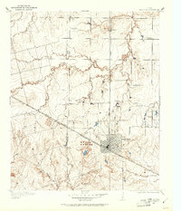 1916 Electra1961 Print · USGSElectra and the surrounding plains of North Texas are captured here just as the regional oil and rail economy was transforming the landscape. Genealogists and historians can trace the precise locations of the County Line School, Mt Carmel Church, and the Red River School.
 - 1918 Map of Electra
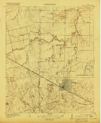 1918 Electra1918 Print · USGSThe North Texas plains near the Wichita-Wilbarger border show a growing network of roads and rural schools during the late nineteen-teens. Researchers can trace early family settlements and local landmarks like Mt Carmel Church, the Enterprise School, and the busy Electra townsite.
 - 1955 Map of Lawton, 1958 Print
 1955 Lawton1958 Print · USGSSouthwestern Oklahoma and North Texas are shown here in the mid-fifties, dominated by the Wichita Mountains and the vital Red River watershed. Genealogists and historians can trace the foundations of Lawton alongside rural landmarks like Rainy Mountain Church and Pleasant Hill School.5 unique versions available
 - 1958 Map of Electra, 1959 Print
 1958 Electra1959 Print · USGSThe Texas-Oklahoma borderlands thrived during the late 1950s as the petroleum industry reshaped the North Texas prairie around Electra. Genealogists and historians can trace the foundations of local communities through landmarks like Haynesville (Punkin Center), Antioch Ch, and the site of Fort Augur.
 - 1972 Map of Electra, 1974 Print
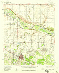
 1972 Electra1974 Print · USGSWichita County was defined by its oil economy and rail connections during the 1970s. Trace the industrial landscape of Electra through its Oil Wells, Gasoline Plant, and local landmarks like the Rodeo Ground.
 - 1985 Map of Burkburnett, 1986 Print
 1985 Burkburnett1986 Print · USGSThe Red River valley and North Texas oil fields are captured here in the mid-eighties, showing the vital connection between military hubs and rail towns. Researchers can trace the path of the Missouri Kansas Texas railroad through Burkburnett or locate Waurika Lake and Sheppard Air Force Base.2 unique versions available
 - 1991 Map of Electra, 1995 Print
 1991 Electra1995 Print · USGSNorth Texas energy and agriculture intersect at the Wichita County line during the early nineties. Genealogists and historians can trace the streets of Electra, locate Mt Carmel Cem, and explore the industrial footprint of Electra Field.
 - 2010 Map of Electra, 2010 Print
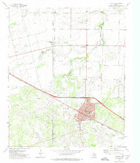
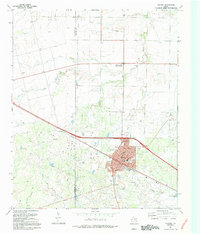
 2010 Electra2010 Print · USGSCovers Haynesville, including Electra, Wichita County, and other nearby areas
 - 2012 Map of Electra, 2012 Print
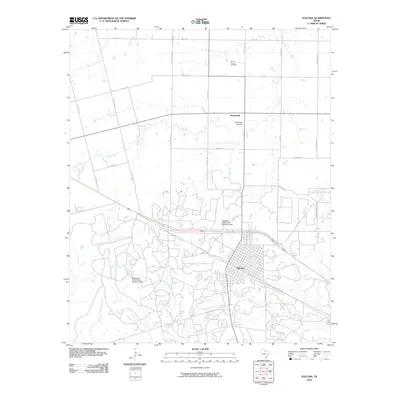
 2012 Electra2012 Print · USGSCovers Haynesville, including Electra, Wichita County, and other nearby areas
 - 2016 Map of Electra, 2016 Print
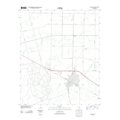
 2016 Electra2016 Print · USGSCovers Haynesville, including Electra, Wichita County, and other nearby areas
 - 2019 Map of Electra, 2019 Print
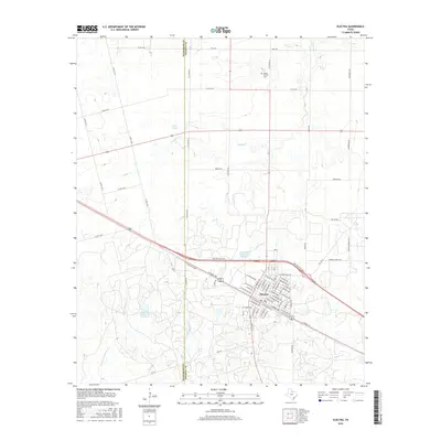
 2019 Electra2019 Print · USGSCovers Haynesville, including Electra, Wichita County, and other nearby areas
 - 2022 Map of Electra, 2022 Print
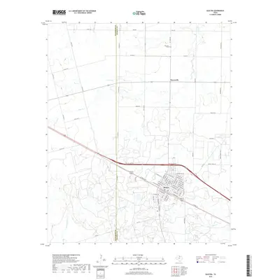
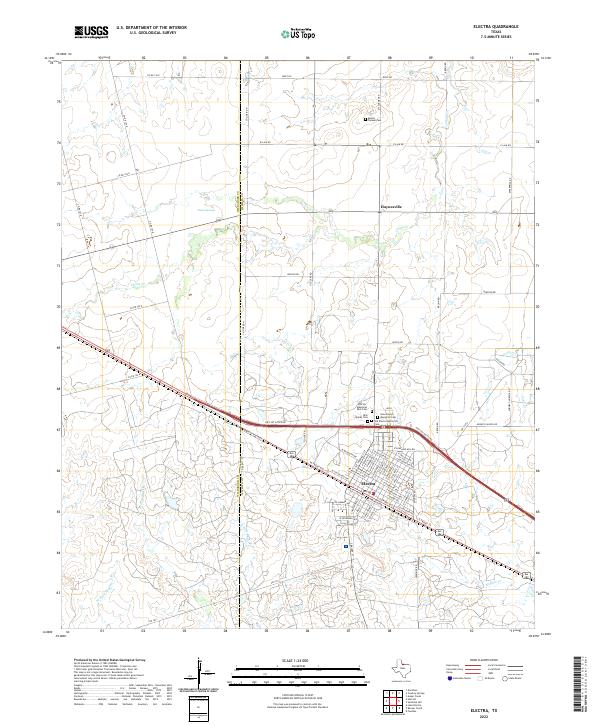 2022 Electra2022 Print · USGSElectra and the surrounding Wichita County plains are shown in this modern survey. Researchers can trace local genealogy at Mount Carmel Cem or follow the path of Buffalo Cr near the old settlement of Haynesville.
End of results
Showing maps 1-12 of 12
Top cities near Haynesville
- Iowa Park historical maps
- Electra historical maps
- Grandfield historical maps
- Davidson historical maps
- Loveland historical maps
Frequently asked questions
- What are the different types of historical maps available for Haynesville?
- What is the oldest map of Haynesville?
- Where can I purchase historical maps of Haynesville for my home or office?
- Where can I download high-res historical maps of Haynesville?
- Are there historical topographic maps available for Haynesville?
- Is there historical aerial imagery available for Haynesville?
- Where are historical maps of Haynesville sourced from?