1950s Maps of Hutto, Texas
Explore 3 historic maps of Hutto from the 1950s. These maps offer a rare glimpse into what life looked like during the 1950s — showing old roads, neighborhoods, homes, and landmarks that have changed or disappeared over time.
Whether you're researching your family's past, planning a metal detecting trip, or studying how Hutto's landscape evolved across the 1950s, these high-resolution maps are a powerful tool for exploring the history of this region.
- Focus on a specific era: All maps on this page are from the 1950s, giving you a focused view of this time period.
- See what’s changed: Compare century-old streets, trails, and buildings to today's modern landscape using overlays and satellite layers.
- Research with precision: Use these maps for genealogy, historical research, land use analysis, or educational projects.
- View, download, or print: Maps are fully viewable online in high resolution, and can be downloaded or printed for your own records.
Start exploring Hutto's history through authentic maps from the 1950s. This is your window into the past.
Hutto, TX maps
(3)- 1951 Map of Round Rock
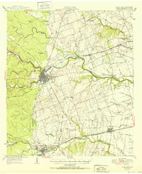 1951 Round Rock1951 Print · USGSWilliamson County at mid-century reveals a landscape of thriving rural communities and intersecting rail lines before the era of modern suburban expansion. Local researchers can pinpoint family landmarks like Palm Valley Ch, trace the old settlement at Old Round Rock, or locate the Bell Gin.
 - 1954 Map of Austin, 1964 Print
 1954 Austin1964 Print · USGSCentral Texas is captured during a period of steady growth as the capital city and its neighboring farm towns began to modernize. Researchers can trace historic rail corridors like the Southern Pacific RR or locate landmarks such as Bergstrom Air Force Base and Pilot Knob.4 unique versions available
 - 1955 Map of Austin, 1956 Print
 1955 Austin1956 Print · USGSAustin and its northern Travis County neighbors appear here in the mid-1950s, just as suburban growth began to reach toward the Williamson County line. Researchers can trace historic family locations and vanished institutions like the Travis County Tuberculosis Sanitarium, McNeil, and New Sweden.
End of results
Showing maps 1-3 of 3
Top cities near Hutto
- Austin historical maps
- Round Rock historical maps
- Georgetown historical maps
- Pflugerville historical maps
- Cedar Park historical maps
- Taylor historical maps
See more
Top neighborhoods of Hutto
Frequently asked questions
- What are the different types of historical maps available for Hutto?
- What is the oldest map of Hutto?
- Where can I purchase historical maps of Hutto for my home or office?
- Where can I download high-res historical maps of Hutto?
- Are there historical topographic maps available for Hutto?
- Is there historical aerial imagery available for Hutto?
- Where are historical maps of Hutto sourced from?