1900s (20th Century) Maps of Wood County, Texas
Explore 30 historic maps of Wood County from the 1900s (20th Century). These maps offer a rare glimpse into what life looked like during the 1900s — showing old roads, neighborhoods, homes, and landmarks that have changed or disappeared over time.
Whether you're researching your family's past, planning a metal detecting trip, or studying how Wood County's landscape evolved across the 1900s, these high-resolution maps are a powerful tool for exploring the history of this region.
- Focus on a specific era: All maps on this page are from the 1900s, giving you a focused view of this time period.
- See what’s changed: Compare century-old streets, trails, and buildings to today's modern landscape using overlays and satellite layers.
- Research with precision: Use these maps for genealogy, historical research, land use analysis, or educational projects.
- View, download, or print: Maps are fully viewable online in high resolution, and can be downloaded or printed for your own records.
Start exploring Wood County's history through authentic maps from the 1900s. This is your window into the past.
Wood County, TX maps
(30)- 1953 Map of Texarkana, 1964 Print
 1953 Texarkana1964 Print · USGSThe Texas-Arkansas borderlands are captured here in the mid-fifties, during a decade of massive military and hydraulic engineering projects. Genealogists and researchers can locate family landmarks like Old Boston Cem, Siloam Ch, and the vast Red River Arsenal.4 unique versions available
 - 1956 Map of Texarkana
 1956 Texarkana1956 Print · USGSThe Ark-La-Tex borderlands come alive in the mid-fifties, showing the transition from a rail-dependent rural economy to a post-war industrial landscape. Researchers can trace the massive Red River Ordnance Depot and find towns like Talco, Bogata, and Naples.
 - 1956 Map of Tyler
 1956 Tyler1956 Print · USGSEast Texas was a powerhouse of oil production and rail transport during the mid-fifties, centered on the sprawling East Texas Oil Field. Researchers can trace the heritage of industrial hubs like Kilgore, military sites such as the Longhorn Ordnance Works, and many rural landmarks like Mount Enterprise.5 unique versions available
 - 1958 Map of Arbala, 1960 Print
 1958 Arbala1960 Print · USGSEast Texas rural life in the late fifties is captured here through the quiet settlements and family cemeteries of Rains and Hopkins counties. Genealogists can trace local roots at Arbala, Bonanza, and the Ishmael Cem along the banks of Lake Fork Creek.4 unique versions available
 - 1958 Map of Alba, 1960 Print
 1958 Alba1960 Print · USGSWood County at the close of the fifties reveals a landscape defined by old lignite pits and oil wells. Genealogists can trace family landmarks like McCord Cem and Pilgrim Rest Ch, while historians can follow the Old Railroad Grade through Alba.3 unique versions available
 - 1959 Map of Calvary, 1960 Print
 1959 Calvary1960 Print · USGSWood County at the close of the 1950s reveals a landscape of oil production and rural community life. Genealogists can trace family roots through sites like Pleasant Ridge Cem, the settlement at Calvary, and an Old Railroad Grade.4 unique versions available
 - 1959 Map of Golden, 1960 Print
 1959 Golden1960 Print · USGSThe Sabine River bottomlands in the late fifties show a landscape of deep wetlands and evolving industry at the junction of three counties. Genealogists and local historians can trace rural landmarks like Sand Springs Church, the Greenland Ford Cem, and the community of Golden.3 unique versions available
 - 1959 Map of Grand Saline, 1960 Print
 1959 Grand Saline1960 Print · USGSGrand Saline and the Sabine River bottomlands are shown in the late fifties, showcasing a landscape shaped by salt mining and rail transport. Researchers can trace rural life through the Morton Mine, Collins Ferry, and community sites like Friendship School.3 unique versions available
 - 1959 Map of Van Lake, 1960 Print
 1959 Van Lake1960 Print · USGSThe oil-rich landscape of East Texas in the late fifties comes alive on this map, showing the rural crossroads and petroleum fields of Smith and Van Zandt counties. Genealogists can locate family landmarks like Dickerson Cem and churches like Union Chapel and Wisdom Temple.4 unique versions available
 - 1959 Map of Yantis, 1960 Print
 1959 Yantis1960 Print · USGSEast Texas ranching and timber lands meet the burgeoning energy sector in the late fifties. Genealogists and local researchers can trace family landmarks like Sandifer Sch, Yantis Cem, and the rural community at Seymore.3 unique versions available
 - 1959 Map of Grand Saline, 1961 Print
 1959 Grand Saline1961 Print · USGSEast Texas in the late fifties reveals a landscape shaped by the oil industry and the railroad. Researchers can trace family-named sites and vanished landmarks like Collins Ferry, Van Oil Field, and the Union Chapel.2 unique versions available
 - 1959 Map of Alba, 1961 Print
 1959 Alba1961 Print · USGSNortheast Texas at the dawn of the 1960s reveals a landscape of oil fields, family cemeteries, and rural rail stops. Genealogists and local historians can locate early sites like Sandifer Sch, Shady Grove, and the Bucks Yandell Cem scattered near the Elm Fork.2 unique versions available
 - 1960 Map of Shady Grove, 1961 Print
 1960 Shady Grove1961 Print · USGSWood County was a landscape of petroleum and pine in the early sixties, with oil wells and rural churches scattered across the creeks. Genealogists can locate family sites near Shady Grove or trace landmarks like Maple Springs Ch and the Hawkins Oil Field.3 unique versions available
 - 1960 Map of Hawkins, 1961 Print
 1960 Hawkins1961 Print · USGSHawkins and the Sabine River valley are shown here during the peak of the local oil boom in the early sixties. Researchers can trace family sites near Jarvis Christian College, find old burials at Liberty Cem, or locate the Hawkins Oil Field wells.3 unique versions available
 - 1960 Map of Hainesville, 1962 Print
 1960 Hainesville1962 Print · USGSWood County was a landscape of small farming communities and timbered creeks in the early sixties. Genealogists and historians can trace family roots through sites like Old Fouke Cem, Mt Pisgah Ch, and the rural Pine Mills Sch.2 unique versions available
 - 1960 Map of Winnsboro, 1962 Print
 1960 Winnsboro1962 Print · USGSEast Texas oil and rail culture intersect here at the start of the 1960s, showing the town and its surrounding fields. Trace family history through Lee Cemetery or explore the local petroleum boom at the Pickton Oil Field and McCrary Oil Field.3 unique versions available
 - 1960 Map of Lindale, 1962 Print
 1960 Lindale1962 Print · USGSLindale and its East Texas surroundings are captured here at a moment of mid-century growth along the Missouri Pacific rail line. Genealogists and local historians can trace family roots through sites like Flewellen Cem, the Bragg Morris High Sch, and the community at Friendship.3 unique versions available
 - 1960 Map of Mineola, 1962 Print
 1960 Mineola1962 Print · USGSMineola sits at a critical rail junction in East Texas at the dawn of the 1960s, serving as a hub for the Texas and Pacific and Missouri Pacific. Researchers can trace rural community roots through New Hope Sch, the Mineola Paul Oil Field, and Rose Hill Ch.2 unique versions available
 - 1960 Map of Cartwright, 1962 Print
 1960 Cartwright1962 Print · USGSWood County in the early sixties remains a landscape of quiet country churches and rural schoolhouses connected by winding creeks. Genealogists and local historians can trace family roots through Cartwright, Little Hope, and the Lone Grove Sch.2 unique versions available
 - 1960 Map of Newsome, 1962 Print
 1960 Newsome1962 Print · USGSWood and Franklin Counties in the early sixties show a rural landscape shaped by the Louisiana & Arkansas (KCS) rail line and local industry. Genealogists can locate family landmarks like Morris Chapel, Clearwater Cem, and the Newsome Oil Field.3 unique versions available
 - 1960 Map of Rhonesboro, 1962 Print
 1960 Rhonesboro1962 Print · USGSWood and Upshur counties are shown at the dawn of the sixties, a landscape of creek-bottoms and rural settlements. Researchers can trace the Old Railroad Grade or find local landmarks like Little Hope Ch and Perryville.4 unique versions available
 - 1960 Map of Pleasant Grove, 1962 Print
 1960 Pleasant Grove1962 Print · USGSWood and Hopkins County land sits at the peak of its oil-producing era in the early sixties. Genealogists and historians can locate rural landmarks like Stormville Ch, Black Oak, and the wells of the extensive Manziel Oil Field.2 unique versions available
 - 1960 Map of Crow, 1962 Print
 1960 Crow1962 Print · USGSWood and Smith Counties are captured here in the early sixties, defined by the winding Sabine River and the rural community of Red Springs. Researchers can locate Red Springs Cem, family-named water bodies like Overton Lake, and several country churches.2 unique versions available
 - 1960 Map of Quitman, 1962 Print
 1960 Quitman1962 Print · USGSWood County’s seat and surrounding oil fields are captured here in the early sixties. Researchers can trace rural lineages through sites like Price Cemetery and Cana School, or locate the Manziel Oil Field and Lake Lydia.3 unique versions available
 - 1965 Map of New Hope, 1967 Print
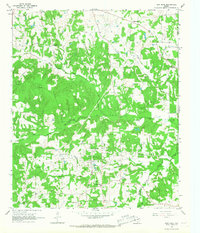 1965 New Hope1967 Print · USGSFranklin and Titus counties in the mid-1960s reveal a landscape defined by the petroleum industry and rural community life. Genealogists and local historians can trace family-named sites like Bethel Cem and Rock Hill Cem alongside the infrastructure of the New Hope Oil Field.2 unique versions available
Showing maps 1-25 of 30
Top cities of Wood County
- Mineola historical maps
- Holly Lake Ranch historical maps
- Quitman historical maps
- Hawkins historical maps
- Alba historical maps
- Yantis historical maps
Frequently asked questions
- What are the different types of historical maps available for Wood County?
- What is the oldest map of Wood County?
- Where can I purchase historical maps of Wood County for my home or office?
- Where can I download high-res historical maps of Wood County?
- Are there historical topographic maps available for Wood County?
- Is there historical aerial imagery available for Wood County?
- Where are historical maps of Wood County sourced from?