Old Maps of Comanche County, Texas
Explore 70 old maps of Comanche County, spanning from 1888 to today. These high-resolution historic maps reveal how streets, neighborhoods, landmarks, and natural features evolved over time — perfect for genealogy, metal detecting, research, and local history exploration.
What you can do with these maps:
- See how Comanche County changed over time: Compare historical maps to modern-day views to trace roads, homesites, rail lines & more.
- View detailed metadata: Each map includes creators, publishers, year, scale, and archive source.
- Overlay maps with satellite & LiDAR: Visualize the past alongside modern tools to explore terrain & human change.
- Trusted historical sources: Maps sourced from the USGS, Library of Congress, and other archives.
- Access maps your way: View online, download high-res files, or order prints for personal or research use.
Start exploring old maps of Comanche County to uncover forgotten places, hidden landmarks, and the deep history beneath your feet.
Comanche County, TX maps
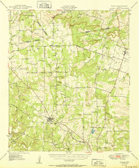
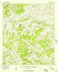
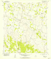
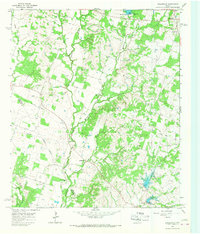
(70)- 1888 Map of Hamilton
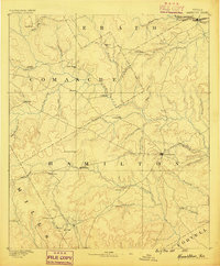 1888 Hamilton1888 Print · USGSCovers Comanche County, including Hamilton, Hico, and other nearby areas
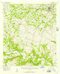
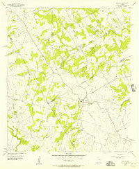
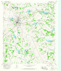
 - 1889 Map of Brownwood
 1889 Brownwood1889 Print · USGSCovers Comanche County, including Brownwood, Comanche, and other nearby areas
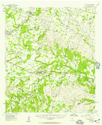
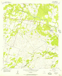
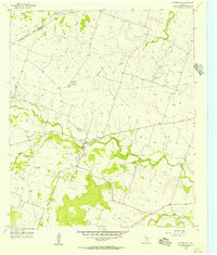
 - 1890 Map of Stephenville
 1890 Stephenville1890 Print · USGSCovers Comanche County, including Stephenville, Dublin, and other nearby areas5 unique versions available
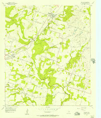
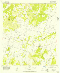
 - 1894 Map of Hamilton
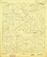 1894 Hamilton1894 Print · USGSCovers Comanche County, including Hamilton, Hico, and other nearby areas5 unique versions available
 - 1894 Map of Eastland
 1894 Eastland1894 Print · USGSCovers Comanche County, including Eastland, Cisco, and other nearby areas6 unique versions available
 - 1894 Map of Brownwood
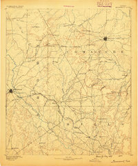 1894 Brownwood1894 Print · USGSCovers Comanche County, including Brownwood, Comanche, and other nearby areas6 unique versions available
 - 1920 Map of Stephenville
 1920 Stephenville1920 Print · USGSCovers Comanche County, including Stephenville, Dublin, and other nearby areas
 - 1931 Map of Mullin
 1931 Mullin1931 Print · USGSCovers Comanche County, including Mullin, Priddy, and other nearby areas
 - 1950 Map of Mullin
 1950 Mullin1950 Print · USGSCovers Comanche County, including Mullin, Priddy, and other nearby areas2 unique versions available
 - 1954 Map of Brownwood, 1955 Print
 1954 Brownwood1955 Print · USGSCovers Comanche County, including Brownwood, Lampasas, and other nearby areas3 unique versions available
 - 1954 Map of Abilene, 1966 Print
 1954 Abilene1966 Print · USGSCovers Comanche County, including Abilene, Mineral Wells, and other nearby areas2 unique versions available
 - 1956 Map of Gustine
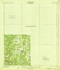
 1956 Gustine1956 Print · USGSCovers Comanche County, including Gustine, Edna Hill, and other nearby areas
 - 1956 Map of Gentrys Mill, 1957 Print
 1956 Gentrys Mill1957 Print · USGSCovers Comanche County, including Gentrys Mill, Sunshine, and other nearby areas2 unique versions available
 - 1956 Map of Gustine, 1957 Print
 1956 Gustine1957 Print · USGSCovers Comanche County, including Gustine, Fleming, and other nearby areas
 - 1956 Map of Pottsville, 1957 Print
 1956 Pottsville1957 Print · USGSCovers Comanche County, including Indian Gap, Springdale, and other nearby areas
 - 1956 Map of Hico, 1957 Print
 1956 Hico1957 Print · USGSCovers Comanche County, including Hico, Gentrys Mill, and other nearby areas2 unique versions available
 - 1956 Map of Lamkin, 1957 Print
 1956 Lamkin1957 Print · USGSCovers Comanche County, including Siloam, Lamkin, and other nearby areas2 unique versions available
 - 1956 Map of Proctor, 1957 Print
 1956 Proctor1957 Print · USGSCovers Comanche County, including Hasse, Proctor, and other nearby areas2 unique versions available
 - 1956 Map of Edna Hill, 1957 Print
 1956 Edna Hill1957 Print · USGSCovers Comanche County, including Edna Hill, Hazeldell, and other nearby areas2 unique versions available
 - 1956 Map of Carlton, 1957 Print
 1956 Carlton1957 Print · USGSCovers Comanche County, including Carlton, Erath County, and other nearby areas3 unique versions available
 - 1956 Map of Pottsville, 1957 Print
 1956 Pottsville1957 Print · USGSCovers Comanche County, including Pottsville, Hamilton County, and other nearby areas
 - 1956 Map of Indian Gap, 1957 Print
 1956 Indian Gap1957 Print · USGSCovers Comanche County, including Indian Gap, Mills County, and other nearby areas
 - 1958 Map of Abilene
 1958 Abilene1958 Print · USGSCovers Comanche County, including Abilene, Mineral Wells, and other nearby areas
 - 1965 Map of Lingleville, 1967 Print
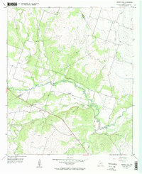
 1965 Lingleville1967 Print · USGSCovers Comanche County, including Victor, Highland, and other nearby areas2 unique versions available
 - 1965 Map of Dublin, 1967 Print
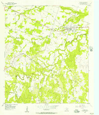
 1965 Dublin1967 Print · USGSCovers Comanche County, including Dublin, Cottonwood, and other nearby areas
Showing maps 1-25 of 70
Top cities of Comanche County
Frequently asked questions
- What are the different types of historical maps available for Comanche County?
- What is the oldest map of Comanche County?
- Where can I purchase historical maps of Comanche County for my home or office?
- Where can I download high-res historical maps of Comanche County?
- Are there historical topographic maps available for Comanche County?
- Is there historical aerial imagery available for Comanche County?
- Where are historical maps of Comanche County sourced from?