Old Maps of Brigham City, Utah for Academic Research
Study the evolution of Brigham City with 28 high-resolution historic maps. Whether you're teaching, researching, or modeling changes in land use, these maps provide essential visual documentation of urban, environmental, and geographic change.
- Analyze long-term change: Track patterns in development, transportation, and natural features.
- Ideal for environmental or urban studies: Support academic projects with primary historical map data.
- Use in the classroom or lab: Educators and researchers rely on these maps to bring historical context to life.
These maps are a powerful tool for teaching, research, and visualizing how Brigham City has changed over the decades.
Brigham City, UT maps
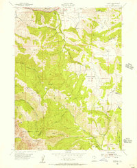
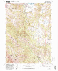
(28)- 1914 Map of Logan, 1957 Print
 1914 Logan1957 Print · USGSCache Valley thrives in the early nineteen-hundreds as a hub of rail travel and sugar beet processing. Genealogists can locate family homesteads near Stephenson School, trace the Oregon Short Line, or find remote operations like the Amazon Mine.
 - 1916 Map of Logan
 1916 Logan1916 Print · USGSCache Valley and the northern Wasatch Range come alive in this mid-1910s survey, showing the peak of the local rail-and-sugar economy. Genealogists can locate family holdings like Hardware Ranch, early rural sites like Stephenson School, and the industrial Sugar Factory.4 unique versions available
 - 1954 Map of Ogden, 1967 Print
 1954 Ogden1967 Print · USGSThe northern Utah corridor and Wyoming borderlands are captured here in the mid-1950s, showing the region's transition from mountain wilderness to settled valleys. Researchers can trace historic institutions like Utah State University or locate vanished points like Church Butte Station and the Trappist Monastery.3 unique versions available
 - 1954 Map of Brigham City, 1968 Print
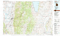
 1954 Brigham City1968 Print · USGSNorthern Utah and the edges of the Great Salt Lake are captured here during the mid-fifties, showing the region's transition from pioneer rail hubs to modern military ranges. Researchers can find old sidings like Lemay Siding, the Golden Spike Monument, and settlements like Washakie.4 unique versions available
 - 1955 Map of Mantua, 1956 Print
 1955 Mantua1956 Print · USGSThe mountain town of Mantua and the surrounding national forest are captured here in the mid-1950s. Genealogists and researchers can locate the Mantua Cemetery, trace mining sites like the Holton Mine, and find youth camps such as Camp Utaba.4 unique versions available
 - 1955 Map of Willard, 1956 Print
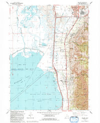
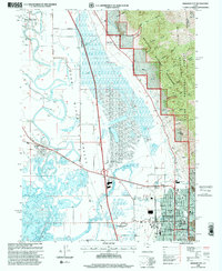
 1955 Willard1956 Print · USGSThe corridor between the Wasatch Front and the Bear River marshes is captured here in the mid-fifties, showing the growth of Brigham City and Willard. Local researchers can locate the Intermountain Indian School, trace the Union Pacific line, and explore the drainage systems of Black Slough.2 unique versions available
 - 1955 Map of Mount Pisgah, 1956 Print
 1955 Mount Pisgah1956 Print · USGSThe high passes of the Wellsville Mountains and the valley settlements of Wellsville and Mantua are captured here in the mid-1950s. Genealogists and local historians can trace family plots at Mount Sterling Cemetery or locate old landmarks like Babbit Shanty Hill and Gold Mine Hill.4 unique versions available
 - 1955 Map of Brigham City, 1957 Print
 1955 Brigham City1957 Print · USGSBrigham City and the surrounding Box Elder valley are captured in the mid-fifties during a period of steady civic growth. Genealogists and historians can trace neighborhood developments around Lincoln School or follow the old Union Pacific lines out to Corinne and the Baker Mine.2 unique versions available
 - 1958 Map of Ogden
 1958 Ogden1958 Print · USGSNorthern Utah and southwestern Wyoming are captured here during a period of steady growth and military expansion. You can trace the Union Pacific rail lines and early road networks connecting Ogden and Logan to Bear Lake and Evanston.
 - 1958 Map of Brigham City
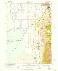
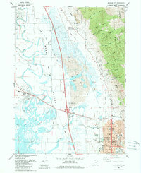
 1958 Brigham City1958 Print · USGSNorthern Utah in the late fifties shows a landscape of extremes, from the salt flats to the bustling Bear River Valley. Trace historical routes like the Old Immigrant Trail and locate local landmarks such as the Brigham Sugar Mill and Booth Valley School.
 - 1960 Map of Ogden
 1960 Ogden1960 Print · USGSIn the mid-1950s, this region of the American West balanced military expansion with frontier history along the Union Pacific RR. Genealogists and historians can trace old settlements like Fort Bridger, the residential growth of Washington Terrace, and industrial sites from the Hill AFB complex to the coal mines of Kemmerer.
 - 1962 Map of Brigham City
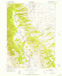
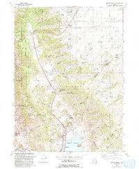
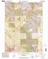
 1962 Brigham City1962 Print · USGSNorthern Utah in the early sixties reveals a landscape of vast salt flats and growing towns along the Wasatch Front. Researchers can trace the Southern Pacific line past the Golden Spike Monument or locate landmarks like Indian Cave and Donner-Reed Pass.
 - 1984 Map of Logan, 1985 Print
 1984 Logan1985 Print · USGSNorthern Utah and its borderlands with Idaho and Wyoming are shown here in the mid-1980s as the Cache Valley communities grew. Researchers can trace the Union Pacific rail lines and find legacy sites like College Ward, Pickleville, and Utah State University.3 unique versions available
 - 1986 Map of Ogden, 1987 Print
 1986 Ogden1987 Print · USGSThe Wasatch Front was undergoing significant development in the mid-eighties as the urban corridor stretched from Ogden toward the Great Salt Lake. Researchers can trace the legacy of regional transport and defense via Hill Air Force Base, the Union Pacific line, and mountain passes near Snow Basin.
 - 1987 Map of Promontory Point
 1987 Promontory Point1987 Print · USGSThe Wasatch Front meets the great salt desert in the late eighties, showing the rapid growth of towns from Brigham City to Layton. Follow the Southern Pacific (Lucin Cutoff) across the water and explore the remote terrain of Antelope Island and Promontory Point.
 - 1988 Map of Brigham City
 1988 Brigham City1988 Print · USGSBrigham City and the Bear River Valley are shown during the late 1980s as a bustling hub of civic life and agricultural infrastructure. Genealogists and historians can trace the street grids of Corinne, Bear River City, and Brigham City, or locate the Harper Ward Cem and the Historical Monument at Calls Fort.
 - 1989 Map of Tremonton
 1989 Tremonton1989 Print · USGSNorthern Utah and the Idaho borderlands appear here in the late eighties, centered on the historic rail corridor and the fertile Bear River valley. Genealogists and historians can trace the legacy of settlements from Washakie to Honeyville and the Golden Spike National Historic Site.2 unique versions available
 - 1991 Map of Mount Pisgah
 1991 Mount Pisgah1991 Print · USGSThe eastern Cache Valley and the soaring Wellsville Mountains are captured here in the early 1990s as the region balanced its agricultural roots with mountain wilderness. Genealogists and hikers can trace old landmarks like the Mount Sterling Cem, the remote Gold Mine, and the waters of the Mantua Reservoir.
 - 1991 Map of Mantua, 1992 Print
 1991 Mantua1992 Print · USGSNear the high ridges of the Wasatch Range in the early 1990s, this area shows a unique blend of mountain mining and valley settlement. Researchers can trace old mountain workings like the Silver Eagle Mine or locate historical social sites including the Bel Mia Girls Home and Camp Utaba.2 unique versions available
 - 1992 Map of Willard
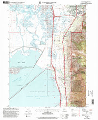
 1992 Willard1992 Print · USGSThe interface of the Wasatch Range and the Great Salt Lake is documented here in the early nineties, showing the growth of Brigham City and Willard. Researchers can trace old water rights along the Ogden Brigham Canal and find local landmarks like the Willard City Spring and Cem.
 - 1998 Map of Willard, 2001 Print
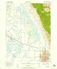
 1998 Willard2001 Print · USGSThe eastern shores of the Great Salt Lake come into focus in the late nineties, showing the interface of the Wasatch peaks and the bay. Researchers can trace the layout of Willard, locate the Cem, and explore the canyon systems of Pearsons Canyon and Matthias Canyon.
 - 1998 Map of Mantua, 2001 Print
 1998 Mantua2001 Print · USGSMantua and the high ridgelines of the Wasatch Range are shown in detail during the late nineties. Local history researchers can trace old mining operations like the Holton Mine, locate the Bel Mia Girls Home, and explore the canyon lands surrounding Mantua Reservoir.
 - 1998 Map of Brigham City, 2001 Print
 1998 Brigham City2001 Print · USGSBrigham City and the surrounding Bear River Valley are shown here in the late nineties, balancing a growing urban center with vast wetlands. Researchers can trace family sites at Harper Ward Cemetery or locate historic landmarks like the Calls Fort Monument.
 - 1998 Map of Mount Pisgah, 2001 Print
 1998 Mount Pisgah2001 Print · USGSThe northern Wellsville Mountains and Cache Valley are captured here during the late nineties as regional development met wilderness protection. Researchers can trace historic routes like Sardine Canyon Road, locate the Mount Sterling Cem, or find industrial sites like the Silver Mine.
 - 2023 Map of Willard, 2023 Print
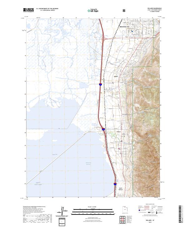 2023 Willard2023 Print · USGSThe eastern shore of the Great Salt Lake meets the Wasatch Range in this modern survey of Box Elder County. Researchers can trace local heritage at the Willard Pioneer Cem and follow the vital Ogden-Brigham Canal through the heart of Willard and Perry.
Showing maps 1-25 of 28
Top cities near Brigham City
- Logan historical maps
- North Ogden historical maps
- Pleasant View historical maps
- Tremonton historical maps
- Hyrum historical maps
- Farr West historical maps
See more
Frequently asked questions
- What are the different types of historical maps available for Brigham City?
- What is the oldest map of Brigham City?
- Where can I purchase historical maps of Brigham City for my home or office?
- Where can I download high-res historical maps of Brigham City?
- Are there historical topographic maps available for Brigham City?
- Is there historical aerial imagery available for Brigham City?
- Where are historical maps of Brigham City sourced from?