Old Maps of Hogup, Utah for Genealogy
Trace your family roots with 11 historic maps of Hogup. These high-res maps reveal old neighborhoods, homesites, landmarks, and streets — helping you uncover where your ancestors lived and how the area evolved over time.
- Explore historic neighborhoods: Identify where your relatives may have lived in the 1800s or 1900s.
- Compare maps over time: Trace the changes in streets, buildings, and landmarks for multi-generational research.
- Perfect for genealogy & ancestry research: Used by family historians and researchers to map out lineage and migration.
These maps are an incredible resource for exploring your personal connection to Hogup's past.
Hogup, UT maps
(11)- 1954 Map of Brigham City, 1968 Print
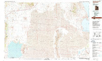
 1954 Brigham City1968 Print · USGSNorthern Utah and the edges of the Great Salt Lake are captured here during the mid-fifties, showing the region's transition from pioneer rail hubs to modern military ranges. Researchers can find old sidings like Lemay Siding, the Golden Spike Monument, and settlements like Washakie.4 unique versions available
 - 1958 Map of Brigham City
 1958 Brigham City1958 Print · USGSNorthern Utah in the late fifties shows a landscape of extremes, from the salt flats to the bustling Bear River Valley. Trace historical routes like the Old Immigrant Trail and locate local landmarks such as the Brigham Sugar Mill and Booth Valley School.
 - 1962 Map of Brigham City
 1962 Brigham City1962 Print · USGSNorthern Utah in the early sixties reveals a landscape of vast salt flats and growing towns along the Wasatch Front. Researchers can trace the Southern Pacific line past the Golden Spike Monument or locate landmarks like Indian Cave and Donner-Reed Pass.
 - 1969 Map of Hogup Ridge North, 1972 Print
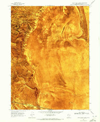 1969 Hogup Ridge North1972 Print · USGSBox Elder County at the end of the sixties shows a landscape of extremes, where industrial rail lines meet the salt flats. Researchers can trace the path of the Southern Pacific near Hogup and the geological reach of Hogup Ridge.
 - 1988 Map of Newfoundland Mountains
 1988 Newfoundland Mountains1988 Print · USGSBox Elder County at the edge of the desert during the late 1980s reveals a landscape of isolated ranges and military testing grounds. Researchers can trace the Old Railroad Grade past Lucin and locate historic water sources like Donner Spring.3 unique versions available
 - 1991 Map of Hogup Ridge North
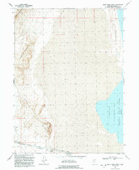 1991 Hogup Ridge North1991 Print · USGSThe northwestern shores of the Great Salt Lake are mapped here in the early nineties, showing a landscape defined by desert mountains and saline bays. Trace the historic Lucin Cutoff railroad line past the settlement of Hogup and the industrial Hogup Pumping Station.
 - 2011 Map of Hogup Ridge North, 2011 Print
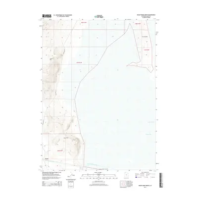
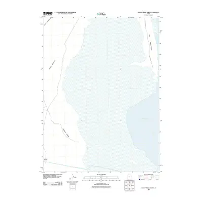 2011 Hogup Ridge North2011 Print · USGSCovers Hogup, including Box Elder County, United States, and other nearby areas
 - 2014 Map of Hogup Ridge North, 2014 Print
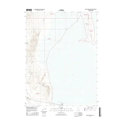
 2014 Hogup Ridge North2014 Print · USGSCovers Hogup, including Box Elder County, United States, and other nearby areas
 - 2017 Map of Hogup Ridge North, 2017 Print
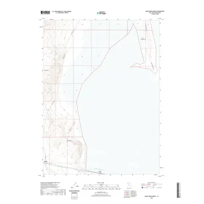
 2017 Hogup Ridge North2017 Print · USGSCovers Hogup, including Box Elder County, United States, and other nearby areas
 - 2020 Map of Hogup Ridge North, 2020 Print
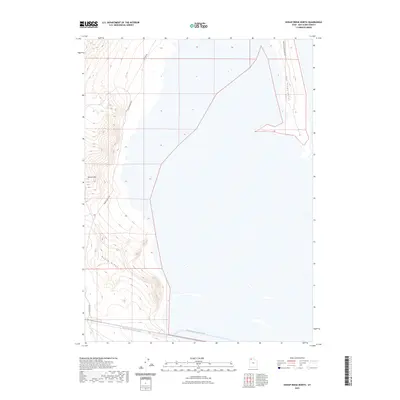
 2020 Hogup Ridge North2020 Print · USGSCovers Hogup, including Box Elder County, United States, and other nearby areas
 - 2023 Map of Hogup Ridge North, 2023 Print
 2023 Hogup Ridge North2023 Print · USGSBox Elder County at the turn of the decade is defined by its remote desert ridges and water management infrastructure. You can trace the path of the Rio Buenaventura Canal as it passes near Hogup Ridge and the landmark heights of Broom Mtn.
End of results
Showing maps 1-11 of 11
Frequently asked questions
- What are the different types of historical maps available for Hogup?
- What is the oldest map of Hogup?
- Where can I purchase historical maps of Hogup for my home or office?
- Where can I download high-res historical maps of Hogup?
- Are there historical topographic maps available for Hogup?
- Is there historical aerial imagery available for Hogup?
- Where are historical maps of Hogup sourced from?