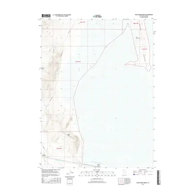
2017 Map of Hogup Ridge North
USGS Topo · Published 2017About this map
Hogup sits at the base of the prominent Hogup Ridge, a key landform in this arid stretch of Box Elder County. The landscape is defined by the heavy infrastructure of the Southern Pacific Causeway and the Rio Buenaventura Canal crossing the low-lying flats to the south. Transportation through this remote terrain is facilitated by several rugged tracks, including E Hogup Rd and the Hogup Bypass Rd. This 2017 survey illustrates the intersection of heavy transit corridors and high-desert topography, showing the distinct elevation gains at Broom Mtn and the unique landform known as The Fingerpoint. The map provides an essential view of how industrial infrastructure and backcountry access roads navigate the Great Salt Lake Desert basin.
Find a feature on this map
14 named features on this map. Tap any name to fly to it.
Don’t see what you’re looking for? This feature index may not catch every label — zoom into the map to look around manually.
Map Details
Editions of this 2017 Hogup Ridge North Map
This is the sole edition of this map. No revisions or reprints were ever made.
Other maps of this area

1954 · Brigham City
USGS Topo · 1:250,000

1958 · Brigham City
USGS Topo · 1:250,000

1962 · Brigham City
USGS Topo · 1:250,000

1969 · Dolphin Island West
USGS Topo · 1:24,000

1969 · Gunnison Island SW
USGS Topo · 1:24,000

1969 · Hogup Ridge South
USGS Topo · 1:24,000

1969 · Strongs Knob
USGS Topo · 1:24,000
1969 · Dolphin Island East
USGS Topo · 1:24,000

1969 · Hogup Ridge North
USGS Topo · 1:24,000

1983 · Round Mountain NW
USGS Topo · 1:24,000