1900s (20th Century) Maps of Castle Valley, Utah
Explore 16 historic maps of Castle Valley from the 1900s (20th Century). These maps offer a rare glimpse into what life looked like during the 1900s — showing old roads, neighborhoods, homes, and landmarks that have changed or disappeared over time.
Whether you're researching your family's past, planning a metal detecting trip, or studying how Castle Valley's landscape evolved across the 1900s, these high-resolution maps are a powerful tool for exploring the history of this region.
- Focus on a specific era: All maps on this page are from the 1900s, giving you a focused view of this time period.
- See what’s changed: Compare century-old streets, trails, and buildings to today's modern landscape using overlays and satellite layers.
- Research with precision: Use these maps for genealogy, historical research, land use analysis, or educational projects.
- View, download, or print: Maps are fully viewable online in high resolution, and can be downloaded or printed for your own records.
Start exploring Castle Valley's history through authentic maps from the 1900s. This is your window into the past.
Castle Valley, UT maps
(16)- 1954 Map of Mt. Waas 3 NE, 1956 Print
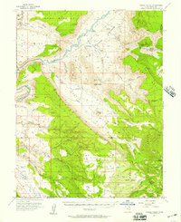
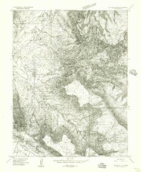 1954 Mt. Waas 3 NE1956 Print · USGSGrand County, Utah, is seen here during the mid-1950s as a landscape of isolated ranching outposts and active mining exploration. Local historians and researchers can locate the Richardson (Site), trace the drainage of Professor Creek, or identify early Prospects scattered near Castle Rock.
 - 1954 Map of Mt. Waas 3 SE, 1956 Print
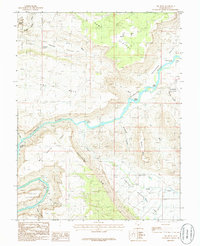
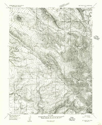 1954 Mt. Waas 3 SE1956 Print · USGSThe Grand and San Juan county line in the mid-1950s reveals a landscape of isolated ranching and fading mining works. Researchers can locate the Castleton settlement, the Battleground monument, and Porcupine Ranch.
 - 1954 Map of Mt. Waas 3 NW, 1956 Print
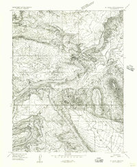 1954 Mt. Waas 3 NW1956 Print · USGSThe Colorado River corridor near Moab is shown here in the mid-1950s, a landscape of high mesas and ranching outposts. Researchers can trace the early boundaries of Arches National Monument or locate the site of White Ranch and Castle Valley.
 - 1954 Map of Mt. Waas 3 SW, 1956 Print
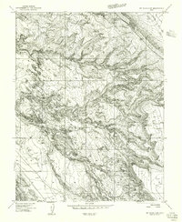 1954 Mt. Waas 3 SW1956 Print · USGSSoutheast Utah at the mid-century reveals a high-desert landscape defined by canyons and mesas. Researchers can trace the early layout of Moab City Park, find a remote Landing Strip, and locate seasonal water sources like Placer Spring.
 - 1954 Map of Castle Valley, 1957 Print
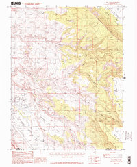
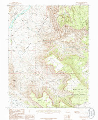
 1954 Castle Valley1957 Print · USGSThe Colorado River corridor in the 1950s reveals a landscape of isolated ranching outposts and former pioneer settlements. Researchers can trace the legacy of early Utah history through the locations of Castleton (Site), the Pinhook Battleground, and remote dwellings like Pace Ranch.3 unique versions available
 - 1956 Map of Moab, 1972 Print
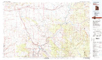
 1956 Moab1972 Print · USGSThe Colorado Plateau and La Sal Mountains appear here in the mid-fifties, just as the uranium boom and energy exploration were reshaping the Four Corners. Researchers can trace the Denver and Rio Grande Western through Cisco or locate the remote outpost of Uravan and Looking Glass Rock.3 unique versions available
 - 1959 Map of Moab
 1959 Moab1959 Print · USGSSoutheast Utah and Western Colorado are mapped here in the late fifties, just as the uranium boom was transforming the remote canyon lands. Genealogists and historians can trace the foundations of Moab and Nucla, or locate mining sites and landmarks like Uravan and Dead Horse Point.
 - 1960 Map of Moab
 1960 Moab1960 Print · USGSThe canyonlands and high plateaus of the Utah-Colorado border are shown here during the mid-century uranium boom. Researchers can trace the river-and-rail corridors of the Colorado River and the Denver and Rio Grande Western near Moab and Uravan.3 unique versions available
 - 1962 Map of Moab
 1962 Moab1962 Print · USGSThe canyon country of southeastern Utah and western Colorado is captured here in the early sixties, showing the reach of the Denver and Rio Grande Western through the desert. Researchers can trace the layout of mining settlements like Uravan and old railroad stops at Cisco and Sagers Station.
 - 1964 Map of Moab
 1964 Moab1964 Print · USGSThe canyonlands of eastern Utah and western Colorado are captured here in the mid-1960s, a time when uranium mining shaped the local economy. Researchers can trace the river-and-rail network through Sinbad Valley and locate mining outposts like Uravan and Vancorum.
 - 1965 Map of Moab
 1965 Moab1965 Print · USGSSoutheast Utah and Western Colorado are mapped here in the mid-sixties, showcasing a landscape of high plateaus and deep river canyons. Genealogists and historians can trace the mining-era towns of Uravan and Paradox or locate remote landmarks like Castleton and Dead Horse Point.
 - 1983 Map of Moab
 1983 Moab1983 Print · USGSThe Colorado River corridor near Moab is captured here in the early eighties, showcasing a landscape of uranium mining and iconic parklands. Trace the Denver and Rio Grande Western RR as it passes through Cisco or locate landmarks like Delicate Arch and the Telluride Mines.3 unique versions available
 - 1985 Map of Big Bend, 1986 Print
 1985 Big Bend1986 Print · USGSGrand County's dramatic canyon country is mapped here in the mid-1980s as the Colorado River winds past iconic formations. Trace the river's path through Whites Rapids and Big Bend or locate landmarks like Delicate Arch and Parriott Mesa.2 unique versions available
 - 1985 Map of Rill Creek, 1986 Print
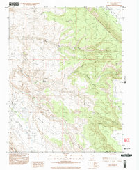
 1985 Rill Creek1986 Print · USGSThe Grand County high country and canyonlands appear here in the mid-1980s, documenting a landscape of steep mesas and vital water sources. Researchers can trace remote 4WD routes across Porcupine Rim or locate local landmarks like Coffee Pot Rock and the Rodeo Ground.2 unique versions available
 - 1985 Map of Fisher Towers, 1986 Print
 1985 Fisher Towers1986 Print · USGSGrand County’s red rock landscape is captured in the mid-1980s, documenting a labyrinth of canyons and soaring spires. Trace the vertical reaches of Fisher Towers and Titan Tower, or locate the Priest and Nuns and the Onion Creek Rapids.
 - 1996 Map of Rill Creek, 2002 Print
 1996 Rill Creek2002 Print · USGSEastern Utah at the close of the twentieth century shows a landscape of rugged canyons and rising mesa communities. Researchers can trace the development of Spanish Valley through local landmarks like the Rodeo Ground, Golf Course, and Cem.
End of results
Showing maps 1-16 of 16
Top cities near Castle Valley
Frequently asked questions
- What are the different types of historical maps available for Castle Valley?
- What is the oldest map of Castle Valley?
- Where can I purchase historical maps of Castle Valley for my home or office?
- Where can I download high-res historical maps of Castle Valley?
- Are there historical topographic maps available for Castle Valley?
- Is there historical aerial imagery available for Castle Valley?
- Where are historical maps of Castle Valley sourced from?