Old Maps of Paria, Utah for Metal Detecting
Plan your next treasure hunt with 12 historic maps of Paria. Find old homesites, ghost towns, trails, and gathering spots that may be lost to time — perfect for identifying promising metal detecting locations.
- Locate forgotten sites: Uncover places like long-lost settlements, abandoned rail lines, or gathering spots.
- Plan better hunts: Use map overlays combined with LiDAR or satellite views to narrow in on historically rich areas.
- Made for detectorists: Thousands of hobbyists use these maps to discover relics, coins, and hidden history.
Use these historic maps to boost your research and find new opportunities beneath the surface of Paria.
Paria, UT maps
(12)- 1886 Map of Escalante
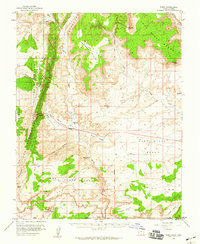
 1886 Escalante1886 Print · USGSSouthern Utah in the late 1880s was a landscape of formidable geological barriers and isolated river crossings. Modern researchers can trace the early layout of Escalante and identify historic points like The Crossing of the Fathers and Potato Valley.5 unique versions available
 - 1954 Map of Paria NW, 1956 Print
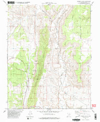
 1954 Paria NW1956 Print · USGSThe high desert of Kane County is captured in the mid-fifties, dominated by the striking geologic uplift of The Cockscomb. Genealogists and historians can locate a remote Cemetery and trace the original water routes of the Paria River and Cottonwood Creek.
 - 1954 Map of Paria, 1959 Print
 1954 Paria1959 Print · USGSThe Kane County high desert is captured here in the mid-1950s, showing the intersection of Utah and Arizona along the Salt Lake Meridian. Genealogists and historians can locate the Paria townsite, the Cem, and several ranching or mining remnants like Adairville and Johnson Store.2 unique versions available
 - 1956 Map of Escalante
 1956 Escalante1956 Print · USGSSouthern Utah and Northern Arizona are charted here in the mid-fifties, just before the canyon floor was transformed. Researchers can trace remote desert commerce at Oljeto Trading Post, find the Adairville (ruins), and locate Uranium mines.5 unique versions available
 - 1960 Map of Escalante
 1960 Escalante1960 Print · USGSSouthern Utah and northern Arizona appear at a historic turning point in the late fifties as Lake Powell begins to reshape the canyons. Researchers can trace remote sites like Goulding Trading Post, a lonely Uranium Mine, and Coyote Ranches before the reservoir's rise.
 - 1981 Map of Fivemile Valley
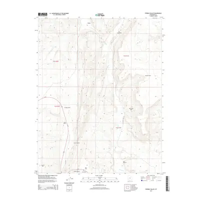
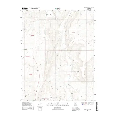
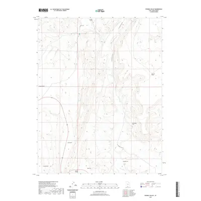
 1981 Fivemile Valley1981 Print · USGSSouthern Utah's geological drama is on full display in the early eighties as the landscape of Kane County was carefully documented by federal surveyors. Researchers can locate the Hattie Green Mine, an isolated Cem, and natural water sources like Fivemile Spring and the Paria River.3 unique versions available
 - 1985 Map of Smoky Mountain
 1985 Smoky Mountain1985 Print · USGSSouthern Utah in the mid-eighties was a landscape of rising reservoir waters and vast desert plateaus. Genealogists and historians can trace the topography around Adairville, the intricate shorelines of Lake Powell, and prominent heights like Navajo Mountain.2 unique versions available
 - 2011 Map of Fivemile Valley, 2011 Print
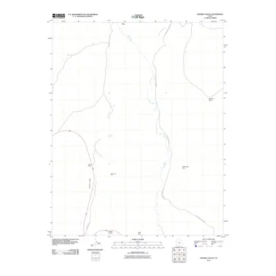 2011 Fivemile Valley2011 Print · USGSCovers Paria, including Kane County, United States, and other nearby areas
 - 2014 Map of Fivemile Valley, 2014 Print
 2014 Fivemile Valley2014 Print · USGSCovers Paria, including Kane County, United States, and other nearby areas
 - 2017 Map of Fivemile Valley, 2017 Print
 2017 Fivemile Valley2017 Print · USGSCovers Paria, including Kane County, United States, and other nearby areas
 - 2020 Map of Fivemile Valley, 2020 Print
 2020 Fivemile Valley2020 Print · USGSCovers Paria, including Kane County, United States, and other nearby areas
 - 2023 Map of Fivemile Valley, 2023 Print
 2023 Fivemile Valley2023 Print · USGSSouthern Utah’s high desert landscape is recorded here in the early twenty-first century, centered on the historic Paria area. Researchers can locate the Pahreah Cem and trace the drainage of the Paria River past The Rimrocks.
End of results
Showing maps 1-12 of 12
Frequently asked questions
- What are the different types of historical maps available for Paria?
- What is the oldest map of Paria?
- Where can I purchase historical maps of Paria for my home or office?
- Where can I download high-res historical maps of Paria?
- Are there historical topographic maps available for Paria?
- Is there historical aerial imagery available for Paria?
- Where are historical maps of Paria sourced from?