Old Maps of Garrison, Utah
Explore 11 old maps of Garrison, spanning from 1949 to today. These high-resolution historic maps reveal how streets, neighborhoods, landmarks, and natural features evolved over time — perfect for genealogy, metal detecting, research, and local history exploration.
What you can do with these maps:
- See how Garrison changed over time: Compare historical maps to modern-day views to trace roads, homesites, rail lines & more.
- View detailed metadata: Each map includes creators, publishers, year, scale, and archive source.
- Overlay maps with satellite & LiDAR: Visualize the past alongside modern tools to explore terrain & human change.
- Trusted historical sources: Maps sourced from the USGS, Library of Congress, and other archives.
- Access maps your way: View online, download high-res files, or order prints for personal or research use.
Start exploring old maps of Garrison to uncover forgotten places, hidden landmarks, and the deep history beneath your feet.
Garrison, UT maps
(11)- 1949 Map of Garrison, 1957 Print
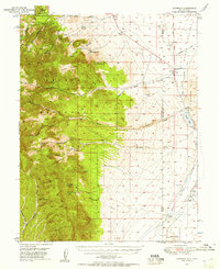 1949 Garrison1957 Print · USGSThe high desert border of White Pine County and Utah’s Millard County comes into focus in the late 1940s as a land of isolated ranches and mountain peaks. Genealogists and historians can locate family landmarks like Davies Ranch and Burbank Cem or trace the early paths to Lehman Caves National Monument.4 unique versions available
 - 1951 Map of Garrison
 1951 Garrison1951 Print · USGSThe Nevada-Utah borderlands are captured here in the early fifties, where the high peaks of the Snake Range descend into the ranching country of Snake Valley. Researchers can trace early family landholdings at Davies Ranch and Dearden Ranch, or locate the Burbank Cem near the state line.2 unique versions available
 - 1956 Map of Lund, 1963 Print
 1956 Lund1963 Print · USGSEastern Nevada and the Utah borderlands are mapped here during the mid-fifties, showing a landscape of high-desert ranches and mountain mining camps. Genealogists and historians can trace family locations through sites like Bristol Silver Mines, Lund, and the Sunnyside Whipple Ranch.2 unique versions available
 - 1960 Map of Lund
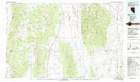
 1960 Lund1960 Print · USGSEastern Nevada and the Utah borderlands are mapped here during the mid-twentieth century, showing a landscape of high peaks and isolated ranching outposts. Researchers can locate remote mining sites like the Tungsten Queen Mine and early settlements including Lund and Shoshone.
 - 1979 Map of Garrison, 1980 Print
 1979 Garrison1980 Print · USGSThe high desert borderlands of Utah and Nevada come into focus in the late seventies, showing the rugged mining and ranching outposts of the Snake Range. Trace old mining operations like the Tungsten Queen Mine or find remote water stops such as Parker Station and Lund Group Well.
 - 1987 Map of Garrison
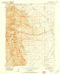
 1987 Garrison1987 Print · USGSThe Utah-Nevada borderlands are captured here in the late twentieth century, showing the small settlement of Garrison and its surrounding desert basins. Researchers can trace the water infrastructure of the Spring Creek Rearing Station or locate Snake Creek Cave and Pruess Lake.
 - 2012 Map of Garrison, 2012 Print
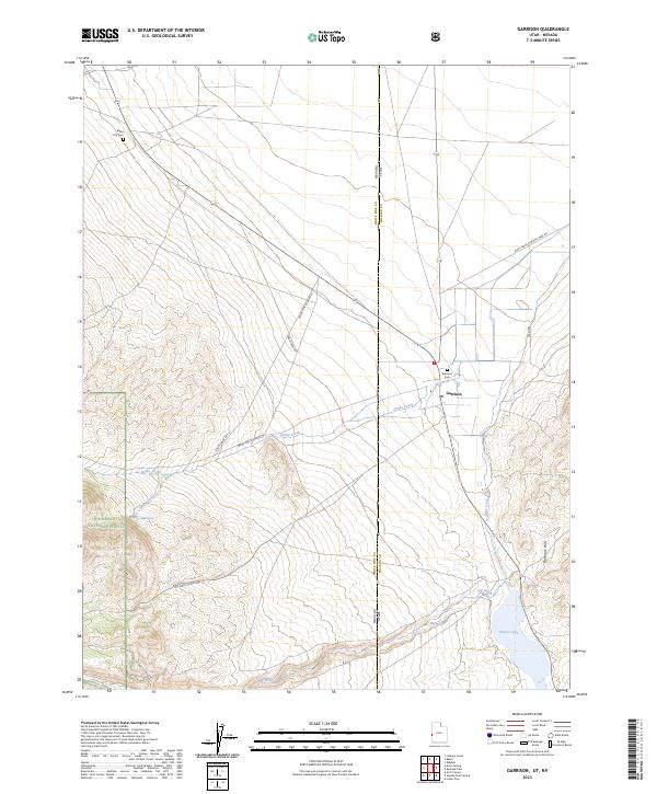
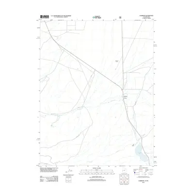 2012 Garrison2012 Print · USGSCovers Garrison, including Millard County, White Pine County, and other nearby areas
 - 2014 Map of Garrison, 2014 Print
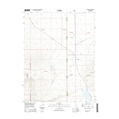 2014 Garrison2014 Print · USGSCovers Garrison, including Millard County, White Pine County, and other nearby areas
 - 2017 Map of Garrison, 2017 Print
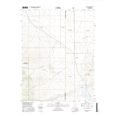 2017 Garrison2017 Print · USGSCovers Garrison, including Millard County, White Pine County, and other nearby areas
 - 2020 Map of Garrison, 2020 Print
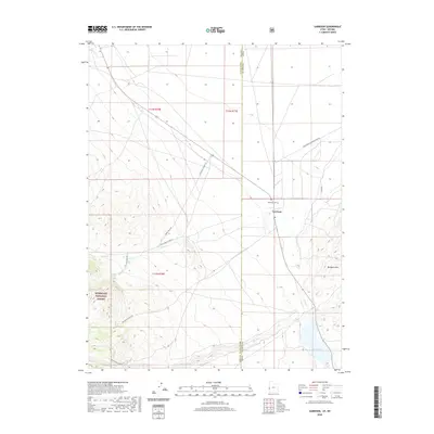 2020 Garrison2020 Print · USGSCovers Garrison, including Millard County, White Pine County, and other nearby areas
 - 2023 Map of Garrison, 2023 Print
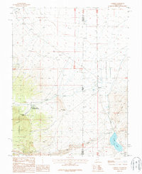
 2023 Garrison2023 Print · USGSThe Utah-Nevada border comes alive in this 2023 study of the high desert and mountain interface. Genealogists and historians can trace the foundations of the Garrison community through landmarks like Baker City Cem and the waters of Preuss Lake.
End of results
Showing maps 1-11 of 11
Frequently asked questions
- What are the different types of historical maps available for Garrison?
- What is the oldest map of Garrison?
- Where can I purchase historical maps of Garrison for my home or office?
- Where can I download high-res historical maps of Garrison?
- Are there historical topographic maps available for Garrison?
- Is there historical aerial imagery available for Garrison?
- Where are historical maps of Garrison sourced from?