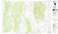
1979 Map of Garrison
USGS Topo · Published 1980About this map
Garrison anchors the eastern edge of this late 1970s survey, situated where the high desert of Snake Valley crosses the state line. The landscape is defined by the massive Snake Range and Humboldt National Forest, which rise abruptly between Spring Valley and the Hamlin Valley drainage. High-altitude peaks such as Wheeler Peak, Baker Peak, and Mt Washington dominate the skyline, while the eastern slopes are punctuated by a series of hard-rock operations including the Tungsten Queen Mine and Silver Bell Mine.
Find a feature on this map
181 named features on this map. Tap any name to fly to it.
Don’t see what you’re looking for? This feature index may not catch every label — zoom into the map to look around manually.
Map Details
Editions of this 1979 Garrison Map
This is the sole edition of this map. No revisions or reprints were ever made.
Other maps of this area

1908 · Fish Springs
USGS Topo · 1:250,000

1910 · Fish Springs
USGS Topo · 1:250,000

1948 · Wheeler Peak
USGS Topo · 1:62,500

1949 · Garrison
USGS Topo · 1:62,500

1950 · Wheeler Peak
USGS Topo · 1:62,500

1951 · Garrison
USGS Topo · 1:62,500

1952 · Ely
USGS Topo · 1:125,000

1953 · Richfield
USGS Topo · 1:250,000

1953 · Delta
USGS Topo · 1:250,000

1956 · Lund
USGS Topo · 1:250,000