
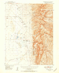
1950 Map of Wheeler Peak
USGS Topo · Published 1950About this map
High-altitude peaks meet the arid expanse of Baking Powder Flat in this 1948 field survey, illustrating the complex landscape of eastern Nevada. The rugged geography of the Nevada National Forest is defined by monumental summits like Wheeler Pk and Mt Washington, where numerous mining operations such as The Chief Mine and the Tungsten Queen Mine underscore the region's mid-century extraction economy.
Find a feature on this map
66 named features on this map. Tap any name to fly to it.
Don’t see what you’re looking for? This feature index may not catch every label — zoom into the map to look around manually.
Map Details
Editions of this 1950 Wheeler Peak Map
2 editions found
Other maps of this area

1948 · Wheeler Peak
USGS Topo · 1:62,500

1949 · Garrison
USGS Topo · 1:62,500

1951 · Garrison
USGS Topo · 1:62,500

1952 · Ely
USGS Topo · 1:125,000

1956 · Lund
USGS Topo · 1:250,000

1956 · Ely
USGS Topo · 1:250,000

1959 · Ely
USGS Topo · 1:250,000

1959 · Sacramento Pass
USGS Topo · 1:62,500

1959 · Connors Pass
USGS Topo · 1:62,500

1960 · Lund
USGS Topo · 1:250,000