
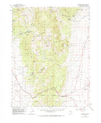
1959 Map of Connors Pass
USGS Topo · Published 1961About this map
The Schell Creek Range dominates this mid-century Nevada landscape, carving a high-altitude divide between Steptoe Valley to the west and Spring Valley to the east. Historically significant as a mining and ranching corridor, the map shows the remnants of earlier activity at Taylor (Site), where a lone Cemetery remains near the mouth of Taylor Canyon. The terrain is defined by a dense network of mountain springs, such as Crethers Springs and South Taylor Spr, which historically sustained livestock and local operations in this arid environment.
Find a feature on this map
72 named features on this map. Tap any name to fly to it.
Don’t see what you’re looking for? This feature index may not catch every label — zoom into the map to look around manually.
Map Details
Editions of this 1959 Connors Pass Map
2 editions found
Other maps of this area

1948 · Wheeler Peak
USGS Topo · 1:62,500

1950 · Wheeler Peak
USGS Topo · 1:62,500

1952 · Ely
USGS Topo · 1:125,000

1956 · Lund
USGS Topo · 1:250,000

1956 · Ely
USGS Topo · 1:250,000

1958 · East Ely
USGS Topo · 1:24,000

1958 · Comins Lake
USGS Topo · 1:24,000

1958 · Ely
USGS Topo · 1:62,500

1958 · McGill
USGS Topo · 1:62,500

1959 · Ely
USGS Topo · 1:250,000