
1958 Map of McGill
USGS Topo · Published 1961About this map
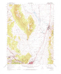
The massive Tailings Area and sewage disposal systems of McGill dominate this late-1950s landscape, reflecting the heavy industrial footprint of copper production in White Pine County. The Nevada Northern Railway provides the primary transportation spine through the valley, connecting the industrial center at McGill with East Ely and the mining operations near Ruth. The map captures a moment when the mining economy is fully integrated into the terrain, from the Limestone Quarry to several named waste dumps like the Puritan Dump.
Find a feature on this map
76 named features on this map. Tap any name to fly to it.
Don’t see what you’re looking for? This feature index may not catch every label — zoom into the map to look around manually.
Map Details
Editions of this 1958 McGill Map
2 editions found
Other maps of this area

1952 · Ely
USGS Topo · 1:125,000

1956 · Ely
USGS Topo · 1:250,000

1958 · McGill
USGS Topo · 1:24,000

1958 · Ruth
USGS Topo · 1:24,000

1958 · East Ely
USGS Topo · 1:24,000

1958 · Comins Lake
USGS Topo · 1:24,000

1958 · Ely
USGS Topo · 1:62,500

1958 · Reipetown
USGS Topo · 1:24,000

1958 · Giroux Wash
USGS Topo · 1:24,000

1958 · Ely
USGS Topo · 1:24,000