
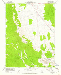
1958 Map of Reipetown
USGS Topo · Published 1961About this map
Mining operations dominate the eastern foothills of the Egan Range, where the intensive excavation of the mid-20th century is etched into the landscape. The settlements of Reipetown and Kimberly serve as the residential hubs for this industrial zone, positioned adjacent to massive open-cast workings including the Veteran Pit, Tripp Pit, and Liberty Pit. The infrastructure of the copper mining era is dense here, with the Nevada Northern railway providing the vital link to the outside world, winding through Weary Flat and beneath the shadow of White Hill.
Find a feature on this map
28 named features on this map. Tap any name to fly to it.
Don’t see what you’re looking for? This feature index may not catch every label — zoom into the map to look around manually.
Map Details
Editions of this 1958 Reipetown Map
3 editions found
Other maps of this area

1952 · Ely
USGS Topo · 1:125,000

1956 · Ely
USGS Topo · 1:250,000

1958 · Ruth
USGS Topo · 1:24,000

1958 · Ely
USGS Topo · 1:62,500

1958 · McGill
USGS Topo · 1:62,500

1958 · Giroux Wash
USGS Topo · 1:24,000

1958 · Ely
USGS Topo · 1:24,000

1959 · Ely
USGS Topo · 1:250,000

1959 · Reipetown
USGS Topo · 1:62,500

1959 · Preston Reservoir
USGS Topo · 1:62,500