
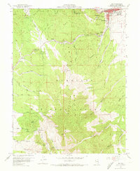
1958 Map of Ely
USGS Topo · Published 1961About this map
The high-desert mining hub of Ely dominates the northeastern corner of this 1950s survey, showing the town's proximity to the heavy industry of the Egan Range. This era was defined by a transition toward recreational land use alongside established mineral extraction, evidenced by the development of the Ward Mtn Ski Hill and the Ward Mountain Recreation Area within the Humboldt National Forest. Infrastructure for the extraction economy is pervasive, including the Nevada Northern railroad and a network of shafts such as the Bell Shaft and Minoletti Shaft. Beyond the town site, the Ely Colony Indian Reservation is situated near prominent landmarks like Murry Rock and Squaw Point. The landscape is heavily dissected by deep canyons, including Robinson Canyon and Murry Canyon, which served as critical conduits for early roads and an aqueduct supplying the growing settlement.
Find a feature on this map
74 named features on this map. Tap any name to fly to it.
Don’t see what you’re looking for? This feature index may not catch every label — zoom into the map to look around manually.
Map Details
Editions of this 1958 Ely Map
5 editions found
Other maps of this area

1952 · Ely
USGS Topo · 1:125,000

1956 · Ely
USGS Topo · 1:250,000

1958 · Ruth
USGS Topo · 1:24,000

1958 · East Ely
USGS Topo · 1:24,000

1958 · Comins Lake
USGS Topo · 1:24,000

1958 · Ely
USGS Topo · 1:62,500

1958 · McGill
USGS Topo · 1:62,500

1958 · Reipetown
USGS Topo · 1:24,000

1958 · Giroux Wash
USGS Topo · 1:24,000

1959 · Ely
USGS Topo · 1:250,000