
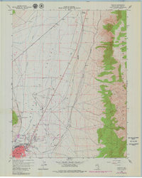
1958 Map of East Ely
USGS Topo · Published 1961About this map
East Ely serves as the focal point of this late-1950s survey, illustrating a high-desert community shaped by industrial and transportation infrastructure. The active Nevada Northern line runs through the valley, complemented by the Old Nevada Northern Railroad Grade to the south. Local life is represented by landmarks such as the County Fairgrounds, the White Pine Golf Course, and even a Drive-in Theater situated north of the city.
Find a feature on this map
27 named features on this map. Tap any name to fly to it.
Don’t see what you’re looking for? This feature index may not catch every label — zoom into the map to look around manually.
Map Details
Editions of this 1958 East Ely Map
2 editions found
Other maps of this area

1952 · Ely
USGS Topo · 1:125,000

1956 · Ely
USGS Topo · 1:250,000

1958 · McGill
USGS Topo · 1:24,000

1958 · Ruth
USGS Topo · 1:24,000

1958 · Comins Lake
USGS Topo · 1:24,000

1958 · Ely
USGS Topo · 1:62,500

1958 · McGill
USGS Topo · 1:62,500

1958 · Ely
USGS Topo · 1:24,000

1959 · Ely
USGS Topo · 1:250,000

1959 · Connors Pass
USGS Topo · 1:62,500