
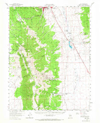
1958 Map of Ely
USGS Topo · Published 1961About this map
Ely and East Ely serve as the primary anchors for this late-1950s survey of the high Nevada desert, where industrial mining and transport history are deeply etched into the landscape. The Nevada Northern RR winds through the northern flats, supporting a region defined by extensive mineral exploration and processing. Evidence of the area's mining heritage is found in the clusters of shafts and mills, including the Old Quaker Mine, Paymaster Mine, and the historic Argus Mill and Monitor Mill sites. To the south, the Ward Charcoal Ovens State Park preserves the massive masonry structures once used to produce fuel for local silver smelters. The map also documents the Colony Indian Res and the site of the town of Ward, which by this era had faded into the mountainous terrain of the Egan Range. Water sources are vital here, with numerous labeled springs such as Ice Plant Spring and Millsite Spring sustaining local ranches like Willow Cr Ranch.
Find a feature on this map
101 named features on this map. Tap any name to fly to it.
Don’t see what you’re looking for? This feature index may not catch every label — zoom into the map to look around manually.
Map Details
Editions of this 1958 Ely Map
2 editions found
Other maps of this area

1952 · Ely
USGS Topo · 1:125,000

1956 · Lund
USGS Topo · 1:250,000

1956 · Ely
USGS Topo · 1:250,000

1958 · Ruth
USGS Topo · 1:24,000

1958 · East Ely
USGS Topo · 1:24,000

1958 · Comins Lake
USGS Topo · 1:24,000

1958 · McGill
USGS Topo · 1:62,500

1958 · Reipetown
USGS Topo · 1:24,000

1958 · Giroux Wash
USGS Topo · 1:24,000

1958 · Ely
USGS Topo · 1:24,000