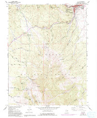
1958 Map of Ely
USGS Topo · Published 1994About this map
Ely serves as the industrial and civic anchor of this high-desert landscape, where the Nevada Northern RR meets a rugged terrain defined by the Ward Mountain Range. The survey documents a region heavily shaped by mining and resource management, with numerous active and historic operations including the Quincy Mine, Farnsworth Ely Metal Mine, and the Black Spot Mine. Large-scale infrastructure like the Aqueduct and Aqueduct Canyon highlights the critical role of water transport in this arid environment, while the Ely Colony Indian Reservation and local Cem provide important genealogical context for the community. Much of the southern and western portions are dedicated to the Humboldt National Forest and the Ward Mountain Recreation Area, preserving significant natural landmarks like the Natural Arch and The Big Bluff.
Find a feature on this map
57 named features on this map. Tap any name to fly to it.
Don’t see what you’re looking for? This feature index may not catch every label — zoom into the map to look around manually.
Map Details
Editions of this 1958 Ely Map
5 editions found
Other maps of this area

1952 · Ely
USGS Topo · 1:125,000

1956 · Ely
USGS Topo · 1:250,000

1958 · Ruth
USGS Topo · 1:24,000

1958 · East Ely
USGS Topo · 1:24,000

1958 · Comins Lake
USGS Topo · 1:24,000

1958 · Ely
USGS Topo · 1:62,500

1958 · McGill
USGS Topo · 1:62,500

1958 · Reipetown
USGS Topo · 1:24,000

1958 · Giroux Wash
USGS Topo · 1:24,000

1958 · Ely
USGS Topo · 1:24,000