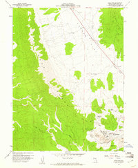
1958 Map of Riepetown
USGS Topo · Published 1961About this map
Mining operations dominate the high desert terrain of the Egan Range in this late 1950s survey of White Pine County. The landscape is defined by the massive excavation footprints of the Veteran Pit, Tripp Pit, and Liberty Pit, alongside a dense network of industrial infrastructure. Residential hubs for the workforce are concentrated at Kimberly and Riepetown, while the Nevada Northern railroad provides the critical link for transporting ore out of the district. Numerous specific vertical workings such as the Alpha Shaft, Morris Shaft, and the Matilda Tunnel indicate the intense subterranean activity surrounding the open pits. Beyond the industrial zones, the terrain transitions into the broad expanse of Copper Flat, where water sources like Lyons Spring and Giroux Sprs provide rare moisture in a landscape of washes and canyons.
Find a feature on this map
32 named features on this map. Tap any name to fly to it.
Don’t see what you’re looking for? This feature index may not catch every label — zoom into the map to look around manually.
Map Details
Editions of this 1958 Riepetown Map
3 editions found
Other maps of this area

1952 · Ely
USGS Topo · 1:125,000

1956 · Ely
USGS Topo · 1:250,000

1958 · Ruth
USGS Topo · 1:24,000

1958 · Ely
USGS Topo · 1:62,500

1958 · McGill
USGS Topo · 1:62,500

1958 · Reipetown
USGS Topo · 1:24,000

1958 · Giroux Wash
USGS Topo · 1:24,000

1958 · Ely
USGS Topo · 1:24,000

1959 · Ely
USGS Topo · 1:250,000

1959 · Reipetown
USGS Topo · 1:62,500