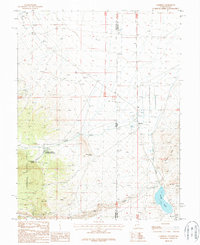
1987 Map of Garrison
USGS Topo · Published 1987About this map
Garrison anchors this high-desert landscape on the border of Utah and Nevada in the late 1980s. The settlement is centered near a Cem and is defined by its proximity to water resources in an otherwise arid basin. To the west, the Humboldt National Forest marks the rise of higher terrain, where the Spring Creek Rearing Station and a Fish Hatchery utilize local springs. The map documents a network of 4wd tracks and corrals that supported ranching and resource management across the state line.
Find a feature on this map
27 named features on this map. Tap any name to fly to it.
Don’t see what you’re looking for? This feature index may not catch every label — zoom into the map to look around manually.
Map Details
Editions of this 1987 Garrison Map
This is the sole edition of this map. No revisions or reprints were ever made.
Other maps of this area

1908 · Fish Springs
USGS Topo · 1:250,000

1910 · Fish Springs
USGS Topo · 1:250,000

1949 · Garrison
USGS Topo · 1:62,500

1951 · Garrison
USGS Topo · 1:62,500

1953 · Richfield
USGS Topo · 1:250,000

1953 · Delta
USGS Topo · 1:250,000

1956 · Lund
USGS Topo · 1:250,000

1956 · Ely
USGS Topo · 1:250,000

1958 · Richfield
USGS Topo · 1:250,000

1958 · Delta
USGS Topo · 1:250,000