
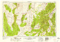
1958 Map of Richfield
USGS Topo · Published 1958About this map
Richfield and the adjacent Sevier River valley serve as the hub of this mid-century portrait of central Utah. The landscape is a study in contrasts, where the high timber of the Fishlake National Forest and peaks like Delano Peak overlook the expansive arid basins of the Escalante Valley. Transportation and industry define the valley floors, with the Union Pacific Railroad threading through stops like Nada Station and Murdock Siding.
Find a feature on this map
121 named features on this map. Tap any name to fly to it.
Don’t see what you’re looking for? This feature index may not catch every label — zoom into the map to look around manually.
Map Details
Editions of this 1958 Richfield Map
2 editions found
Other maps of this area

1885 · Manti
USGS Topo · 1:250,000

1885 · St. George
USGS Topo · 1:250,000

1885 · Beaver
USGS Topo · 1:250,000

1885 · Sevier Desert
USGS Topo · 1:250,000

1885 · Fish Lake
USGS Topo · 1:250,000

1885 · Pioche
USGS Topo · 1:250,000

1886 · Kanab
USGS Topo · 1:250,000

1886 · Escalante
USGS Topo · 1:250,000

1886 · Pioche
USGS Topo · 1:250,000

1891 · St. George
USGS Topo · 1:250,000