1900s (20th Century) Maps of Blanding, Utah
Explore 18 historic maps of Blanding from the 1900s (20th Century). These maps offer a rare glimpse into what life looked like during the 1900s — showing old roads, neighborhoods, homes, and landmarks that have changed or disappeared over time.
Whether you're researching your family's past, planning a metal detecting trip, or studying how Blanding's landscape evolved across the 1900s, these high-resolution maps are a powerful tool for exploring the history of this region.
- Focus on a specific era: All maps on this page are from the 1900s, giving you a focused view of this time period.
- See what’s changed: Compare century-old streets, trails, and buildings to today's modern landscape using overlays and satellite layers.
- Research with precision: Use these maps for genealogy, historical research, land use analysis, or educational projects.
- View, download, or print: Maps are fully viewable online in high resolution, and can be downloaded or printed for your own records.
Start exploring Blanding's history through authentic maps from the 1900s. This is your window into the past.
Blanding, UT maps
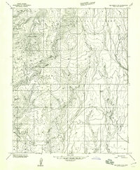
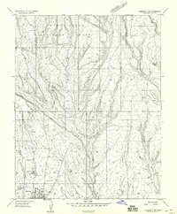
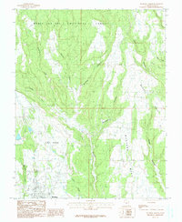
(18)- 1935 Map of Elk Ridge
 1935 Elk Ridge1935 Print · USGSSan Juan County in the mid-1930s is a rugged expanse of high mesas and forest ranger stations. Researchers can locate remote cattle operations like Stirrup Ranch and early archaeological sites including the Owachomo Bridge and various Cliff Dwelling locations.2 unique versions available
 - 1940 Map of Elk Ridge
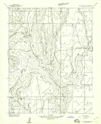
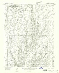
 1940 Elk Ridge1940 Print · USGSSoutheast Utah is shown just before the war as a landscape of remote cattle ranches and ancient archaeology. Genealogists and historians can locate family holdings like Wilson Ranch or explore the early layout of Natural Bridges National Monument and the town of Blanding.2 unique versions available
 - 1956 Map of Cortez, 1972 Print
 1956 Cortez1972 Print · USGSThe Four Corners region comes alive in this mid-century study of the high plateaus and deep canyons surrounding Cortez. Trace the development of desert outposts like Towaoc or follow the historic Laramie Trail across a landscape dotted with ancient sites at Mesa Verde National Park.2 unique versions available
 - 1957 Map of Elk Ridge 4 NE, 1959 Print
 1957 Elk Ridge 4 NE1959 Print · USGSSoutheastern Utah’s high desert is captured here in the mid-1950s, showing the early infrastructure of the Manti-La Sal National Forest. Researchers can trace old transportation routes and landmarks like Mancos Jim Butte, the Aqueduct, and the winding Jeep Tr.
 - 1957 Map of Elk Ridge 4 SE, 1959 Print
 1957 Elk Ridge 4 SE1959 Print · USGSSan Juan County, Utah, was a frontier of both ancient history and modern industry in the late fifties. Researchers can trace the mid-century infrastructure of Tunnels and a Landing Strip alongside much older sites like the Cliff Dwelling.
 - 1957 Map of Brushy Basin Wash, 1960 Print
 1957 Brushy Basin Wash1960 Print · USGSSan Juan County was a landscape of deep canyons and sandstone ridges in the late 1950s, during an era of Atomic Energy Commission activity. Genealogists and historians can locate remote outposts like Perkins Ranch, an Indian Village, and several ancient Cliff Dwellings.4 unique versions available
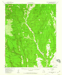
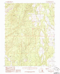
 - 1957 Map of Blanding, 1960 Print
 1957 Blanding1960 Print · USGSBlanding and the surrounding high plateau of San Juan County are captured here in the late fifties. You can trace early canyon-dwelling sites and Petroglyphs near Montezuma Canyon alongside mid-century landmarks like the Drive-in Theater and L-C Ranch.4 unique versions available
 - 1958 Map of Cortez
 1958 Cortez1958 Print · USGSThe Four Corners region comes alive in the late fifties, showing the interplay between expanding mountain settlements and ancient archeological sites. Trace the layout of Cortez, Monticello, and Blanding alongside landmarks like Mesa Verde National Park and Fort Lewis A&M College.
 - 1959 Map of Verdure 3 NW
 1959 Verdure 3 NW1959 Print · USGSThe community of Blanding and the surrounding mesa country are captured here in the late fifties as the town grew. Genealogists and historians can locate the High Sch, the L-C Ranch, and old resource sites like the Clay Pit north of town.
 - 1959 Map of Cortez
 1959 Cortez1959 Print · USGSThe Four Corners region in the late fifties was a landscape of ancestral sites and isolated ranching outposts. Genealogists and historians can trace the early footprints of Cortez, Towaoc, and Mexican Hat alongside the canyons of the San Juan River.2 unique versions available
 - 1959 Map of Verdure 3 SW
 1959 Verdure 3 SW1959 Print · USGSBlanding and the surrounding San Juan County mesas are documented here in the late fifties as the town's modern footprint began to expand. Local researchers can locate early municipal sites like the Sewage Disposal and Canal alongside ancient Cliff Dwellings.
 - 1962 Map of Cortez
 1962 Cortez1962 Print · USGSThe Four Corners region comes alive in the early sixties, showing a landscape defined by reservation lands and federal forests. Trace the route of the Rio Grande Southern RR or locate the Uranium and vanadium mines near Monticello.
 - 1966 Map of Cortez
 1966 Cortez1966 Print · USGSThe Four Corners region in the mid-sixties reveals a landscape of high mesas, tribal lands, and archaeological preserves. Researchers can trace the ancient sites at Hovenweep National Monument, follow the Denver & Rio Grande Western Railroad, or locate old settlements like Ginger Hill and Yellow Jacket.
 - 1982 Map of Blanding, 1983 Print
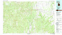 1982 Blanding1983 Print · USGSSoutheastern Utah and the Colorado borderlands are shown here in the early eighties, capturing the high-desert settlements of San Juan County. Researchers can trace local landmarks like Nancy Patterson Lake, the ranching community of Ucolo, and the remote Lockerby.
 - 1985 Map of Black Mesa Butte
 1985 Black Mesa Butte1985 Print · USGSSan Juan County's high plateaus and deep drainage systems are documented here in the mid-eighties. Researchers can locate remote landmarks like Black Mesa Butte and Ruin Spring, or trace the winding course of Cottonwood Wash.
 - 1985 Map of Blanding North
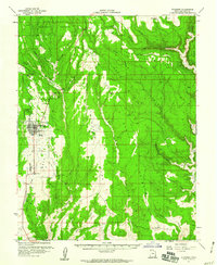
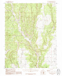
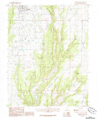
 1985 Blanding North1985 Print · USGSBlanding and its surrounding canyons were undergoing steady growth in the mid-1980s as modern infrastructure expanded across the high plateau. Researchers can trace the rugged network of Mustang Mesa and Alkali Point alongside landmarks like Pinenut Knoll.
 - 1985 Map of Mancos Jim Butte
 1985 Mancos Jim Butte1985 Print · USGSSan Juan County in the mid-1980s reveals a high-desert landscape of national forest land and significant geological landmarks. Researchers can trace the drainage patterns of Brushy Basin Wash and Cottonwood Wash near the distinct Mancos Jim Butte.
 - 1985 Map of Blanding South
 1985 Blanding South1985 Print · USGSBlanding and the surrounding high mesas of San Juan County are documented here in the mid-1980s. Local researchers can trace the drainages of Recapture Creek and locate vital landmarks like Mustang Spring, Richmond Spring, and Road Canyon Point.
End of results
Showing maps 1-18 of 18
Top cities near Blanding
Frequently asked questions
- What are the different types of historical maps available for Blanding?
- What is the oldest map of Blanding?
- Where can I purchase historical maps of Blanding for my home or office?
- Where can I download high-res historical maps of Blanding?
- Are there historical topographic maps available for Blanding?
- Is there historical aerial imagery available for Blanding?
- Where are historical maps of Blanding sourced from?