
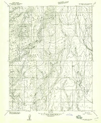
1957 Map of Elk Ridge 4 SE
USGS Topo · Published 1959About this map
White Mesa and Black Mesa define this high plateau landscape, where the deeply carved drainage of Cottonwood Canyon and the Brushy Basin break the horizontal lines of the San Juan County terrain. In the late 1950s, this area was a workspace of transition, containing a remote Landing Strip, several Tunnels, and a mining Prospect that indicate mid-century exploration of the region's geological resources.
Find a feature on this map
17 named features on this map. Tap any name to fly to it.
Don’t see what you’re looking for? This feature index may not catch every label — zoom into the map to look around manually.
Map Details
Editions of this 1957 Elk Ridge 4 SE Map
This is the sole edition of this map. No revisions or reprints were ever made.
Other maps of this area

1886 · Abajo
USGS Topo · 1:250,000

1892 · Abajo
USGS Topo · 1:250,000

1893 · Abajo
USGS Topo · 1:250,000

1935 · Elk Ridge
USGS Topo · 1:96,000

1940 · Elk Ridge
USGS Topo · 1:125,000

1954 · Elk Ridge 4 NW
USGS Topo · 1:24,000

1956 · Cortez
USGS Topo · 1:250,000
1957 · Elk Ridge 4 NE
USGS Topo · 1:24,000

1957 · Brushy Basin Wash
USGS Topo · 1:62,500

1957 · Blanding
USGS Topo · 1:62,500