Old Maps of Fry Canyon, Utah for Academic Research
Study the evolution of Fry Canyon with 14 high-resolution historic maps. Whether you're teaching, researching, or modeling changes in land use, these maps provide essential visual documentation of urban, environmental, and geographic change.
- Analyze long-term change: Track patterns in development, transportation, and natural features.
- Ideal for environmental or urban studies: Support academic projects with primary historical map data.
- Use in the classroom or lab: Educators and researchers rely on these maps to bring historical context to life.
These maps are a powerful tool for teaching, research, and visualizing how Fry Canyon has changed over the decades.
Fry Canyon, UT maps
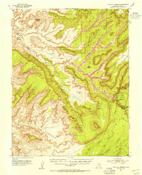
(14)- 1886 Map of Henry Mountains
 1886 Henry Mountains1886 Print · USGSSouthern Utah remains a wilderness of deep canyons and volcanic peaks in this 1880s survey. Researchers can trace the original courses of the Colorado River through Cataract Canyon and find landmarks like Navajo Mt and Monument Valley.
 - 1892 Map of Henry Mountains
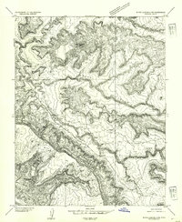
 1892 Henry Mountains1892 Print · USGSSouthern Utah in the late 1800s remains a wilderness of deep canyons and isolated peaks under the direction of J.W. Powell. Geologists and historians can trace the geological spine of the Water Pocket Fold and the early boundaries of the Navajo Indian Res. near Monument Valley.6 unique versions available
 - 1952 Map of Natural Bridges, 1954 Print
 1952 Natural Bridges1954 Print · USGSSoutheast Utah at the dawn of the atomic age reveals a landscape defined by deep sandstone gorges and the early marks of uranium prospecting. Researchers can locate the iconic spans of Natural Bridges National Monument, archaeological sites like Water Jar Cave, and early river crossings at Soldier Crossing.3 unique versions available
 - 1954 Map of White Canyon 4 NW
 1954 White Canyon 4 NW1954 Print · USGSSan Juan County in the early fifties was a landscape defined by deep erosional drainages and essential desert water sources. Researchers can trace early routes through White Canyon via Soldier Crossing or locate landmarks like Jacobs Chair and Rock Spring.
 - 1956 Map of Escalante
 1956 Escalante1956 Print · USGSSouthern Utah and Northern Arizona are charted here in the mid-fifties, just before the canyon floor was transformed. Researchers can trace remote desert commerce at Oljeto Trading Post, find the Adairville (ruins), and locate Uranium mines.5 unique versions available
 - 1960 Map of Escalante
 1960 Escalante1960 Print · USGSSouthern Utah and northern Arizona appear at a historic turning point in the late fifties as Lake Powell begins to reshape the canyons. Researchers can trace remote sites like Goulding Trading Post, a lonely Uranium Mine, and Coyote Ranches before the reservoir's rise.
 - 1980 Map of Hite Crossing, 1987 Print
 1980 Hite Crossing1987 Print · USGSSouthern Utah's canyon country comes alive in the early eighties as the waters of Lake Powell reshape the landscape. Trace old mining operations like the Happy Jack Mine or the remote peaks of the Henry Mountains.
 - 1987 Map of Jacobs Chair
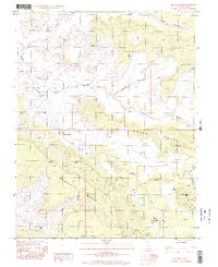
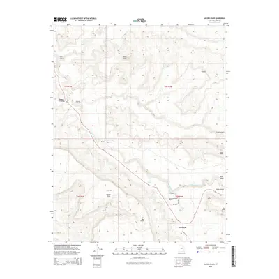
 1987 Jacobs Chair1987 Print · USGSSan Juan County at the close of the 1980s remains a landscape of deep canyons and massive desert mesas. Genealogists and historians can trace the paths through Soldier Crossing or locate remote landmarks like Jacobs Chair and the Fry Canyon Trailer Park.
 - 1996 Map of Jacobs Chair, 2002 Print
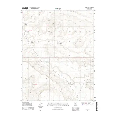
 1996 Jacobs Chair2002 Print · USGSSan Juan County’s high desert landscape is documented here in the late twentieth century, showing a remote area shaped by deep canyons and mesas. Researchers can trace the layout of the Fry Canyon Trailer Park, the Landing Strip, and early exploration sites like Gravel Crossing.
 - 2011 Map of Jacobs Chair, 2011 Print
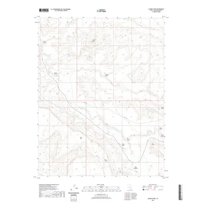
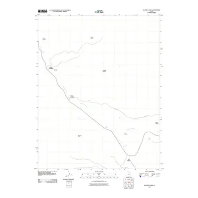 2011 Jacobs Chair2011 Print · USGSCovers Fry Canyon, including Soldier Crossing, San Juan County, and other nearby areas
 - 2014 Map of Jacobs Chair, 2014 Print
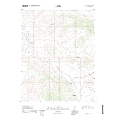
 2014 Jacobs Chair2014 Print · USGSCovers Fry Canyon, including Soldier Crossing, San Juan County, and other nearby areas
 - 2017 Map of Jacobs Chair, 2017 Print
 2017 Jacobs Chair2017 Print · USGSCovers Fry Canyon, including Soldier Crossing, San Juan County, and other nearby areas
 - 2020 Map of Jacobs Chair, 2020 Print
 2020 Jacobs Chair2020 Print · USGSCovers Fry Canyon, including Soldier Crossing, San Juan County, and other nearby areas
 - 2023 Map of Jacobs Chair, 2023 Print
 2023 Jacobs Chair2023 Print · USGSFry Canyon and the surrounding mesas are mapped in this recent survey of the San Juan County desert. Local historians and hikers can trace remote landmarks like Jacobs Chair, Rock Spring, and the path of the Fry Canyon Ruins Rd.
End of results
Showing maps 1-14 of 14
Frequently asked questions
- What are the different types of historical maps available for Fry Canyon?
- What is the oldest map of Fry Canyon?
- Where can I purchase historical maps of Fry Canyon for my home or office?
- Where can I download high-res historical maps of Fry Canyon?
- Are there historical topographic maps available for Fry Canyon?
- Is there historical aerial imagery available for Fry Canyon?
- Where are historical maps of Fry Canyon sourced from?